Laredo, Texas, Jan. 27 — It’s more than a thousand miles to Iowa. It’s 700 to Mexico City. It’s the end of January, and it’s 84 degrees.
Here, at the doorstep to Mexico, Interstate Highway 35 finally rolls to a stop.

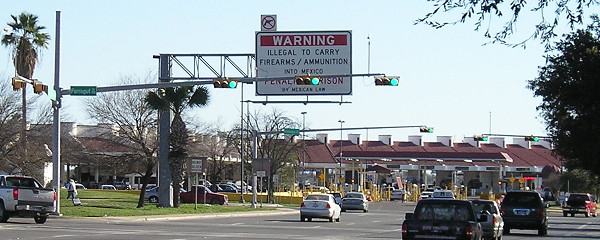
Four stoplights separate I-35 from International Bridge No. 2
There’s no “End” sign, just the freeway itself coming from a depressed grade up to stoplights with overhead and ground-based signs pointing to the bridges or US 83’s journey farther south on this side of the Rio Grande. On this day, the humongous Mexican and American flags were not flying to delineate the border, but the casas de cambio serve about the same purpose.

I-35 only goes to one of these places.
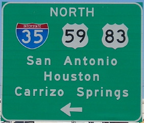
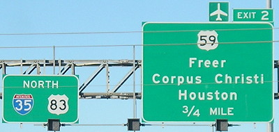
US 59 shields on the big signs (see above) imply that route starts at the same place as I-35, but all regular ones have “To” above them and the first shield set heading north doesn’t have 59. Its true beginning is two miles from here.
Fifteen minutes later, it’s time to head north. Two numbers can take you to Iowa — one fast, one slow — and one of those goes all the way into Canada. I’ve now passed both US termini of US 59. However, it’s I-35 I’ll be taking north to close that gap in Texas.
If you were to travel straight through, it would take 17½ hours to get from Laredo to Lamoni. Nearly half of that route is contained inside Texas.

