Sikeston, Missouri, May 24 — Today was Bridge Day. I encountered four bridges from the late 1920s and early 1930s. Each had that classic superstructure that’s not used anymore.
Route: IL 13, KY 56, KY 109, US 60, KY 91, IL 1, IL 146, IL 145, US 45 into Metropolis and then into Kentucky, US 62, KY 123, KY 80, US 51 to I-57 and back through Cairo, US 62, US 61, US 60
I began the day by heading east on IL 13 and took the last intersection down (literally down) into Old Shawneetown, which was practically deserted. The Lincoln Trail (southern branch) is directed through the town. There is a large bank building on the street when you come down, but it is NOT the “first bank in Illinois”; that site is very hidden right in the bridge and levee’s shadow. The IL 13/KY 56 crossing was my first harrowing narrow steel-deck bridge of the day.
I went east instead of south for one reason: Union County, Kentucky. Going there dictated how I would wind my way through the rest of southeastern Illinois. I cut south on KY 109 to get to Marion, where I photographed the north end of US 641, and then returned north. The GPS actually had a little ferry icon and ordered me to take the ferry. Cave-in-Rock had plenty of cars along its business district, which surprised me. There was spray paint on the road for the high-water mark last year.
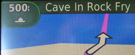
Please do not attempt to use your vehicle as a flotation device.
Kentucky’s roads have excellent asphalt but NO SHOULDERS and lots of winding roads. I have more respect for H.B. Elkins doing what he does. SO MUCH harder than doing it in Iowa.
On 146, I detoured to Rosiclare to find “End 34”, one of the many(!) routes in Illinois that duplicate a US and state number. Then 146 and 145 had a separated-grade intersection.
I drove into Metropolis and ate at KFC, then went to the Superman and Lois Lane (Noel Neill) statues, followed by a tour of the Super Museum. The museum is very small but jam-packed with just about everything that had Superman slapped on it at one point in the past 80 years. The entire stop lasted less than an hour.
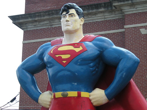
Superman grew up in Kansas, but two actors to portray him have been from Iowa.
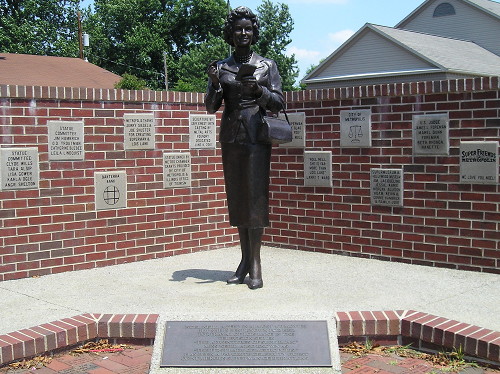
Larger than life: Noel Neill was 5’4″, but “Lois Lane” is 6’1″ or 6’2″ in heels.
Now it was time for another narrow steel-decked bridge with a superstructure as I took US 45 into Paducah. There was pullout southbound with “Jackson Purchase” marker but I did not see it in time to stop. No warning.
US 45’s business route is signed, but I followed the mainline to US 62. I followed that westward, with one detour along KY 1820 for Graves County. I know the road ran just south of the line because Google Street View showed the marker and this was on the Missouri Atlas and Gazetteer. In fact, most of my time in Kentucky could be tracked on either the Illinois or Missouri DeLorme atlases.
On the approach to Bardwell, I noticed a large white building on a hill with flags of the armed services outside. I didn’t see the words “Carlisle County Courthouse” until it was too late to stop. At the time, it was two days short of being a year old. Even in the 21st century, courthouses still burn down.
In Columbus, the road does a strange thing. KY 80 joins KY 123 as if it were still going to the long-gone ferry, but right before the two roads intersect KY 58, there is a split and TWO roads, both with two-lane traffic, parallel each other for a short distance. One has the post office on it. It’s weird. I went to the “end of the road” where the ferry had been (neither KY 58 nor 80 are signed on the stretch though) and then returned to Columbus-Belmont State Park.
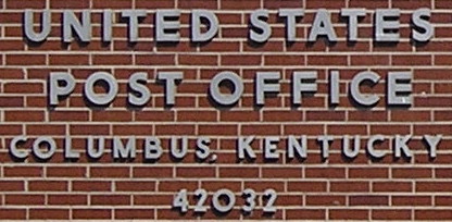
Not quite Kentucky’s westernmost post office, but close.
Even though it was 4 PM, the park museum was closed. What gives? I asked the woman at a concession stand. “She closed up at 2:30,” she responded with a strong Southern accent. I stood there dumbfounded for a moment, not quite sure what to make of this. I ended up just walking around, checking out the displays and working up a sweat from the low-90s temperatures. Some of the panels are about the New Madrid earthquake, including this phrase: “A 6.0 quake has a 60 percent chance of hitting by 2000 A.D.”
The Battle of Belmont was the first action the 7th Iowa saw in the Civil War. The battle was also where the first Scott County soldier died. Here’s the marker on the Missouri side with battle description.
I took 80 back to US 51, and when I passed through Bardwell again I hit 1000 miles for the trip. That was followed in relatively short order by the US 60/62 bridge into Illinois.
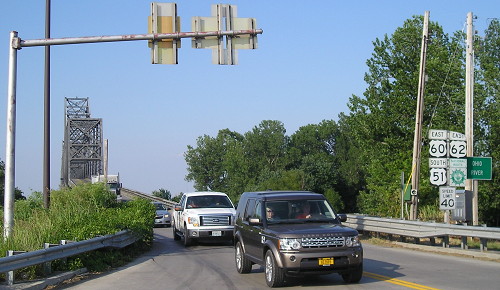
The 51/60/62 triplex in Illinois has no space between the intersection and the river.
US 60 and 62 run more north-south than east-west in their tiny sojourn in Illinois, going south from Kentucky into Missouri. The segment is also south of 37 degrees north latitude — the line that serves as the border for the states between Nevada and Missouri.
Although I sorely wanted to, I did not cross into Missouri immediately. I wanted to get the section of US 51 south of I-57 out of the way. The only word to describe Cairo as it is today is “depressing.” Abandoned buildings abound. It is the extreme example of what has happened to river towns bypassed first by the railroad, then by the automobile, and finally by the interstate.
US 51 is four lanes undivided and I cruised through, aside from one stop. I took my GPS out of the car to find 37 degrees north latitude and found it in the middle of 8th Street, right where a street angles off from US 51 and where there is an overhead “Historic Downtown Cairo” metal arch. This short piece of US 51 put me over 50% of the route in the state.
Finally, it was time to go into Missouri. I missed getting a photo of “Left lane KY Right lane MO”, a sort-of counterpart to the state-directional tags in Keokuk, and of the corresponding initials painted on the lane closer to the intersection. But I did make sure to get pictures as I crossed the intersection so I can “time” how long it took. Even with that, US 60 and 62 in Illinois went from zero to clinched for me in half an hour.
I followed US 62 all the way to Sikeston with one detour to get the I-57 business loop in its entirety. About this time a haze began to set in in the sky. I had long before decided I would end the day in Sikeston, since turning around meant nearly no lodging for the next 70 miles.
I took part of Business 60, turning south on 61. I got a photo of 60-61-62 at the business route intersection but not the interchange to the south. Another time, I hope.
How a hotel should NOT treat someone asking about price: Put them on hold for four minutes with schmaltzy recorded messages from “staff” and then redirect them to the reservations desk. Because of this the Drury was out of the running before I even got a number.
Meanwhile, the Comfort Inn was willing to knock an additional 5% off my already-discounted AAA rate. It also had the warmest hotel pool I’ve ever been in. Big kudos.
