Jan 15

Photos by the numbers: 74

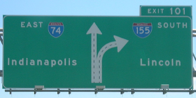
August 6, 2005: East of Peoria, two interchanges in a row on I-74 are for other interstates, I-474 and I-155.

I-74 is Iowa’s connection through the southern part of the old Northwest Territory. It’s only in the state for a few miles. It would have made more sense to send it around the Quad Cities on what is I-280, but it was not to be. Illinois’ effort to put I-80 on that route drew enough of an outcry from Iowa that the interstate routings there are now locked in place.

Today, I-74 has some of the oldest bridges in the interstate system, the ones across the Mississippi River built in 1935 and 1959.

While Cincinnati, the eastern end of I-74, isn’t quite Southern, there is one little connection to the disjointed segments in North Carolina: Near Exit 1 in Davenport is Iowa’s only freestanding Chick-Fil-A.
Posted in Sequences | Comments Off on Photos by the numbers: 74
Jan 14

Photos by the numbers: 73

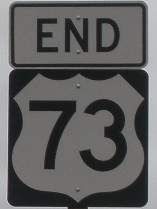
October 15, 2009: South end of US 73 on the western edge of the Kansas City metro. The location changed a few years ago, after Kansas moved the remaining independent pieces of US 24/40 east of KS 7 onto I-70.

US 73 should have been in Iowa. In 1934, the state even created an IA 73 in the hope of an immediate upgrade. Unfortunately, US 73 had already been extended through Nebraska by then, and Iowa got US 59 instead.

Posted in Sequences | Comments Off on Photos by the numbers: 73
Jan 13

Shield oddity in Kirksville MO

I am working on updating listings for the Clinched Highway Mapping website and found a news story from October from KTVO on the bypass of Kirksville, Missouri.

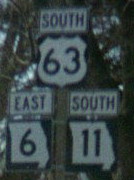
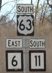
What made me do a double-take was one shot, below left, of the shields along the bypass. Missouri uses the state outline, as seen in the right picture, which I took along the old route in 2002.

Did MoDOT run out of blanks? Was this a contractor’s work? It’s such a little, yet glaringly obvious, error.

The 60-odd miles of 63 between Kirksville and Ottumwa is now the only two-lane segment between Des Moines and Jefferson City.

Posted in Construction, Highway Miscellaneous | Comments Off on Shield oddity in Kirksville MO
Jan 13

Photos by the numbers: 72

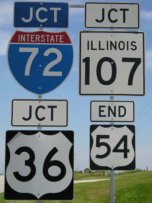
July 16, 2008: East end of US 54 in western Illinois. It used to go to Chicago; a piece that doesn’t stick closely to the interstates is still IL 54. US 36 was signed as the freeway route and I-72 was added later, but there are significant stretches where it could be returned to the two-lane route.

The “54” is normal size. The others are jumbo for interstates, although this is the intersecting road. Illinois puts its name on its state route shields (has to, with Indiana’s also being square) but not the interstates.

Posted in Sequences | Comments Off on Photos by the numbers: 72
Jan 12

Photos by the numbers: 71

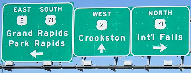
May 9, 2007: Bemidji, Minnesota. Northernmost point traveled on US 71, less than 120 miles from Canada.

My southernmost point on US 71 is in the Shreveport area.

Posted in Sequences | Comments Off on Photos by the numbers: 71
Jan 11

Sullivan’s corner

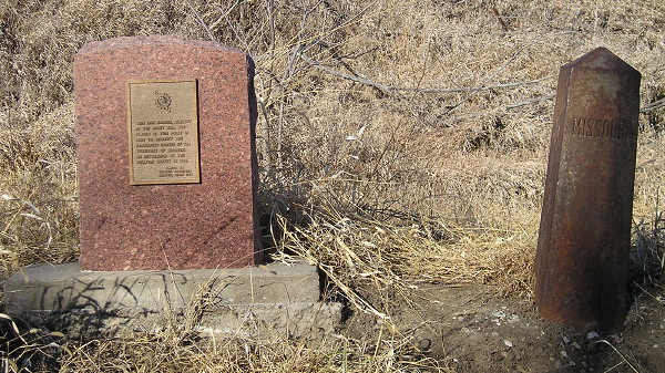
South side of Section 25, Jackson Township, Taylor County. From 1820 to 1837, this was the northwest corner of the state of Missouri. The survey east of this point to the Mississippi River left something to be desired.

The linked page will be updated (eventually) with the markers above. A completely dry (until now) January made the dirt road needed to get there from the north passable. When you get a 55-degree day in January you don’t let it go to waste.

Posted in Geography | Comments Off on Sullivan’s corner
Jan 11

Photos by the numbers: 70

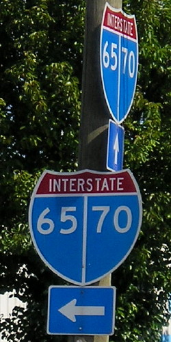
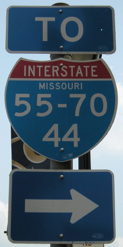
July 15, 2008 and June 9, 2011: Split shields in downtown Indianapolis and St. Louis. Weird, aren’t they?

I’ve been on I-70 from the west edge of Denver to the east I-55 split and from Indianapolis to Fredericksburg MD, leaving gaps at both ends and the middle.

Posted in Sequences | Comments Off on Photos by the numbers: 70
Jan 10

Photos by the numbers: 69

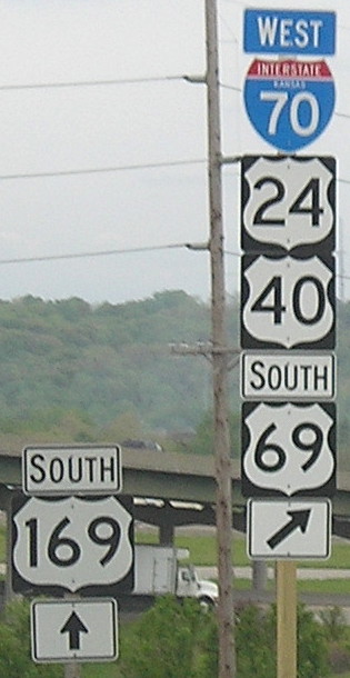
May 5, 2009: Kansas City, Kansas. This is after the rerouting of US 24/40 onto I-70 in KCK, taking away the independent segment of those routes east of US 73/KS 7. US 69 and 169 bump against each other repeatedly in the KC area. The numbers have even swapped roads a few times. There are some ways to iron it out — without dumping more onto the interstates, I might add — but it’s unlikely to happen.

I’ve traveled every mile of US 69 from the Texas/Oklahoma state line to its north end in Albert Lea.

Posted in Sequences | Comments Off on Photos by the numbers: 69
Jan 10

So long, Pamida

This is a few days old, but it appears the Pamida brand will be going away. There are Pamida stores in Toledo and Eldora. Guess I should’ve taken a picture one of those many times I was cataloging changes on US 30.

Posted in Tama County | Comments Off on So long, Pamida
Jan 09

Photos by the numbers: 68

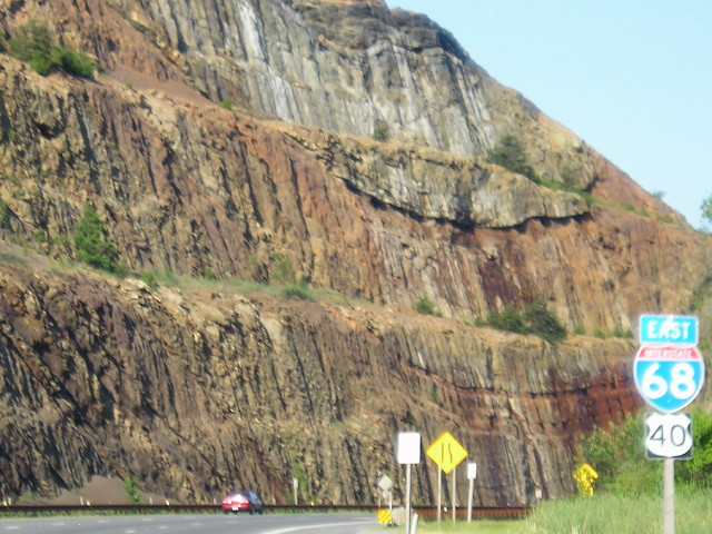
June 25, 2009: Sideling Hill cut on I-68 in western Maryland. Sadly, we did not have time to stop at the visitors center, which closed permanently six weeks later. Here’s a description of the geographical features.

This trip also gave me a stretch of US 40 in Maryland, so now I’ve been on it for some length in every state although some of those are interstate-only.

Posted in Sequences | Comments Off on Photos by the numbers: 68