Jul 22

Algona, Lu Verne consolidation in final stretch

A vote in September will turn what 25 years ago had been five official school districts, and 2½ high schools, into the largest one-high-school consolidated district in Iowa.

Algona and Lu Verne have spent the past year going through the process to consolidate, and Prairie Lakes AEA approved the petition May 17. A complete index of the documentation is available on Lu Verne’s website, but I link to it with the full knowledge that the website itself will become defunct in about a year. Here’s the Algona link.

The Algona/Lu Verne FAQ notes that the 2005 and 2022 combined enrollments of the two districts are virtually identical, but the latter includes Titonka and Corwith-Wesley students, showing the continuing trend of depopulation in rural Iowa. The FAQ correctly, but cagily, avoids questions about the Lu Verne school’s continued use, only stating, “Presently Algona has room to handle the students that would be coming from the Lu Verne CSD.”

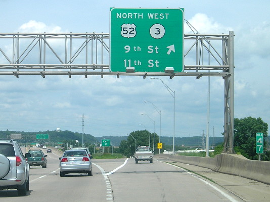
The new district will be called Algona, though I think at this point either Kossuth County or South Kossuth would be better. The map deletes no territory, but part of Corwith-Wesley was partitioned off to other districts in 2015. The new Algona will replace Van Buren as Iowa’s largest district with one high school, but will be just under MVAOCOU (two districts) and Western Dubuque (two high schools) in area. Van Buren supplanted longtime area champion Davis County by adding Harmony in 2019.

The Lu Verne area will have to approve a Physical Plant and Equipment Levy (PPEL) in the September 13 election in order to equalize property taxes in the two former districts.

Posted in Schools | Comments Off on Algona, Lu Verne consolidation in final stretch
Jul 20

When Griswold called out Lewis

Griswold American, July 21, 1921:

Seems to be Worried.

If one were to judge from the following article taken from the Lewis Standard, the people of the town of Lewis are fearful lest they lose the little old White Pole road, and that with the loss of this noted road the town would dry up and be removed from the universe:

“Lewis is now on the White Pole road, or Primary road No. 2. There is now and has been for months an effort made to change this road so that it will run south on the Atlantic cemetery road to the so called ‘Short’ Line. Eventually, and we do not believe the time is far away, this will be one of the transcontinental highways. If the change is made it will not be a month or for six weeks, but for all time to come, and Lewis will be isolated. The question is, will we fight to keep what we’ve got, or will we let other towns take it away from us? Let’s fight!”

Now, look here, Bro. Willey. If you and your people would work with your neighbors and not run off to “foreign” towns to do your boosting, Lewis would be much better off. The insinuation that Griswold is trying to get what little road you have is all bunk. The people of Griswold have done more to assist Lewis in maintaining good roads than the people of Lewis themselves have. It does not help Lewis to have people along the White Pole road say in public that they would give good sums of money to have the road taken away. Griswold is not trying to take anything away from Lewis — in fact we have tried to do you a good turn. The grading of the road west of the Indian creek bridge would be of benefit to Lewis. Tourists and others have already been through Lewis before they strike this road when coming this way, and if they are traveling east through Griswold they will go through Lewis via this road. Now get down to brass tacks and look at the matter from the proper end of the telescope.

Lewis was afraid that the White Pole Road, which in the western half of Iowa would later become US 6, would be routed onto the I.O.A. Short Line between central Cass County and Council Bluffs. The Short Line went through Griswold, and decades later would be added to the state system as the westernmost part of IA 92.

Consider that the 1920s were within living memory of towns drying up and being removed from the universe when a railroad didn’t go through. Through that lens, Lewis’ fears weren’t necessarily unfounded.

In the summer of 1921, Lewis had already experienced one change in the state primary system: IA 24 had been rerouted through Atlantic, but still touched Lewis with IA 2 on what’s now Nishna Valley Road. The 6-mile segment left behind is one of Iowa’s most-numbered roads: After being restored to the system later, it spent time as IA 2, IA 92, IA 100, and IA 414 before becoming G43. Also, by the end of the year, the road to Atlantic had been straightened out to its present alignment.

For more about the area, see the IA 100 (1920 Series) page and what’s probably the second-most reproduced Iowa highway photo of the prewar years.

Posted in 1920 Highway Sytem | Comments Off on When Griswold called out Lewis
Jul 18

Rodney Dangerfield, call your office (again)

From the photos with this story by the Associated Press at Big 12 Media Days last week:

But then, with Cincinnati-Houston set to become a conference football game next year, can you blame them for not keeping things straight?

Unrelated, except inasmuch as another data point that AP could stand to hire another editor or two: THE PHRASE IS “SET FOOT.” NOT “STEP FOOT.”

Posted in Sports | Comments Off on Rodney Dangerfield, call your office (again)
Jul 15

Dubuque US 61-151 signage to be updated


June 18, 2015: This exit sign along US 61/151 in Dubuque is among those that will be replaced later this year.

The opening of the Southwest Arterial, and subsequent removal of US 52 through Dubuque, resulted in a “green-out” on various signs on the US 61/151 expressway/freeway through the city. Soon those traces will be gone. A July 19 sign letting that is officially “statewide” but mostly concentrated in Dubuque County replaces signs dating back to the early 1990s, when the road opened (see my Dubuque Highway Chronology for more).

Exit numbers are coming to US 61/151 in the area, too! The letter of the law of “lowest highway number gets the exits*” would have resulted in some discontinuity, because US 52 was clearly a piggybacking route. (MM 47 in the photo above is 52’s.) But now that US 52 and IA 3 are no longer in this area, the state is taking the opportunity to add US 61’s exit numbering through the city. Grandview Avenue will be Exit 187, IA 946 (the connector to US 20) will be Exit 188, White Street will be Exit 189A, 9th/11th Streets (plus the “Historic Millwork District”) will be Exit 189B, and Kerper Boulevard will be Exit 190.

Signs in the letting have Dubuque Greyhound Park on them, but greyhound races ended permanently in May.

Other parts of the letting include:

  • At I-35 Exit 69 (Grand Avenue), a supplemental sign for Des Moines University and something called the “MidAmerican Energy Company RecPlex” which according to its five-tweet Twitter account is “a one-of-a-kind sports facility in Central Iowa.” A KCCI story about it said donors “hope the new sports complex will bring more families to West Des Moines” because if anywhere in Iowa has trouble attracting families, it’s Des Moines’ western suburbs.
  • At I-80 Exit 8 (US 6), a straight-up replacement BGS for US 6 that ideally would have “East” added beside the shield, since 6 does not go through Council Bluffs on surface streets anymore. This sign is in the “accelerated time frame” so it could be a replacement for one that was damaged.
  • Signs in the generic interchange style for the new Swiss Valley Road interchange southwest of Dubuque on US 20.
  • Removal of lighting and catwalks from the sign trusses that will remain in place in Dubuque but get new BGSs. This has popped up in other projects too, and I wonder if increased reflectivity of the signs has eliminated the need for independent lighting.

*A very notable flaunting of those rules: I-35/80 around Des Moines using I-80’s numbers.

Posted in Construction | Comments Off on Dubuque US 61-151 signage to be updated
Jul 13

Gladbrook school demolition finishing up

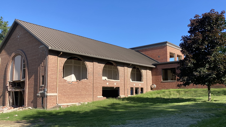
June 17, 2022: The Gladbrook school was in mid-demolition during Corn Carnival. Windows and fixtures had been removed.

KWWL has a story, with unembeddable video, about the Gladbrook school being demolished. The story has an error in it: The school was closed in 2015, not 2018. The Gladbrook-Reinbeck board voted in 2018 to tear it down. The dissolution vote precipitated by the closure happened, and failed, in mid-2017.

Drone video in the story the work about half done, with the gym in the southwest corner intact as of Tuesday.

Posted in Schools, Tama County | Comments Off on Gladbrook school demolition finishing up
Jul 11

Next phase of mixmaster redesign in letting stage


This is an excerpt from a contract being let July 19, showing the I-35 flyover in red and grading work in tan.

Grading in the southwest and northeast corners of the northeast mixmaster in Des Moines, and the new I-35 flyover bridge, are among the construction projects in the July 2022 Iowa DOT letting.

This is “Stage 3A” of the plan, which advances the new eastbound I-80 to northbound I-35 flyover bridge, westbound I-80 to northbound I-35 exit ramp, and eastbound I-80 to southbound I-235 exit ramp. The flyover itself is 2650 feet long — half a mile plus 10 feet.

There was a public meeting about this stage of the project nearly five years ago (PDF here) (Des Moines Register story here). The real start, though, might be considered to be the NE 54th Avenue bridge replacement just to the north of the mixmaster in 2016. At that time, transportation engineer specialist David Evans told trade publication Construction Equipment Guide that the bridge “is probably the longest span bridge not over water in Iowa.” It appears to me that the flyover bridge or one of the other two in the final build-out of the plan could replace it.

I believe there are five left exits remaining in the state of Iowa. This mixmaster project and the I-29/I-480 project that started last year will eliminate two of them.

Posted in Construction | Comments Off on Next phase of mixmaster redesign in letting stage
Jul 08

License Plate Letters — MAP

This combination is easy to illustrate!


May 9, 2007: A panel at Itasca State Park, headwaters of the Mississippi River, is about the Jefferson Highway.


February 8, 2012: The Civil War in Missouri, as seen at Battle of Lexington State Historic Site. “A visitor center provides a comprehensive view of the battle that raised Southern spirits that the war was winnable and made Unionists in Missouri think twice about whether they could hold the state.”

The M’s began to be issued in the previous cycle in early 2003.

Posted in License Plates | Comments Off on License Plate Letters — MAP
Jul 06

How much for just the stick?

Prices at the Iowa State Fair are going up. KCCI has a story (not embeddable), including an interview with a major concessionaire who says prices are going up 50 cents to $1.

Perhaps the first sign of this was last year, when the pork strip basket I raved about in 2019 was $2 more in 2021 (and had less dramatic presentation).

Admission at the gate is $14, with advance tickets for $9, not half price like they were a few years ago. I suspect that could go up next year too.

Posted in Iowa Miscellaneous | Comments Off on How much for just the stick?
Jul 01

Marion celebrates new trail bridge

The city of Marion had a ribbon-cutting this morning (July 1) for a “CeMar Trail Gateway Bridge”. Here’s a press release from the city and story at Corridor Business Journal. The bridge is part of the CeMar Trail.

The trail is using the corridor the “Milwaukee Road” railroad used in Marion, and the bridge is in the same spot as the railroad overpass over Business 151. The bridge is slightly askew from the straight line of the trail to be closer to perpendicular to the road, as can be seen in the photo with the CBJ story. The bridge replaced a road underpass in use since the beginning of the 20th century at 1st Street, just to the west. Its opening affected the routing of the highway, although there was a surprisingly long gap between the new bridge over Indian Creek to the south and the railroad overpass’ opening.

The overpass was 60 years old when it was demolished, and abandoned some time in the 2000s. Marion has wanted to turn the right-of-way into a trail basically since that happened. Here’s a document from 2017 about trails on the northwest side of the Cedar Rapids area that would connect to this trail.

Posted in Iowa Miscellaneous | Comments Off on Marion celebrates new trail bridge
Jun 29

Iowa’s 1920 highway system: IA 48, a Highway of Theseus


August 23, 2019: The current Essex school, which opened in 1970, is at the southwest corner of town. A vacated portion of original IA 48, an extension of South Avenue, ran through part of the building’s footprint and across home plate of the softball diamond.

IA 48 runs from Shenandoah to Red Oak, as it did in 1920, and now also goes north to US 6, but the original route has next to nothing in common with what you’d drive today.

For about five years (1926-31), IA 48 also went south from Shenandoah to the Missouri state line, only to have IA 4 replace that part. After a short stint as IA 73 (II) in 1934, that road became US 59.

The 1920 route started in Shenandoah, southeast of downtown. A little more than a decade later, it ran on Sheridan Street through downtown of the largest non-county-seat city in Iowa’s southwest quadrant. It did that until being moved to the north side of the city in 1980.

From there, it stairstepped to Essex until a diagonalization in 1930. The 1929 preliminary plan kept a corner at 190th Street and B Avenue.

It is extremely easy to walk on the portion that carried the designation in both 1920 and 2020 — Forbes Street to the M41 junction in Essex. I believe the section-line skip on the north-south road has been there a while, given that the 1930 paving document showed structures on the other side of the railroad.

From Essex to Red Oak, the original route is mostly gravel but has M41 as a farm-to-market designation. The tiny town of Coburg missed out twice, first being ¾ mile east and now 1½ miles west of 48. At Red Oak, it overlapped IA 8 (now US 34) into downtown, ending probably at the courthouse or town square, until an early truncation.

Its extension to US 32 was a two-step process: First to Griswold via Elliott in 1930, and then to 32 after 16 months. The last extension brought the route of the original north-south route of IA 100 back into the primary system.

(Roadgeeking and Philosophy: A Course in Applied Metaphysics, coming to a classroom near you!)

Posted in 1920 Highway Sytem | Comments Off on Iowa’s 1920 highway system: IA 48, a Highway of Theseus