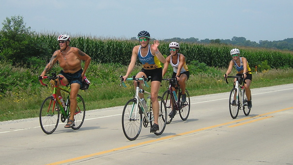
July 29, 2021: RAGBRAI riders enter Center Point. RAGBRAI was not held in 2020, so 2023 marks the 50th ride. (The plague ended a lot of continuous/consecutive records.)
My analysis (with passing corrections) of the RAGBRAI L map is based on what I saw on the full route reveal page as of April 5. See also this somewhat analytical post on how RAGBRAI L can still count 50 communities along the ride.
- Day 1 is identical to Day 1 in 1973. This general, but not exact, route was last followed in 2015.
- Between Early and Lake View, 255th Street is D36 and Perkins Avenue is M68 – these designations don’t pop up on Google Maps for some reason.
- The route between D36 (old US 20) and E16 has never been used.
- Using US 30 (not IA 30) between Carroll and Glidden is a first, and the first time any rural segment of US 30 has been included.
- The segment east of Jefferson to IA 144 is still E53, and again, unmarked on Google. Ditto for P54/Clover Avenue, which goes through Berkley.
- E57 between P54 and R26 has never been used. Neither have IA 17 and old IA 415 between Madrid and Polk City. The first route from Ames to Des Moines was completely different south of Slater, including entering on NW 6th Drive (1973) vs. US 69/NE 14th Street (2023).
- The route heading out of Des Moines to Mitchellville hasn’t been used before, including NE 72nd Street (not Avenue), which technically is 1st Avenue S in Altoona.
- After Colfax, save for going through Iowa City and Davenport, the 1973 and 2023 routes in the eastern half of Iowa have nearly nothing in common. That’s due to needing another day along the way.
- US 6 between Newton and Kellogg has never been used. Neither has the Grinnell to Montour segment, V18 from E64 to Chelsea, or IA 212. Another part was only used in 1979: E64 from US 63 south of Tama to V18.
- Tama-Toledo last hosted in 2008, and RAGBRAI was last in Tama County in 2012.
- East of Iowa City is half a Google Maps “tell”, half a Johnson County contortion. Old 6 east of Iowa City shows up as F46 on the state map and one sign (but not on US 6 itself at the intersection), despite county maps showing the F46 designation going east on gravel 400th Street (Johnson)/310th Street (Cedar). Google marks part as X16, but the county map doesn’t. The entire segment from Iowa City to US 6 is American Legion Road, and Johnson County needs to figure out what alphanumeric name it really is. (I suggest designating the whole paved road F50.) Then the ride route follows US 6 to West Liberty. None of this segment has been used before.
- IA 70 is the north-south road heading south of West Liberty, but then it’s IA 22 east to Muscatine.
- Except for a few miles west of Montpelier in 2018, IA 22 between Muscatine and Davenport has never been used.
- Better luck next time (again), Bettendorf?
- First-timers: Berkley (which, although not starred, has the ride inside city limits) and Buffalo
- Been-a-long-timers: Glidden, 1981; Kellogg, 1991; Breda, 1994; Rippey, 1994; Ankeny, 2000; Madrid, 2001
