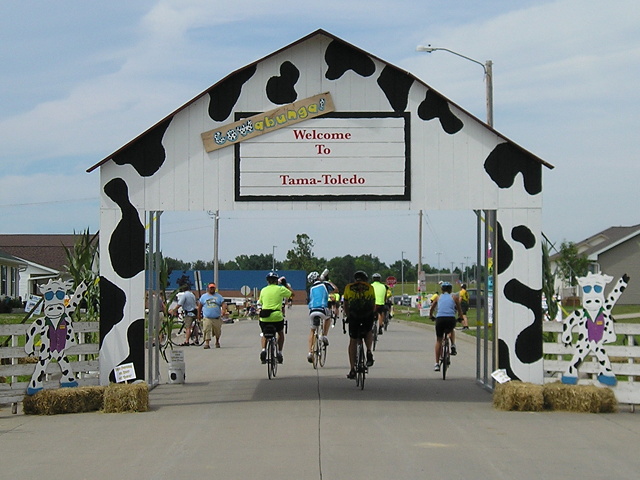
July 23, 2008: Riders enter Tama on RAGBRAI XXXVI. Tama-Toledo is again a host community this year.
RAGBRAI will be going from Des Moines to Tama-Toledo on Thursday, and highs are expected to be in the upper 90s. By the official map, riders will not have had a pass-through town since Grinnell, but the ride will graze the corner of Montour. Maybe there will be a water stop of some sort there.
I wasn’t going to post anything specific to the ride this week, having covered the map beforehand here and also here. I was also waiting for official town maps to be posted, and then (gestures upward at sticky post).
The town maps are up now at the official overnight stop website. It’s unfortunate that the Lincoln Highway bridge, featured in the logo, is not in condition for riders to go over. It may never be again, but that’s a blog post draft that isn’t ripe yet.
The rider information page is here. The Google map is here. Try as I might, I could not get the static maps to show up full-size, and then I tinkered with the hyperlinks.
HERE is the Tama-Toledo overview map. Bikes will come in on E49, US 63, Business 30, Broadway, and Ross Street, splitting off along the way to various campgrounds. The South Tama school campus will be the main campground. (“Elementary Echool”? You guys could have had someone proofread your stuff for cheap. Just saying.) There will be three bus routes circulating through the towns.
HERE is the entertainment map at Toledo Heights Park. There are nearly three dozen vendors, including the Tama County Cattlemen and Rube’s Steakhouse (!). Many will be lining the edge of the infield of one of the ball diamonds. That’s Business 30, not the Lincoln Highway, on the south edge. There is also a stage in downtown Tama, where a band called Lincoln Highway will play at 3:30.
NOTE: There is no left turn from eastbound US 30 to Business 30 due to construction. The US 63 exit will be closed.
HERE are detailed notes for residents about which streets will close and which will be open. The Friday information says US 63 will be closed from E29 to E69, and if that is the case that’s a 16-mile stretch from the Garwin corner south to nearly the county line. Riders will head out of Tama to the south and turn at E64 (Sandhill Auto Salvage).
Further along the route, Belle Plaine’s June newsletter said the Iowa State Patrol will begin shooing riders out of that town by 12:30. That day ends in Coralville (S.T. Morrison Park) via the Amanas.
