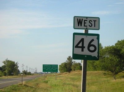
Photo #20,000: IA 10 becomes SD 46 north of Hawarden, July 20, 2012.
The 20,000th photo stored in my archive came during a trip to northwestern Iowa, to travel IA 60 for a third time and clinch the few remaining roads in the area. It’s one in a cluster taken at the South Dakota state line where IA 10 goes north to become SD 46.
The biggest and best tool that has helped me manage my collection is iPhoto. In 2009, when I got a new computer with new iPhoto and could add locations to photos instead of just keywords, that brought new ways to sort (despite some flaws in the programming).
I have some unique crossovers in my photo-place-locations. I have both Delaware County, Iowa, and the state of Delaware; Lincoln, Iowa, and Lincoln, Nebraska; and of course Washington, DC, and a bunch of Washington Counties.
By the numbers, through Nov. 30 (about 11½ years of photos), here’s what has been categorized:
- Seven highway ceremonies under three different governors, including all the major ones except the Fort Madison bypass. Certain politicians and reporters were at multiple ceremonies as well, but none at all of them.
- 36 states, three provinces, and DC with photos, six film-only. States with the fewest pictures: Maine (1), Rhode Island (2), Massachusetts (4), Connecticut (6), and Oregon (6), all film.
- 660 photos related to US 20 (515 outside Black Hawk County)
- 975 photos in Tama County
- Over 7,000 that are tagged as not highway- or sign-related, although my rules aren’t rigid for that.
- 11,559 in Iowa — 55% of the total — followed by Missouri (1310), Illinois (1226), and Texas (!) (700).
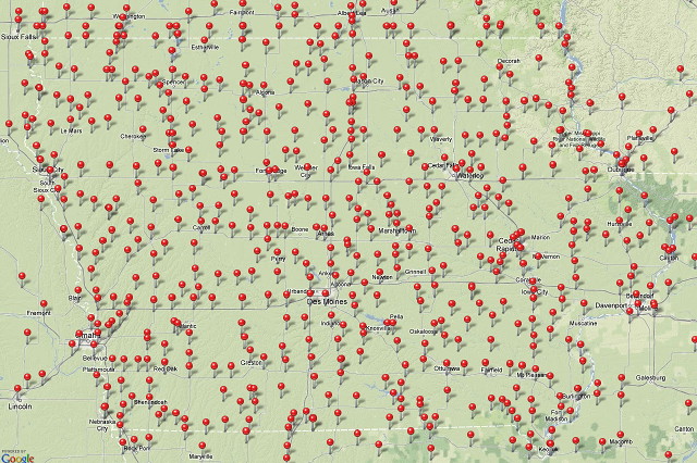
Here’s what the iPhoto map of Iowa looks like. Since pins disappear as you zoom out, a US map wouldn’t look as intimidating.

