State Center has four different historic routings of the Lincoln Highway, and that’s not counting present-day US 30 to the south or the 1912 Transcontinental path. The town recently put out a pamphlet to explain the different markings.
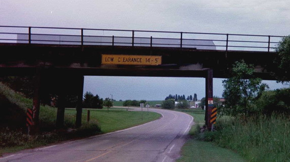
The photo above is from 2001, showing the railroad overpass on 9th Avenue on the west side of town. That was part of the third-generation route; note the L on the right side. The routing right before that crossed the railroad downtown, using Main Street and 3rd Street before that to go northwest. This section with the overpass remained a part of US 30 until the 1960s.
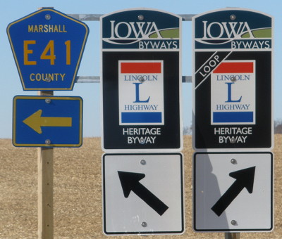
The original original didn’t go through State Center at all but stayed to the north, along 230th Street to Lamoille. Although the Transcontinental used present-day E41, the north route was chosen first and then moved south later. Today, the north route is marked as a loop, shown below at the east end near Lamoille in 2011. This photo also illustrates how the “Loop” sign is not much different from the regular and be hard to grasp on the road.