
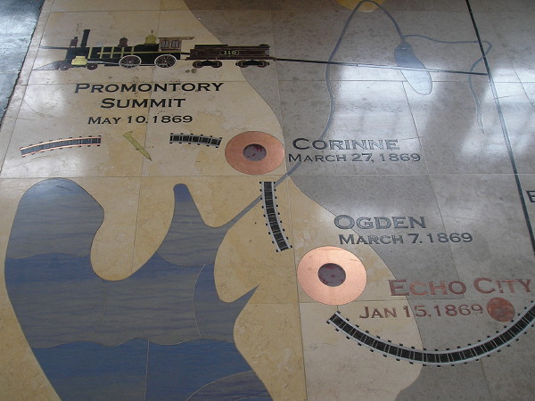
August 5, 2016: The restored Union Pacific depot in downtown Cheyenne WY has an inlaid map of the eastern portion of the Transcontinental Railroad. However, it marks Omaha as the terminus.
A century and a half ago today, the United States was connected in a way it had never been before. The Union Pacific and Central Pacific Railroads hooked up at Promontory, Utah, to complete the Transcontinental Railroad across the western half of the nation.
Iowa played a role in that, of course. Council Bluffs was chosen by Abraham Lincoln to be the east end of the Union Pacific Railroad. Between 1865 and 1869, the Chicago and North Western Railroad rapidly built track from Boone to Missouri Valley to hook up with north-south trackage that parallels I-29 today. The final, true transcontinental connection wasn’t quite a done deal until a railroad bridge across the Missouri River opened in 1872. (See “How Omaha Railroaded Council Bluffs,” Omaha magazine, March/April 2017.) The C&NW route, the first east-west railroad completed across Iowa, would serve as the basis for the nearly all of the Lincoln Highway and US 30, and itself become part of the Union Pacific in 1995.
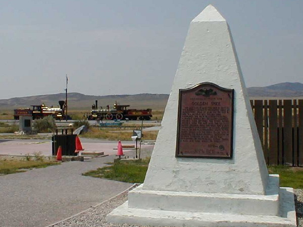
August 1, 2000: Golden Spike National Historic Park, Promontory Summit, Utah. (Yup, been there.) A significant segment of the railroad was bypassed in 1904 with a causeway over the Great Salt Lake and the rails were pulled up for scrap in World War II.
More Transcontinental Railroad-related pictures can be seen in my trip reports from 2016 (Day 1, Day 4).
One hundred years and seventy-two days after the United States was united by rail, that nation landed men on the moon. We’ll reach half of that time span this Aug. 25.