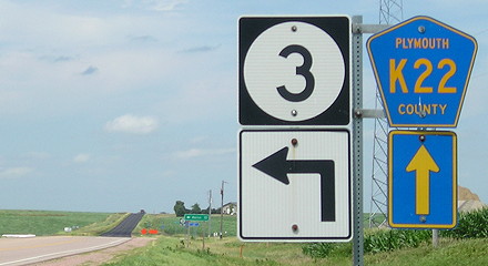
July 17, 2020: The loneliest intersection of 1920. IA 29 ended here; IA 27 went east and west.
Western Iowa had nearly all of the primary numbers, save for 28, in the 26-through-37 span. As far as I know, it just sort of happened. Three of those routes were predominantly in Plymouth County.
- IA 27 covered what’s now the westernmost part of cross-state IA 3 because the auto trails had enormous pull at the time. The Hawkeye Highway veered southwest from Le Mars to Sioux City, leaving a gap in the county. In Akron, 27 met IA 12 and both ended.
- IA 29 spent a lot of time getting out of Sioux City, but after that was all in Plymouth County, not touching any other town. This was the “Perry Creek road”, as it stayed close to the creek halfway into Liberty Township. It passes 2 miles east of the extinct map dot of Adaville, which today is only a church, and 2 miles east of the extinct map dot of Ruble, which today is an abandoned business building, an abandoned one-room schoolhouse, and one house, and is not to be confused with the town of Struble elsewhere in the county.
- IA 30 started with a lot more corners between Moville and Kingsley than IA 140 has today. Its endpoint could be considered “just outside” of Remsen at the time, but one could see the town from the intersection. But in 1919-20, there was a lot of flip-flopping as to whether 30’s north-south segment from Kingsley would be where 140’s is, or a mile west. Also, straightening the Hawkeye Highway to avoid downtown Remsen and Marcus appears to have been a last-minute change but I have no set date.
IA 29’s endpoint in this group deserves a little more discussion. In every other route, numbers were extended, sometimes by great distances, redundantly along other roads so every endpoint was in a town. With 29, that wasn’t possible without taking a giant turn toward either Le Mars or Akron. Brunsville, 5 miles east, had “Gas and oils” and a blacksmith in 1912, according to Huebinger’s Automobile and Good Road Atlas of Iowa.
