
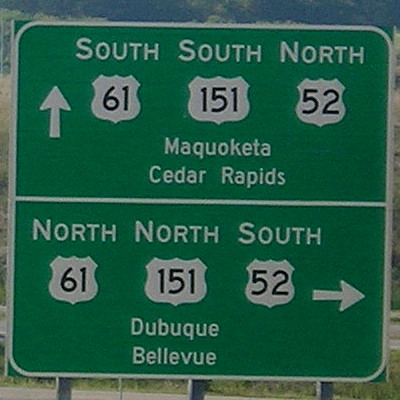
August 23, 2020: Southeast corner of the Southwest Arterial at US 61, looking northwest. Note the wrong-way multiplex. The city names look seriously undersized to me. I would’ve made them larger and put them on the same line (“Dubuque / Bellevue”).
In tandem-ish with noting the release of the new state map, I realized that I had not touched my Dubuque Highway Chronology. I put it off until the Southwest Arterial opened, then, well, my second two-thirds of August was a little tricky to navigate.
I had to do some font tweaking. Although I did not include IA 32 on the page, because it focuses on the downtown area, I placed a mention at the end. Unfortunately, neither Jason Hancock nor I found out an exact date the signs came down, just that it was earlier this year.
The main update is to the bottom two maps, with the final one being advanced a bit due to the arterial not opening before 2020 began. The KCRG story about the arterial is here.