
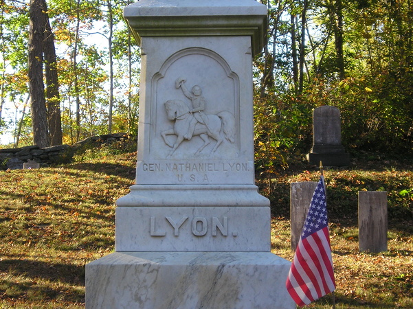
October 12, 2017: The grave of Nathaniel Lyon is in Phoenixville, Connecticut, in the northeastern corner of the state. Lyon was killed at the Battle of Wilson’s Creek in Missouri, southwest of Springfield, in 1861. The following year, the Iowa Legislature renamed Buncombe County for Lyon.
Technically, Connecticut’s eight counties have been dead for six decades. However, for historical and federal government “county equivalent” reasons, they have remained in use to some extent. These boundaries are the ones county counters at mob-rule.com have used. Connecticut became my third clinched state* in two trips: 2002 (traveling on I-95) and 2017 (my second trip to New England).
Now it’s being un-clinched.
Last June, following approval from the Census Bureau and publication in the Federal Register, Connecticut became reorganized into nine “planning regions” that will be recognized as its counties. Very broadly, the north-central two counties are being merged and the western three are being broken into five. The new lines already appear on OpenStreetMap at closer zoom levels. The subdivisions used to create the regions are based on the state’s 169 “towns”, which you can see on this 2020 election results map.
My Bristol-Plymouth-Waterbury travel leg that touched three old counties is now entirely within the new “Naugatuck Valley” county council of government. The new “Northwest Hills,” unfortunately, contains an area I didn’t visit.
M0b-rule is changing its maps Feb. 1. My net number of counties won’t change, but the national total will, and I’ll have a “well, I had been all over, but the map changed” story to tell.
*In addition to every county in Iowa, Illinois, Connecticut, Rhode Island, Wisconsin, and Delaware, I’ve visited every mainland county in Massachusetts and all but the tip of the arrowhead in Minnesota. Some of those states were easier than others.