Jul 01

New Iowa Sportsman’s Atlas out

A blurb in the Dickinson County News notes the Iowa Sportsman’s Atlas has been updated for the first time in seven years. What does this have to do with Iowa highways? The atlas uses Iowa DOT county maps as the base for its display of state parks, recreation areas, and other locations of interest for those who enjoy the outdoors. In that respect, what you’re getting is a big spiral-bound* — and now full-color — Iowa county map book. The website to order the atlas has a preview showing the top tier of counties.

*At least, it’s been spiral-bound in the past, which is immensely helpful if you want to have it left open to a page.

Posted in Maps | Comments Off on New Iowa Sportsman’s Atlas out
Jun 30

One year ago today

An EF2 tornado hit Traer during Monday’s storm, a deadly system that lashed Northeast Iowa with vicious winds and torrential rain. — Waterloo Courier, July 1, 2014

In all, the “One-two Punch” derechos of June 30, 2014 produced more than 300 non-duplicate reports of severe weather from eastern Nebraska to southern Michigan and northwest Ohio, including nearly two-dozen short-lived tornadoes (path lengths less than ten miles and durations less than ten minutes). The first derecho tracked from central Iowa to Lake Michigan (a distance of 320 miles) in five hours, with an average forward speed of 64 mph. — NWS Storm Prediction Center: Midwest Derechos of June 30-July 1, 2014


June 30, 2014, 2:09 PM. Screen capture from KCCI, which was clearly waffling about whether this was “in the viewing area” but stuck with it.


Photo taken July 2


Photo taken July 2


Photo taken July 2


Toledo Street and Westview Street, Traer. Photo taken July 2


Photo taken July 3

Posted in Tama County | Comments Off on One year ago today
Jun 29

Missouri trip Day 6

Route for June 27, 2014: Metcalf Avenue, US 69, K-68 becoming MO 2, I-49, US 71, I-29, I-35, MO 1, MO 152, I-29, MO 92, MO 92 Spur, MO 273, MO 371, US 36, K-7, connector to Rulo, US 159, US 59, I-29, US 59, US 71, MO 48, Route Z, US 69, Route C, I-35, IA 5, US 69.


A VERY small number of I-49 shields with the Missouri name exist, which is a bad omen for those of us who like state names on interstate shields. The location of this sign shall remain hidden for its own protection.

To start my return to Des Moines, I drove south, then east, then north, to get the part of I-49 that I missed yesterday. I continued on that part of US 71 into downtown that is not a freeway. The MO 1 bridge was closed, so I did the part north of I-35.

I figured I would stop at McDonald’s in Platte City when I got there to check the weather, and it was a good a time as any to eat. I then took MO 371, old US 71, to St. Joseph. It wouldn’t serve to be a US route today.

It still wasn’t raining at St Joe, although it was cloudy, and I went to the second town in Kansas to use the library’s wifi from the car. (It worked.) The rain was almost all gone, so I headed west. (Also, the Pizza Hut on the edge of town recently closed.) Iowa Point is nothing but an intersection. White Cloud had an Lewis and Clark marker and was right by a bulging Missouri River. (Later in the day, I read I drove past the Four State Lookout. There were no signs. D’OH.)

Rulo, the southeasternmost city in Nebraska, got its one-block main street paved along with the new US 159 bridge. The GPS gave me 200 miles to go by sending me down I-29 and then on something unorthodox I wouldn’t have/didn’t come up with (top), but it seemed worth a shot.

The southeastern (road) corner of Nebraska. The true KS-MO-NE triple point is, of course, in the Missouri River about a mile to the east. The nearest anything is the Iowa Tribe casino to the southwest.

I followed that backroad path through northwest Missouri, and then had an uneventful trip back up I-35.

Posted in Trip Reports | Comments Off on Missouri trip Day 6
Jun 26

Missouri trip Day 5

Overland Park, Kansas, June 26, 2014 — I said “quarter after nine” for a wake-up call. It rang at 7:15 and 7:20. It wasn’t a good start to the day.

About an hour and a half up US 160, I got to Wilson’s Creek Battlefield National Historic Site. This is where Nathaniel Lyon, namesake of Iowa’s Lyon County, was killed after surprising the rebels early. However, Union could not hold it together and a Confederate regiment was mistaken for an Iowa regiment (wearing gray) until it was too late.

After two hours-plus there, I headed east to clinch US 60 in Missouri. Then, once into Oklahoma, I explored more of old US 66. The 1922 “Sidewalk Highway” on E200th and S520th is some of the worst washboard road I’ve ever encountered. So much gravel is on it the pavement is nearly gone. There was a Will Rogers Highway marker at the intersection of 220th and 520th, south of the 59/60/69 junction.


South end of a segment of narrow US 66 concrete in far northeastern Oklahoma. The concrete isn’t nearly as visible elsewhere — it’s more felt than seen.

I returned to the very southwestern corner of Missouri to see the tri-state marker there. South of that intersection is one of the most interesting highway duplexes in the country, AR 43 and OK 20. From there it was time to travel the newly signed I-49 through Missouri. Right now, I-49 randomly starts/stops 5 miles north of the state line, and will for the foreseeable future because of lack of funding to bypass Bella Vista, Arkansas.


Tri-state marker at Southwest City, Missouri. Camera is in Arkansas looking toward Oklahoma. Below, the dual-state sign-duplex.

I thought I was going to end the day in Harrisonville, but there was no lodging available. There wasn’t any in Lee’s Summit either. After a call to the Super 8 line and an exchange with someone unfamiliar with the area, I used the last in both my physical and metaphorical gas tanks to take I-470 and I-435 into my fourth state of the day and plop into bed.

Posted in Trip Reports | Comments Off on Missouri trip Day 5
Jun 25

Missouri trip Day 4

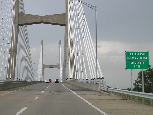
Branson, Missouri, June 25, 2014 — Today, near the literal heart of the American population, was an all-American day: Getting my kicks on Route 66, visiting the museum complex at Fort Leonard Wood, finishing I-44 and US 65 in Missouri, and capping off with a Titanic exhibition.


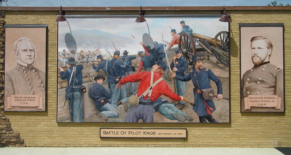
One of the many murals in downtown Cuba, “Mural City,” along old US 66.

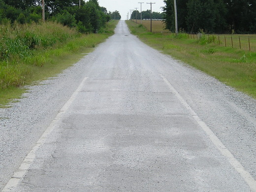
The Missouri Ozarks are nice to drive through, at least on an interstate. The drive is very scenic. I stopped at Route 66 Diner (how could I not?) near the north end of Spur I-44 to Fort Leonard Wood. Burger and fries were $8, a very un-66-like price.


Things move a little slower on the old old US 66 at Devil’s Elbow.

One thing I learned about Fort Leonard Wood was that the base originally was planned for Leon, Iowa, but was relocated. One of the first four-lane segments of 66 was built to handle fort traffic. That segment was the last part of 66 bypassed by I-44 (PDF), and both it and the Devil’s Elbow alignment before it are drivable today.

I spent two hours at the one-building-three-museums covering the Army Corps of Engineers, military police, and Chemical Corps.

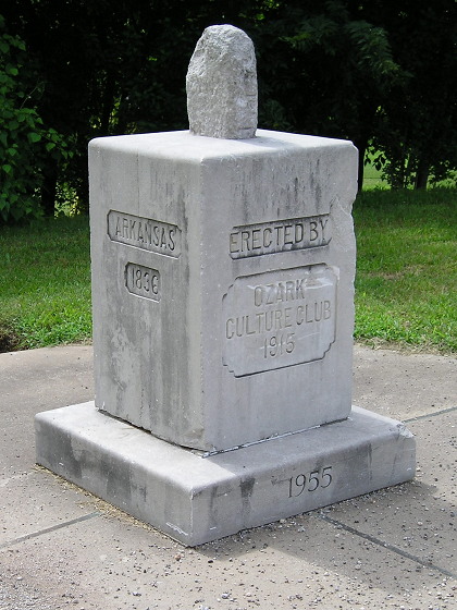
Then it was back on I-44, and to a rest area that is a microcosm of US 66’s history in Missouri. Literally. It has a lot in common with the Lincoln Highway-themed Iowa Welcome Center near Missouri Valley. The picnic areas are styled like US 66 roadside attractions and the building has an inlaid map of the highway on the floor.


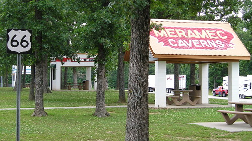
A highway-quality US 66 shield is beside a sidewalk painted like a highway to the “roadside stops/attractions.”

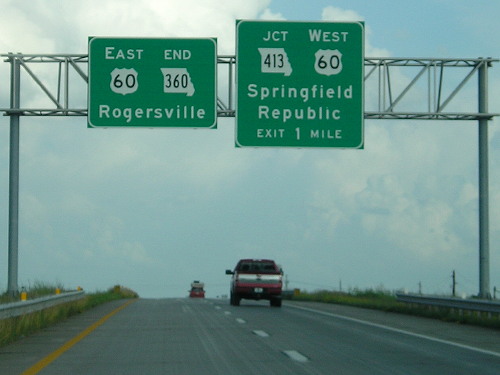
Springfield includes Bass Pro Shops on its attraction signs.

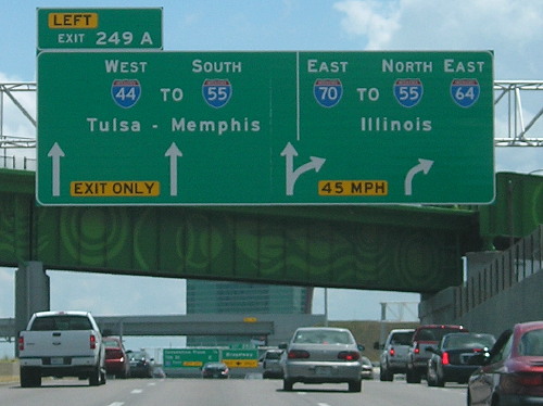
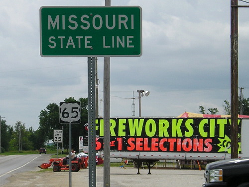
I turned south on US 65, which was clogged until Osage. Then it got hilly. Up and down and up and down. It may have been an expressway, but I am fine with not doing that on a daily basis.

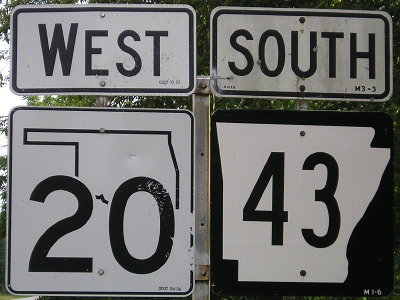
I crossed into Arkansas, clinching 65 in Missouri, and turned around, bound for Branson and the Titanic exhibit. The exhibit was everything I’d hoped for and more. (And for the second day in a row, I could do something after 5 PM.)

Bernard Hill (Captain Smith in the movie) narrates some of the audio clips you heard by pressing buttons. I saw things I hadn’t seen before, like Kate Odell photos and Father Browne photos. Many artifacts from passengers were from the small time frame between stops in the British Isles.

Then I got to the reproduction of the Grand Staircase…and “Southampton” was the background music. It was perfect. A “crew member” pointed out that the staircase was built to spec, including a new design trend for 1912, linoleum.

My passenger card was a third-class male going to Iowa (!), and I figured he was toast, but he lived.

In the gift shop, it looks like anything vaguely boat-shaped with a black bottom, white top, and four funnels can be sold as Titanic-related. (We knew that already. -Ed.) I wasn’t impressed with some things. A kit from Poland was for the “101th” anniversary.

I ended a very long day having covered two museum sites, the World’s Largest Rocking Chair, and a bit of highway history.

Posted in Trip Reports | Comments Off on Missouri trip Day 4
Jun 24

Missouri trip Day 3

Sullivan, Missouri, June 24, 2014 — The first stop today came from, of all places, C-SPAN3.

It had just been St. Louis weekend on the cable channel, and from a short feature, I found out that a Civil War museum had opened a year earlier at Jefferson Barracks. Of course I had to go. It’s not big but the former gym of the restored former PX is full of artifacts related to the war and Missouri’s role in it as a border state that allowed slavery.

After that, it was time to clinch my last interstate in Illinois (I-255) and the new I-70 bridge across the Mississippi River. It was tricky in a couple places because of lane closures, but I made it work. All the other bridges in downtown St. Louis were also part of this bi-state back-and-forth and, after Cape Girardeau yesterday, I’ve traveled every highway bridge except two across the Mississippi from St. Paul to Memphis.


New BGSs for the new I-70 in East St. Louis bypass St. Louis for Kansas City. If you take I-70 into Missouri, you can NOT go south.


The segment of I-70 past the Gateway Arch, which runs north-south, is now part of I-44, in the reverse direction (south is west). Notice the inclusion of three states on this gantry.

Up next was a return to the Missouri History Museum (was there in 2011), to see the large area dedicated to the 250th anniversary of the city of St. Louis. It, too, was interesting and informative. It was structured as “50 people, 50 places, 50 images, 50 moments, 50 objects” to cover the city’s history. There are “birthday cakes” all over the city and area, including Ted Drewes on old US 66, where I stopped for ice cream.

But my day wasn’t done yet. I stopped on the east side of Route 66 State Park to see the now-closed bridge (deck removed), then took I-44 down to Meramec Caverns. Despite being held up by a train, I made the last tour of the day with a small group and it was spectacular.


Meramec Caverns

Posted in Trip Reports | Comments Off on Missouri trip Day 3
Jun 23

Missouri trip Day 2

Mansfield/St. Louis, Missouri, June 23, 2014 — Laura Ingalls Wilder had a refrigerator.

“Of course she had a refrigerator,” you say, “she died in 1957.” But do you think about the older woman writing the books, or do you think of the pioneer girl of the “Little House on the Prairie” series? The same girl who lived in various places in the still-mostly-untamed Midwest (including Iowa), reading by candlelight, eventually had a farmhouse on the edge of Mansfield, Missouri. Today, that house is open for tours and looks the way it was when she died, including the refrigerator in a little alcove built specifically for it.

That was my first stop of the day, and it lasted the whole morning, taking in tours of both the farmhouse and the Rock House, which was a gift from her daughter and the place Wilder started writing the books.


Wilder monument in downtown Mansfield

While the day started out very nice, rain would come on and off after that. I pulled off to eat in Winona just in time to watch a deluge out the Subway window. US 60 is four lanes all the way from Springfield to Sikeston. I swung through Poplar Bluff, where at the northwest corner of town both US 60 and US 67 exit from themselves at a cloverleaf interchange, but decided against going down to US 160’s new east end because of the rain.


Once isolated in southern Missouri, Poplar Bluff now has four-lane connections to I-44, I-55, and I-57. The US 67 bypass opened in June 2001.

In Sikeston there is the triple-sequential intersection of US 60, 61, and 62, and I followed 61 north to Jackson. Jackson, not Cape Girardeau, is the county seat. I followed I-55 for a while, then got back on 61 through Ste. Genevieve, in a far different climate than the first time I’d been through (blizzard conditions on the way to the Liberty Bowl).


This bridge at Cape Girardeau, which opened Dec. 13, 2003, is the second highway bridge across the Mississippi River south of St. Louis.

Finally, I stopped on the south side of St. Louis, at one of those old, sprawling Holiday Inns that you can get lost in easily, and used a coupon from a travel book picked up on I-55.

Posted in Trip Reports | Comments Off on Missouri trip Day 2
Jun 22

Missouri trip Day 1

A recap of last summer’s sojourn down, across, up, diagonally through, and then up again in Missouri. First up, a short report, on a day spent traveling.

Ava, Missouri, June 22, 2014 — I mostly followed US 65 down to I-44, with one small hiccup: It was closed between Lucas and IA 2, so I went via Chariton and Cambria. After Sedalia, I was on a part of 65 I hadn’t been before. It was relatively early by the time I got to Springfield, so I bypassed it on I-44 and MO 360 turned eastward on US 60. I got to Mansfield and turned south to add another county not just to duck in and out, but stay overnight.

Princeton MO, at US 65/136, has a really new Casey’s. A woman in front of me bought cigarettes and scratch tickets — “those numbers are the only thing I’m superstitious about.”

I entered four new counties, but not one of them had a name unique to my travels.


Guess what season it is.


Good ol’ Rocky Mountain Northern Ozark Oysters.


Although US 60 has been upgraded to four lanes across southern Missouri, at Springfield it reverts to being a lesser route, and MO 360 serves as the four-lane connecting it to I-44.

Posted in Trip Reports | Comments Off on Missouri trip Day 1
Jun 19

Corwith school building will be demolished


July 6, 2011: Take a bow, the night is over…

The dissolution of the Corwith-Wesley school district will be emphasized with the demolition of the school building in Corwith, The Des Moines Register reports. The board voted unanimously to tear it down, guarding against the possibility of it becoming another one of Iowa’s abandoned schools.

A correction and a clarification to the Register article: In two weeks there will be 336 school districts left, as Garner-Hayfield and Ventura are consolidating. In addition, although the figure of 4300-plus districts in 1950 looks enormous, almost 90% those disappeared before 1965, falling by the hundreds each year as town schools took in rural areas to end the era of one-room schools in Iowa. In the past half-century, Iowa will have gone from 458 school districts to 336, still a loss of one-quarter of all districts in the state.

My “longform” about the demographics in north-central Iowa remains available here.

Posted in Schools | Comments Off on Corwith school building will be demolished
Jun 18

Farmers Savings Bank celebrates 100th anniversary

Farmers Savings Bank, officially Farmers Savings Bank & Trust-Traer, was incorporated and chartered in 1915. This evening is its annual Customer Appreciation Picnic. The bank has put out a timeline of its history (PDF), which includes adding a bank in Vinton.

Congratulations to a Traer institution on this milestone.

(You know you’re in a small town when at least one business has “Farmers” in its name.)

Posted in Tama County | Comments Off on Farmers Savings Bank celebrates 100th anniversary