Jul 25

RAGBRAI in Tama County

Tomorrow, the Register’s Annual Great Bicycle Ride Across Iowa goes through Tama County for the ninth time. Garwin and Clutier are getting their third visits. The 2012 route duplicates 2004 through nearly all the county, except instead of turning south at the Benton County line it will go east.
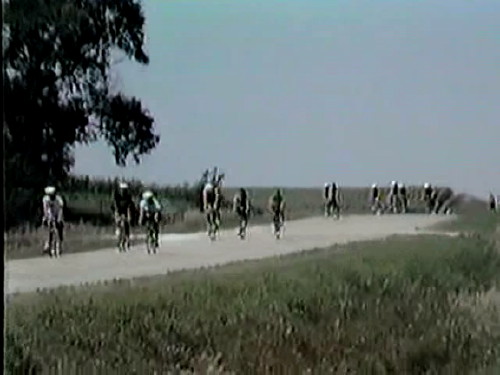

Video frame of RAGBRAI XIV riders on E29 at V18, July 24, 1986. North Tama teachers and the Clutier Lions Club had food stands at the corner.
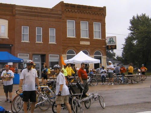

Garwin, RAGBRAI XXXII, July 29, 2004. Look at the temperature! Taken with the “bad camera.”

In 2004, it rained all day. In 2008, Chelsea was weeks removed from flooding worse than 1993. This year, the county is in the midst of the worst drought since 1988 — and ironically, it’s supposed to rain.
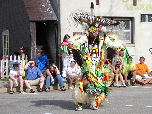

Tribal dance at the Tama County Courthouse, RAGBRAI XXXVI, July 23, 2008. Tama-Toledo was an overnight stop that year.

Clutier is a little odd stop on the route, because instead of going through, it requires riding in and then riding out on the same road. The town reportedly is going to have five thousand kolaches, so I assure riders: It will be worth it. (It’s also the only town in 34½ miles of travel, so there’s that.)

This is a timed post.
Posted in Tama County | Comments Off on RAGBRAI in Tama County
Jul 25

License Plate Countdown — ZPL

The Zwingle-Peosta-La Motte school district?

Posted in License Plates | Comments Off on License Plate Countdown — ZPL
Jul 24

RAGBRAI XL: Complete 40-year list of towns

Every year, the RAGBRAI overnight towns are announced near the beginning of the year. Later in the year, first in June but now usually in March, a complete route is unveiled. Sometimes changes are made before the bikes hit the pavement.

Based on maps printed in the Register each year, I have compiled a listing of each year’s ride and each town visited, in order. This is an unofficial list. If ever you should find that my list and something from ride authorities disagree, listen to them (and correct me).

I haven’t parsed the list or maps to find out commonalities, but you can search for towns or strings of towns. For example, “Orange City, Alton, Granville” appears five times, and adding “, Marcus” at the end yields three results. (But there’s also one “Alton, Orange City” line.)

This is a timed post.
Posted in Iowa Miscellaneous, Maps | Comments Off on RAGBRAI XL: Complete 40-year list of towns
Jul 24

Rhoads work

KCRG misspelled Iowa State coach Paul Rhoads’ name Monday on its website — twice. (Notice the spelling in the link is different from that in the screenshot.)

Maybe if he beats Iowa again his name will get out there more.

Posted in Sports | Comments Off on Rhoads work
Jul 24

Coverage of NT in state baseball tournament

North Tama’s run in the postseason ends at the hands of a private school from northern Iowa (again).

KCRG has video (30-second ad for 30-second clip). KCCI has a full recap of the quarterfinals (NT is last). KWWL, the Waterloo Courier and Marshalltown Times-Republican have articles. KIMT has video from the Algona Garrigan side, but there is not a direct link.

The temperature reached 105 during the game, certainly the hottest in North Tama baseball history.

The Redhawks did a good job of keeping Garrigan at bay early but it wasn’t enough. A strike zone a mile wide didn’t help.

Posted in Sports | Comments Off on Coverage of NT in state baseball tournament
Jul 23

RAGBRAI and US 20

The RAGBRAI route from Cherokee to Lake City today goes through Sac City. It comes into from the north on M54, then goes west on US 20 through town until M54 turns south.

This is possibly the only time RAGBRAI has ever used a portion of US 20. It’s fitting/ironic, then, that the street in Sac City will cease to be 20 within the next two years. In fact, once that happens, Sac City will be the county seat most isolated from state-maintained roads.

Various sections of old 20 have been used quite often. The old alignments of all the major routes are sort of an inadvertent contribution from the state to the ride.

Posted in Maps | Comments Off on RAGBRAI and US 20
Jul 20

Eight. Dollar. Corn.

Pardon me for my amazement. Just wow.

Posted in Uncategorized | Comments Off on Eight. Dollar. Corn.
Jul 19

RAGBRAI XL: A look back at the maps

Next week will be the 40th time bicycle riders have taken off on the Register’s Annual Great Bicycle Ride Across Iowa. Each year’s is different, but over the decades, some segments have been visited time and time again.

The official site has a collection of overnight city listings and short histories of each ride, but doesn’t go into the detail of the routes followed. I looked those up.

I took out a fresh map and a pack of markers to start retracing the routes as printed in the paper over the years. I did them in reverse, most recent to earliest. When a route ran into a previously used road, I let the previous color take precedent. (All of this is easier than trying to go point-to-point on the computer.) This got a little complicated, though, when those re-retraced routes diverged and I lost track of what was where. This does not account for in-town routes, just point-to-point, and may not cover last-minute modifications.

Here are some of the informational items that appear once all the lines have been drawn. The facts below are in no particular order.

  • RAGBRAI has been to approximately 635 of Iowa’s 946 incorporated places — two-thirds of the towns in the state.
  • Many roads used in the first five to ten years have never been touched again. This could be due to a variety of things, including the massive growth of the ride or growth in vehicle traffic on those or nearby roads.
  • The growth of the ride also probably accounts for why Akron was only used as a starting point in 1982. The ride has not started in a town on the Big Sioux River aside from Sioux City since 1998 (Hawarden), and before that 1985 (Hawarden again); Rock Rapids, Sioux Center, and Le Mars are used for those jumping-off points instead.
  • Four-lane roads are, of course, no-go zones except when US 6 was used between Adel and Waukee in 2006.
  • US 6 and US 59 are the only US routes in Iowa that have seen extensive ridership.
  • On a related note: Old US 20 in Delaware County and old US 30 between Ames and Tama are crucial components to getting across the state.
  • Only visit to Allamakee County and only time the ride ended in Lansing: 1977
  • Only visit to Louisa County: 1979
  • Only city on the 1973 route not revisited since: Prairie City
  • Every city on the 1975 and 1980 routes was revisited later.
  • Onawa was used as a starting point three times in the first 15 years but twice in the last 25.
  • Northern Benton County was visited three times in the early years (’78, ’83, ’85) but hasn’t been back on the route until this year.
  • A bituminous road southeast of Oxford doesn’t appear on the state map, but has been used often.
  • Stanwood, Clarence, Lowden, Wheatland, and Calamus, strung along US 30 in eastern Iowa, feel a little left out. It’s possible to go through all but the first and last on that list without touching 30, but it’s never been done.
  • Every city on IA 3 east of Oelwein has also missed the boat. Dubuque County has too many hills.
I hope to pull up some more map-related posts in the coming week.
Disclaimer: Although I work for the Register, this is entirely a personal project. What I saw and wrote about related to this was what appeared in print. Errors, omissions, and opinions are mine and mine alone.
Posted in Maps | Comments Off on RAGBRAI XL: A look back at the maps
Jul 18

Redhawks to state! Again!

The North Tama baseball team beat seventh-ranked BGM for its first trip to the state tournament in a decade, and the first since the tournament moved to Des Moines.

The Redhawks will be the 8 seed playing Algona Garrigan.

Marshalltown Times-Republican article here.

This school year is the first time North Tama has made three state tournaments —football, girls basketball, and baseball.

Posted in Sports, Tama County | Comments Off on Redhawks to state! Again!
Jul 17

Off the grid


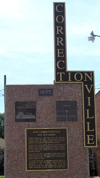
The title of the marker, “How Correctionville Got It’s Name!” is both enthusiastic and mispunctuated. It’s “its” not “it’s”.

Correctionville, in Woodbury County, is named for the survey correction line that runs through the town and across the state. The offset in the county lines is related to this line. Another offset runs on the Muscatine-Cedar county line above the southern tier of the counties to the west.

At various points in its history, US 20 has followed significant portions of the line across the state. Segments from Dyersville to Raymond, the Black Hawk-Grundy county line to IA 14, Williams to Duncombe, and Early to the east edge of Sioux City hewed on or closely to the line.

With the construction of four-lane roads, though, new segments often stray from the grid, either slightly or running on the half-section. Much of new 20 from Early to Moorland will be about a mile and a half south of the correction line; new 20 in Grundy County is half a mile off. Continue reading

Posted in Construction, Highway Miscellaneous | Comments Off on Off the grid