
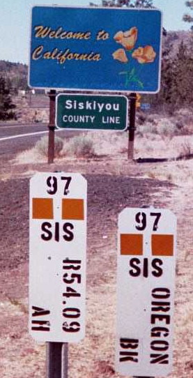
August 2001: California has its own style of mile markers, with county identifiers. This is US 97 at the Oregon border. I have traveled the entire length of US 97 in California.
August 2001: California has its own style of mile markers, with county identifiers. This is US 97 at the Oregon border. I have traveled the entire length of US 97 in California.
San Antonio, Texas, Jan. 27 — I-35 turns pretty rural just 10 miles from the international border, but has some impressive interchanges at the loop north of the city and the Camino Colombia. The welcome center is at Exit 18, where US 83 splits off. About 25 miles in is a federal inspection point.
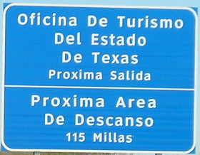
¿Donde está el baño?
And then, a lot of flat land, much like Iowa in winter when there’s no snow and no crops. The semi traffic was heavy, which is obvious given I-35’s key role in NAFTA. I was grateful I had reversed course to be traveling northeast on this segment instead of southwest. The sun behind me was much more calming and made for easier driving. Although it’s still January, this far south I got more time before sunset than in Iowa.
I reached Exit 111, US 57, with minutes of daylight to spare. (But not enough daylight to avoid blurry pictures, it appears now.) I headed west to the only nearby signed intersection on the route, nearly getting blinded by the sun in the process. There was a noticeable amount of traffic for the location and time of day. With that, I got a few miles traveled on one of the shortest, least accessible US routes in the country. Continue reading
Laredo, Texas, Jan. 27 — It’s more than a thousand miles to Iowa. It’s 700 to Mexico City. It’s the end of January, and it’s 84 degrees.
Here, at the doorstep to Mexico, Interstate Highway 35 finally rolls to a stop.
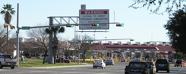
Four stoplights separate I-35 from International Bridge No. 2
There’s no “End” sign, just the freeway itself coming from a depressed grade up to stoplights with overhead and ground-based signs pointing to the bridges or US 83’s journey farther south on this side of the Rio Grande. On this day, the humongous Mexican and American flags were not flying to delineate the border, but the casas de cambio serve about the same purpose. Continue reading
Polk County. Skipped the U’s and V’s again, apparently.
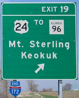
April 20, 2008: North end of I-172 in no place in particular, Illinois. Functionally, I-172 is a big bypass of Quincy and connection for Quincy to points southwest and southeast, but now it works for the northeast as well with progress on the IL 336 corridor. It’s part of the Chicago-Kansas City corridor, a name pushed as an attempt to get truck traffic to use I-88 to the Quad Cities and a series of four-lane roads south of there to Hannibal, then US 36 (future I-72) and I-35 to KC. Illinois has also given the route a designation of IL 110, which like IA 27 is redundant for a good portion of the route.
So…why Keokuk? IL 96 goes to Hamilton, across the river from Keokuk, and IL 96 isn’t at this intersection — it’s to the west — so that’s three separate routes one must take from this location to get there. I won’t complain too much, though, since Missouri has the exact opposite problem of not mentioning Keokuk on US 61 until it absolutely has to!
Keokuk and Mount Sterling are the control cities for the entire length of I-172 except the south end itself. Compare, for example, this sign at an interchange with I-39. Mount Sterling is east on US 24.
(You thought I would go with the obvious choice for this number, didn’t you? Ha!)
Or: Two counties named Jim
Or: So that’s what 70 mph on a two-lane is like
San Antonio (via Corpus Christi et al.), Texas, Jan. 27 — I started in the Corpus Christi area by driving back across the bay to the USS Lexington and spent two and a half hours there. The tours are all set up so there’s only one way to go.
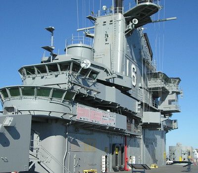
Superstructure of the USS Lexington
I-69 is signed on the BGSs, and some of those have “Texas” on the shields, but ground-mounted shields are inconsistent. There is a posted end where the freeway turns into a 35-mph curve. There is some beginnings of construction there, presumably to rectify that, but I-69 won’t be going south for a while.
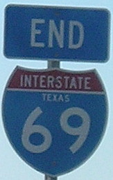
This is wrong. So, so wrong. I-69 does not belong anywhere in Texas. Or Louisiana, Arkansas, or Mississippi.
Filled the tank and ate in Kingsville, near-last outpost of civilization on US 77 for a while. You can tell it counts for civilization in Texas because it has a Whataburger. Iowans only know Whataburger for its trolling of the (former) Big 12 North during basketball games, running advertisements during games like Iowa State-Kansas State when its northernmost locations are in Stillwater and Tulsa. Continue reading
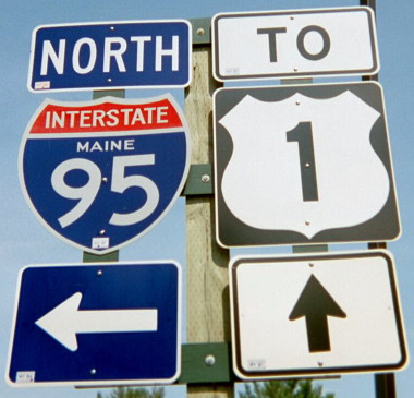
August 2002: Our vacation to Canada that year took us just inside the Maine border, to get that state checked off our lists.
Nevada, North Dakota, Maine. Quite a set, isn’t it?
Corpus Christi, Texas, Jan. 26 — Texans take an inordinate amount of pride in the shape of their state. It’s everywhere. (See, for example, the shield in the previous Texas post.) Today, that spirit manifested itself in the Texas-shaped waffles at the hotel breakfast.
I saw a pamphlet advertising an IMAX movie about the Alamo with 3 hours of validated parking. The movie was 45 minutes. It was entertaining, but I probably could have done without it, especially given a 15-minute History Channel version I saw later that did the same thing. I think it ends up a wash on parking though, and didn’t cost me any real time.
Since I was coming into the Alamo from the mall side, I completely missed the iconic structure at the beginning. Oops. Instead I started in the courtyard and wandered more or less in the reverse I should have. The interior is part shrine, part archaeological project, part museum. Incidentally, once you get past the arch that defines the front (that wasn’t there in 1836), the roof is a regular rounded concrete one.

Inside: Memorial to the Alamo fighters and views of the architecture
The parking garage’s pay setup gave me an hour more at $3, so I spent it wandering part of the Riverwalk. I ate pizza (Yeah, yeah, I know. But it was a place on the Riverwalk. That counts for something right?) and listened to a mariachi band playing for other customers.
Then it was out for a quick photo of the Alamodome, a detour back up to photograph the north end of I-37, then back south. Since it was early afternoon it was a good time to do the I-410 loop.
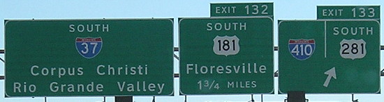
The south part of the loop was surprisingly empty and only four lanes. It got up there on the north side though, along with some fantastic interchanges. This is the first x10 that I’ve clinched. Not bad, considering that four years ago I-10 itself was my least traveled 2di.
While between I-35 and I-10 on the west side, I heard that the Texas Transportation Commission had just approved raising the speed limit to 75 on multiple interstates, including I-35 between SA and Laredo, practically all of I-37, I-10 northwest of SA, and I-10 between SA and Houston. I would soon find out why.
There’s not really much to see on I-37, even with my short detour to Wilson County. Parts of the asphalt rival I-80 in Dallas County as the “loudest” pavement I’ve been on. On the other hand, none of the roads in Texas have the pops and seams associated with freeze-and-bake cycles in the North.
I was surprised that I-37 only had “picnic areas” as opposed to full-fledged rest areas along the route. I did NOT see any state-name I-37 shields the entire time, a shame given that only Texas can lay claim to this number.
I approached Corpus Christi in the 5:00 hour, perfect for driving east. Saw the newly installed I-69 signs and downtown traffic wasn’t bad at all. Since I would be coming back this way, I thought I would take the road past the curve to become US 181 and see where it led me. I ended up on Shoreline Boulevard against the seawall. Although there are four intersections, the street’s name is “Interstate Highway 37” to the end.

A stoplight on an interstate? Not really, but doesn’t this look weird?
I took US 181 across Corpus Christi Bay, my first time on that route, and got a Days Inn in Portland. Temperatures were in the 70s, there wasn’t a cloud in the sky, and it was a perfect end to a fruitful day.
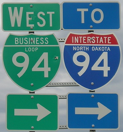
May 11, 2007: West of Mandan, North Dakota, a very long Business Loop 94 leaves old US 10 to return to the interstate. Just north of here is my westernmost point traveled on I-94, a segment that extends all the way to Ann Arbor. That’s about 70 percent of the route. It will be difficult to get to the rest.
San Antonio, Texas, Jan. 25 — It seemed obvious to do when I looked at it. There were two more sites related to President Johnson and the National Museum of the Pacific War in Fredericksburg, and there wasn’t that much driving in between. It turns out the AAA book grossly underestimates the time needed for all of them.
Route: US 290, US 87, I-10
Number of songs on my iPod with “Texas” in the name: Six, not including “Austin” or “Laredo”
An in-between designation of “four-lane undivided rural” for Texas highway maps would be a good idea. The only difference between 290 to Fredericksburg and some roads marked as two lanes is a narrow paved median.
The first stop was LBJ’s boyhood home in Johnson City. I skipped the films, having been at the museum the previous day. From the tour, I learned that his mom was college-educated, a rarity in those days, and the family would often talk politics in the kitchen.
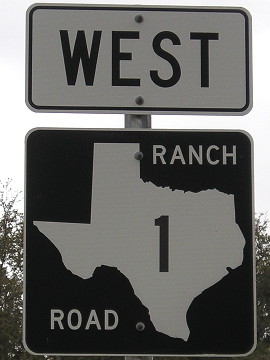
Old US 290 past the LBJ Ranch is Ranch Road 1
Stopped by the LBJ ranch and toured it and the Texas White House. I would’ve preferred to skip part of the driving — it’s not like I haven’t seen a Hereford before, even if these were shorthorns — but it was one way around. The CD from the Park Service could stand to be broken up into tracks, although it did track the driving pretty accurately.
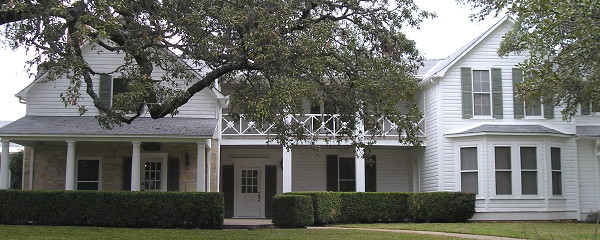
Every room wired for phone lines, TV, and Muzak
The house wasn’t open until recently, after Lady Bird’s death, and it put the National Park Service in the interesting position of removing modernizations to bring rooms back to their bright-yellow formica 1960s glory. The bedrooms were just opened to the public a month ago. And wow, did LBJ love his telephones and electricity. Perhaps a byproduct of going without electricity early in life.
Reached the National Museum of the Pacific War in Fredericksburg at 3. AAA says you need two and a half hours, but four at a minimum is more like it. There’s an outdoor tour portion that is an hour alone, and I didn’t get through the entire museum before it closed at 5. Unfortunately, I was intent on meeting someone in San Antonio, and couldn’t take up the offer to use the admission the next day.
South of Fredericksburg, US 87 was my first experience of a 70-mph limit on a two-lane road, a curvy two-lane at that. I-10 starting at Comfort was very central Texas in character, but once I got nearer the San Antonio metro it escalated quickly. I had to pass my exit because of the traffic.
I had a reservation at a hotel in the northwest that used to be a Hampton but is now a Quality. I suspect that Hampton gave it up because of age. Upon my second trip to the room, I realized it had an ashtray and no “No smoking” marker outside. I went back to the desk for another room and got it. The new room…had an ashtray. I went back to find out what was up. He said the hotel was now smoke-free. When? December. I asked for a nonsmoking room that had already been one and got an upgrade to a “King Deluxe” with a fold-out couch and fridge.