
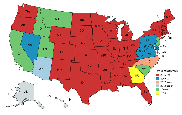
This is an expanded yet condensed version of my 29 states in 12 months of ’16-17. The only additions to the red group on this map were Wyoming (two months before the 12 began), South Dakota (very barely), Washington, Oregon, and North Dakota — all but SD 12 to 17½ years since the previous stop.
At the close of this decade, my least-recently-visited of the 48 are Georgia, Montana (less than 15 hours in the one visit), Idaho, Utah, New Jersey (at 2 hours, now the record-holder for least time spent), and California.
But small-ballers only count states. Counting counties is where it’s at, and I racked up 128 new counties in 11 states the past two years, for a current total of 1680 (53.47%). But again, my nearest unvisited counties with an interstate in them are in Indiana and Arkansas.