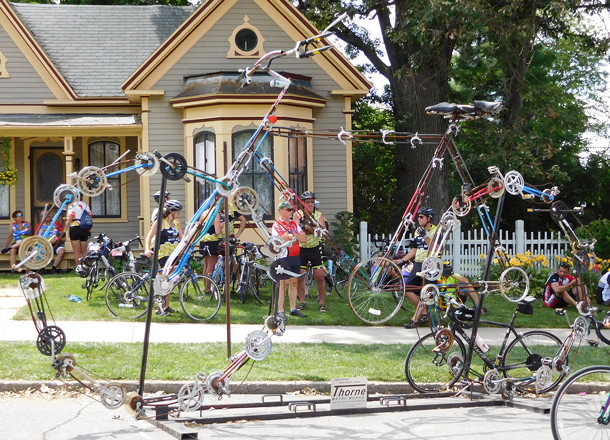
 July 22, 2015: A sculpture made of bicycle parts greets RAGBRAI riders as they go through Parkersburg.
UPDATE 5/4/21: Revised with information following revised daily route maps.
In October, the RAGBRAI website put out unlabeled daily maps, based on the plan from 2020, while also mentioning the meeting towns (daily halfway points). It was pretty easy to figure things out from there. But I waited to post the list, to check on certain edge cities and to make sure something weird didn’t happen. (I mean, weirder.) This turned out to be exceptionally prudent, because on what typically would have been the overnight-stop announcement day, the full 2021 route was released with some segments completely changed. Here are my observations.
- Alta’s wait is over! After being skipped over so many times as riders came into Storm Lake, the town gets its first visit. This will make Traer the largest non-suburb never to have RAGBRAI pass through. “All Out for Alta” – there’s your promo.
IA 3 between Remsen and Meriden has never been used before.- Part of the original Day 2 route was shifted to Day 1, as Sac City replaces Storm Lake as an overnight stop.
Most of the route between Sac City and New Hartford follows the pre-four-lane alignment of US 20. (Some deviations have been added.)Lytton and Moorland, unable to be visited in the past because of the heavy traffic on US 20, are both on the route for the first time.- The “optional gravel day” appears to go into Wright County but anyone following this will only go through Webster City and Alden.
- The official map plays fast and loose with some “towns”.
Roelyn is an elevator. Raymar is a collection of houses that should have been annexed by Elk Run Heights years ago, and the RAGBRAI map omits the latter for some reason.Alice is a church. Hale is a supper club, which is enough to get it on the state map. Six Mile is a collection of houses. Not marked: Prairie Valley Elementary School, out on its lonesome at the D46/P21 intersection between Rinard and Somers. - Newell is dropped for
Schaller andEarly. Dike and Hudson are dropped for Janesville. - I am disappointed/surprised that the roads are not labeled on the route maps. [UPDATE: They were on 5/4.] Also, Aplington is misspelled on the main and daily maps [also fixed].
- Stone City, Viola, Whittier, and Waubeek — all unincorporated — are on the Karras Loop.
- Oxford Junction to Clinton is on an entirely different route, because De Witt replaces Maquoketa for an overnight and a really short Day 7.
The 2020/2021 routes for RAGBRAI and Iowa’s Ride intersect at Alden, and both follow nearly the same route between Urbana and Central City.- First ever visits:
Cleghorn, Meriden, Alta (as noted above), Early, Lytton, Yetter,Somers, Callender, Moorland, Janesville, Calamus. - Evansdale and Elk Run Heights, both last visited in 1974, are back on the map after a very, very long wait. Other pre-2000 towns:
Brandon, Urbana, andCenter Point (1985);Remsen andRinard (1998) and Jesup (1998).
