
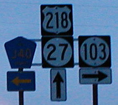
December 30, 2001: West end of IA 103 at the Avenue of the Saints. IA 27 and 103 were only contemporaries for two years before 103 was decommissioned. This intersection is in a different place now that 218 has been upgraded to four lanes.
December 30, 2001: West end of IA 103 at the Avenue of the Saints. IA 27 and 103 were only contemporaries for two years before 103 was decommissioned. This intersection is in a different place now that 218 has been upgraded to four lanes.
Gas went up 14 cents in Iowa last week. The current price for super unleaded is between 40 and 50 cents higher than it was in February 2008 and 2011, $1.30 above 2007, and nearly double that of 2009. Since I historically fill up few times in February, I have few data points, but the trend is not good.
Very little of Jan. 31 was spent in Texas. I had returned the car the previous morning so all I had to worry about was the airport shuttle. My suitcase checked in at 49.5 pounds(!) and I figured out security a little more smoothly this time. The most interesting part of the morning on the ground was a correction in the Austin American-Statesman apologizing for incorrect punctuation of the word “y’all”. My second flight was delayed 40 minutes and then restored before I even left Austin.
The conditions were so good the plane arrived in Phoenix before the ground crew was expecting it. It didn’t help me any, though, since I had a long layover ahead. I was thankful for the power outlets and comfortable seats.
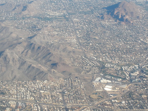
Phoenix from the air looks like a real-life SimCity. Build flat and straight right up to the mountains, then stop.
Takeoffs and landings in Phoenix always give a good view of downtown. The pair today made PHX my most-visited airport of the 21st Century.
Somewhere over Colorado, the clouds filled in and the sun set.
Final arrival in Omaha was also ahead of schedule. Unlike both 2000 and 2010, the return to the Midwest wasn’t nearly as much of a weather shock with above-normal temperatures here.
The two hours back to Des Moines weren’t a problem at all. I was nearly back when I tuned in to hear Iowa State beat Kansas State.
Coming later: Miscellaneous observations and notes.
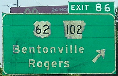
August 2, 2010: I-540 near the Wal-Mart headquarters of Bentonville, Arkansas. The flash illuminates the old sign, from the days when it was only US 71, vs. the exit tab added later.
It didn’t last too long — it happened before free throws with 1:33 left in the game — but the Iowa State fans came through. Hilton Coliseum is now, to my knowledge, the northernmost venue to hear an “S-E-C!” chant. (There was also “Na-na-na-na, hey hey hey, goodbye,” which I believe happened with Colorado too.) I don’t know the location of the northernmost non-sarcastic chant, though.
Final score: ISU 69, A&M 46. A proper eviction.
Related, yet not: A recap of the Jan. 29 women’s game from A&M’s perspective. Plus, a series of pictures from the cross-court drive that resulted in a foul on Chelsea Poppens and the free throws that won the game for A&M. First, Nikki Moody gets absolutely clocked, then the whistle’s blown on Poppens (who, admittedly, did her best to flop) despite the arm thrust out at her.
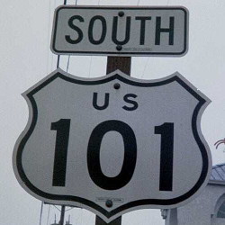
July 31, 2001: Eureka, California. Love the cutout shields. They’re not quite the old style without the state name, though.
Our trip up 101 between San Francisco and US 199 was interrupted only by a trek through the Avenue of the Giants.
Austin, Texas, Jan. 30 — I spent the entire morning at the George H.W. Bush Museum in College Station. I was glad I hadn’t tried to cram it in earlier. The museum is well put together, aside from the “Oval Office” that’s not even a mockup and them not allowing pictures there so as to try to get you to cough up $5 or $9 for one of theirs. Truman, Ford, and LBJ all do that part better.

Then I spent an additional hour looking around the athletic areas. The athletic center next to Kyle Field has Big 12 conference school flags with A&M flags in Nebraska and Colorado’s spots. Those will have to be replaced and new flagpoles added with A&M going to the SEC.
I finally headed out of Bryan at 1:45. I tried to get the GPS to follow a route that would keep me on US 190, but this was easier said than done. Adding to that, US 190 exits from itself twice in short order just east of I-35 (Spur 290 has two lanes, 190 one) and at I-35. At I-35, the exit is VERY poorly signed — take the exit to the frontage road far ahead, then go through lights at the volleyball interchange and turn left. The interchange isn’t a pure volleyball because of the frontage roads but it’s essentially the same concept.
Moderate traffic in the Killeen area, and then a complete morass in Copperas Cove, which is probably why they’re working on a bypass. West of there to Lampasas it’s four lanes with a center turning lane.
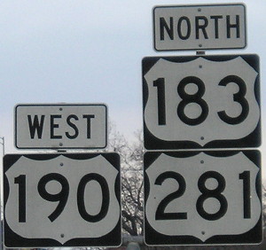
It’s not the highest US route multiplex sum, but it’s high up there.
I turned north just a bit to be on the 183/190/281 triplex, but construction and increasing clouds turned me south again after going through downtown. US 183 is four lanes undivided all the way to Austin. That center lane makes all the difference; 290 is marked as four lanes on the AAA map while 183 isn’t.
Both the layout of the road and the GPS tried to get me to take the tollway. There are a couple signs saying US 183 turns, but you have to be alert not to get onto “183A”. I think there used to be a way Texas could have signed the road as “Toll US 183,” but putting the US route on the free road is the right way to go. Hear that, Illinois?
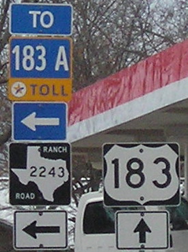
No, I will not turn left. Stop recalculating.
The GPS wanted me to turn left to the toll road every time I passed an intersection that connected. I wish there was a way to input “Avoid toll road” or, more specific to this case, “I don’t want to go to that road and stop trying.” I think that’s out of the realm of current technology, though, and are why roadgeeks with maps are still important.
Once US 183 met the tollway/freeway again, it had to “merge onto itself” and this was mostly moderately signed. That’s when it steadily started to sprinkle. After crossing I-35, traffic started to slow near the Manor Road exit, where there are some high ramps being constructed. It was a crawl most of the rest of the way to the hotel near the airport. I turned the car in and saved $40 for not having it another 12 hours, plus I won’t have to worry about it in the morning.
With the five counties I added today, I almost closed the gap between I-35 and I-45, but not quite. Limestone County was just awkward to get to, and although it theoretically would have been doable, I got back to Austin just about the right time.
According to Clinched Highway Mapping, I have traveled approximately 1036 miles on I-40 and 1035 miles on US 40.
That’s not going to be the case for long, though. Once the Crosstown Expressway’s westbound lanes open in Oklahoma City, I will lose both my clinch of I-40 in Oklahoma and interstates in the state of Oklahoma. The eastbound lanes opened earlier this year.
Fifteen years and a month after 000AAA was handed out to someone in Adair County, we’ve reached Z. There are less than 500,000 combinations left, assuming IOQUV are skipped again. (Use of D in the second position may or may not have been constant.) If the Legislature had been on the ball three years ago, January would have been the perfect time for a new design, but as far as I know we’re going to be stuck with a simple alphanumeric rollover. That raises the question of what we’ll do when (if?) the design does change.
However, the plate I saw had a much more significant issue. The zeroes had a slash through them. It is every bit as aesthetically displeasing as you would image. It’s also completely unnecessary, because even in a switch from 999ZZZ to AAA000, as long as Iowa keeps letters and numbers together there’s no confusion.

It’s 2012, not 1987!
(PS: Southeast Polk, you play it too fast.)
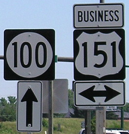
July 16, 2006: Junction of IA 100 (Collins Road) and Business US 151 (1st Avenue) in northeast Cedar Rapids. This was the end of IA 100 in 1984-96, and before then, IA 150 turned left here in a wrong-way multiplex with US 151 — it was going south while 151 was going north on a road running northeastward.
This ends the easy part of the number sequence. From this point forward, I won’t hesitate to use dates already used, nor will I make photos from previously used intersections ineligible.