Jan 13

Photos by the numbers: 72

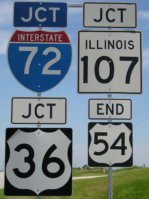
July 16, 2008: East end of US 54 in western Illinois. It used to go to Chicago; a piece that doesn’t stick closely to the interstates is still IL 54. US 36 was signed as the freeway route and I-72 was added later, but there are significant stretches where it could be returned to the two-lane route.

The “54” is normal size. The others are jumbo for interstates, although this is the intersecting road. Illinois puts its name on its state route shields (has to, with Indiana’s also being square) but not the interstates.
Posted in Sequences | Comments Off on Photos by the numbers: 72
Jan 12

Photos by the numbers: 71

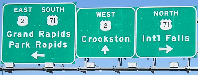
May 9, 2007: Bemidji, Minnesota. Northernmost point traveled on US 71, less than 120 miles from Canada.

My southernmost point on US 71 is in the Shreveport area.

Posted in Sequences | Comments Off on Photos by the numbers: 71
Jan 11

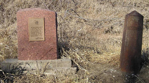
Sullivan’s corner

South side of Section 25, Jackson Township, Taylor County. From 1820 to 1837, this was the northwest corner of the state of Missouri. The survey east of this point to the Mississippi River left something to be desired.

The linked page will be updated (eventually) with the markers above. A completely dry (until now) January made the dirt road needed to get there from the north passable. When you get a 55-degree day in January you don’t let it go to waste.

Posted in Geography | Comments Off on Sullivan’s corner
Jan 11

Photos by the numbers: 70

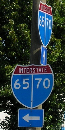
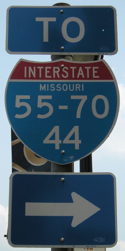
July 15, 2008 and June 9, 2011: Split shields in downtown Indianapolis and St. Louis. Weird, aren’t they?

I’ve been on I-70 from the west edge of Denver to the east I-55 split and from Indianapolis to Fredericksburg MD, leaving gaps at both ends and the middle.

Posted in Sequences | Comments Off on Photos by the numbers: 70
Jan 10

Photos by the numbers: 69

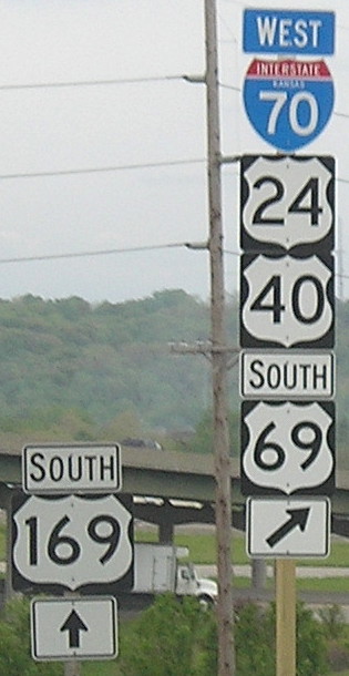
May 5, 2009: Kansas City, Kansas. This is after the rerouting of US 24/40 onto I-70 in KCK, taking away the independent segment of those routes east of US 73/KS 7. US 69 and 169 bump against each other repeatedly in the KC area. The numbers have even swapped roads a few times. There are some ways to iron it out — without dumping more onto the interstates, I might add — but it’s unlikely to happen.

I’ve traveled every mile of US 69 from the Texas/Oklahoma state line to its north end in Albert Lea.

Posted in Sequences | Comments Off on Photos by the numbers: 69
Jan 10

So long, Pamida

This is a few days old, but it appears the Pamida brand will be going away. There are Pamida stores in Toledo and Eldora. Guess I should’ve taken a picture one of those many times I was cataloging changes on US 30.

Posted in Tama County | Comments Off on So long, Pamida
Jan 09

Photos by the numbers: 68

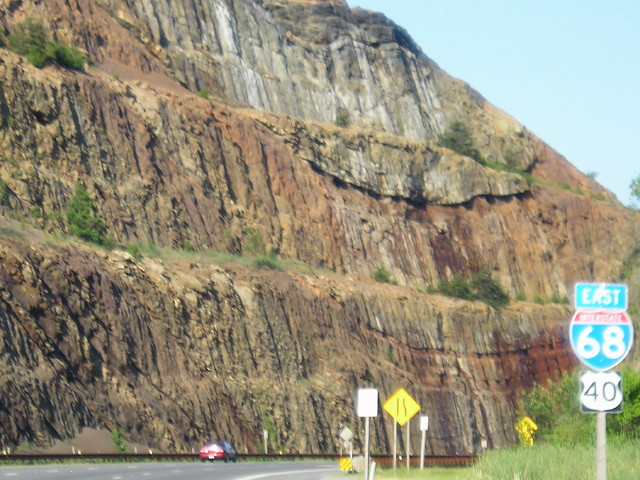
June 25, 2009: Sideling Hill cut on I-68 in western Maryland. Sadly, we did not have time to stop at the visitors center, which closed permanently six weeks later. Here’s a description of the geographical features.

This trip also gave me a stretch of US 40 in Maryland, so now I’ve been on it for some length in every state although some of those are interstate-only.

Posted in Sequences | Comments Off on Photos by the numbers: 68
Jan 08

Photos by the numbers: 67

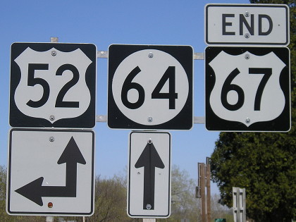
April 18, 2006: North end of US 67 near Iowa’s easternmost point. US 67 is a diagonal route, although its later northernmost segment runs more north-south. For nearly 35 years, 67 defined the eastern curve of Iowa from Davenport to Dubuque, running concurrently with US 52 for no particular reason.

Two of the numbers are out of place sequence-wise, but Iowa has every odd US route number from 59 to 71, plus 75 and 77.

Posted in Sequences | Comments Off on Photos by the numbers: 67
Jan 07

Photos by the numbers: 66

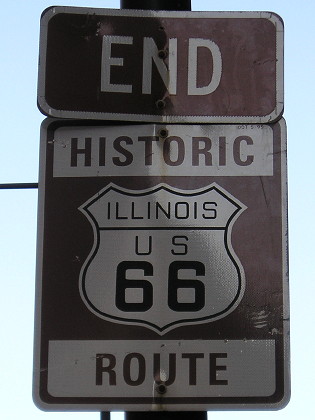
June 12, 2011: Downtown Chicago at the “classic” or “traditional” end of US 66.

It is always interesting to be traveling on a lonely Iowa county road and hear news and traffic on WBBM. (Less so to actually BE on the Dan Ryan/Kennedy and hear the same.) The bustling city is six hours away, and I enjoyed walking up and down the Magnificent Mile, but the gravel roads and open skies and peaceful fields have their own magnificence.

Posted in Sequences | Comments Off on Photos by the numbers: 66
Jan 06

Photos by the numbers: 65

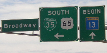
May 19, 2004: Downtown Albert Lea, less than five miles from US 65’s north end. This is also the south end of MN 13. It would have been smarter for Minnesota to extend US 69 either to this intersection (instead of 13) or have it come up with 13 to I-90 rather than have it continue to end at old US 16.

Posted in Sequences | Comments Off on Photos by the numbers: 65