Because of the freeway revolt that resulted in I-40 being routed around the north side of Memphis, the exit numbering convention is a little off. There are multiple lettered exits in “mile” 1 and 2, and then I-40’s exits around I-240 are a little strange. Eastbound, Exit 10 is followed by Exits 12A-B-C followed by Exit 12, while westbound, it is Exit 12 followed by Exits 10B-A followed by Exit 10 — and 10B is I-40 exiting from itself. Mileposts on the side note distances on Mile 11B.
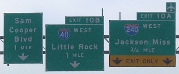 Westbound I-40 approaching east junction I-240. The exit sends traffic down to one lane, just like I-55’s loop ramp east of the Mississippi River.
Sam Cooper Boulevard is the part of I-40 through Memphis that was built. It goes about halfway through to a dead end north of Liberty Bowl Stadium. There are still signs that say “West / [blank space] / Little Rock.”
To clinch I-240, you have to go north of the exit for I-40 west. The north-south route has a consistent mainline. In the future, it’s supposed to become part of I-69, but as of the end of 2012 there are no signs.
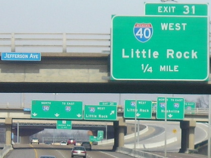
I-240 and frontage roads approaching I-40. I-240 has one exit to the north, Jackson Avenue, before the mainline of I-40 fully merges.
After crossing the river into West Memphis, everything is in Clearview. There are frontage roads running on either side of the I-40/55 duplex, and only one westbound exit shared by I-40/55. There are three subsequent entrance ramps. For hotels on the south side of the road, there are two ways to get there, either the AR 191 bridge or a U-turn all the way on the west end. (Or make sure to take the offramp before 55 merges.)
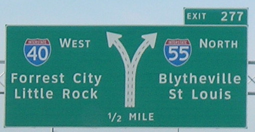
View of I-40/55 west split from frontage road at AR 77
What you don’t see in all this are the US highways along for the ride. If the BGS above showed all the routes like it is supposed to, it would have I-40 West, US 63 South, and US 79 South on the left, and I-55 North, US 61 North, US 63 North, and US 64 West on the right. Arkansas loves putting US routes on interstates, but hates putting them on signs. And yes, this is the easternmost extend of US 63’s southeastward trend in Arkansas before it is reversed to go west-southwest along I-40; I’ve ranted about that already. (Still valid!)
After this short stint in Arkansas (along with a slew of slightly out of focus pictures), it was time to head back to Tennessee and downtown Memphis for Beale Street and the Liberty Bowl parade.
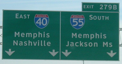
All roads lead to Memphis. Note also the rare two-states-away line with Jackson, although to separate it from Jackson TN with the postal abbreviation it should be “MS” not “Ms”.
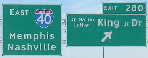
Rather than abbreviate, West Memphis spelled out King’s name in a smaller size. That means the sign has both the “Dr” for “Doctor” and the “Dr” for “Drive.” I’m sure that would drive a GPS nuts.
