
June 22, 2013
The Iowa Welcome Center/Lincoln Highway Interpretive Center northeast of Missouri Valley is a definite stop for any traveler. A film inside the welcome center, as well as the displays and representations of the early days of highway travel, are all worth seeing.
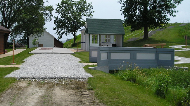
The picture above shows the evolution of surfacing, laid right on an old grade of the Lincoln Highway (a part of Monroe Avenue used to curve right instead of left as part of the route). You can walk from dirt to gravel to brick/concrete to asphalt. On the side are scaled-down replicas of a bridge, tourist cabin, and gas station typical of the era. The bridge leads to a kids’ play area on winding roads complete with a set of Burma-Shave signs.
Much of the signed Lincoln Highway between Missouri Valley and Dunlap is gravel, moved west and diagonalized in later stages. It’s narrow and not always straight, either, a contrast even to the 10 miles of gravel between Westside and Carroll.