
The trio of Meriden, Cleghorn, and Marcus were once served by individual spur routes from IA 5 (now IA 3) until the highway was moved closer to the railroad. Today, IA 143 is the only number that remains, because downtown Marcus was still a mile off the road and then 143 was extended northward later.
I thought I was able to mark the threesome off the list back in June 2004. They certainly look “on” the highway, right? But just to be sure, I checked the city maps online. Cleghorn’s southern border is IA 3, but then I saw the dotted line for Meriden, implying that the city limits did not reach the highway. Then I looked on Google Street View and saw the arrow pointing to the town rather than announcing city limits.
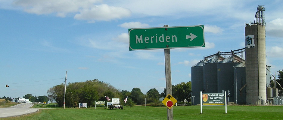
October 3, 2016: Somewhere in that green space is the official city boundary. Perhaps a rail siding was removed or, more likely, the highway pavement shifted northward. This photo enlarges in a new window/tab.
If I had completed my travels and then saw this, I would have been some combination of upset and resigned, because it’s not a short jaunt over there. Fortunately, I could incorporate a visit into this last trip with little difficulty.
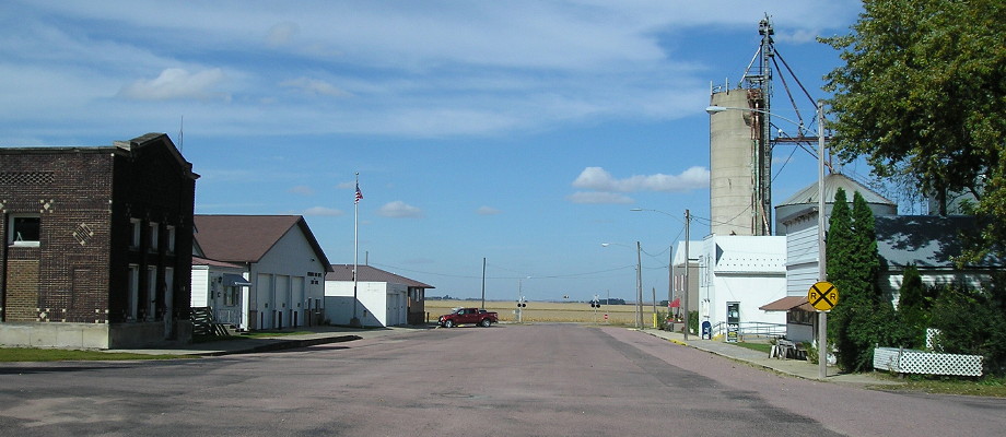 Downtown Meriden. Behind the camera is the telephone company, which aside from the elevator was the only place cars were parked in the middle of a weekday afternoon.
For good measure, I also took the time to go into Cleghorn rather than just past it, and photograph the school that was closed recently. MMC got to keep a high school in Marcus after a tenuous dance with Remen-Union to the west, but Cleghorn Elementary was shuttered as a side effect. There are now only seven high schools along IA 3 west of I-35.