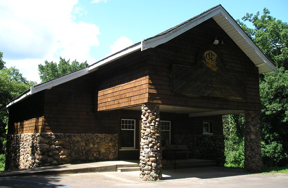
July 29, 2017: The Iowa Civilian Conservation Corps Museum in Backbone State Park shows off the contributions the New Deal program made to Iowa’s state parks and natural resources. Backbone, Iowa’s first state park, celebrates its centennial next year.
At the end of 1926, Iowa had a network of newly signed highways. The brand new federal system linked the state from coast to coast and from the Dominion of Canada to New Orleans and the Gulf of Mexico (at the expense of the auto trails, which would dry up in the next five years).
The October 1926 renumbering included the introduction of the round shield with “IOWA” at the top. Ducking just under the wire for inclusion were #152 (a spur to Murray, signed at the same time US 34 was signed south of town), #153 (Wyoming to Oxford Junction), and #154 (the road that was superseded by IA 187 at the end of 1980).
In the remaining three years of the decade, nine new routes would be assigned, while additions to the system and construction changed the routing of others. The first true addition has a little bit of mystery at the beginning and a large mystery at the end.
On May 3, 1927, the Iowa Highway Commission added a road to the north entrance of Backbone State Park to the primary system. At the time, a month could pass between approval of a road in the system and assigning it a number, and another month or more before it was signed in the field, and still more time if construction was involved.
This tiny road was given a number that, months earlier, had run the length of the state: IA 19. Why 19? This ties in to my previous post: The westernmost extension of US 18 came after all the highway signs were put up in October. That meant that not only was #19 newly available, but the #19 shields could be shipped across the state for use. IA 19 had to be designated before September 20, 1927, when a memo explicitly said #104 was the only unused number, save for #24 which had been replaced by #2 a month earlier and had lots of signs.
The November 15, 1927 meeting of the Clayton County Board of Supervisors mentioned a minor change in IA 13 southeast of Strawberry Point. The change took the road off what today is East Mission Road running east out of Strawberry Point and put it on the modern alignment of IA 3/13, including the intersection of the road to Backbone, marked as IA 19 on the 1928 map.
That would have been the end of the story…but there’s one more thing.
In 1957, when the Highway Commission started reassigning numbers to get out of the way of the new interstate system, IA 19 was redesignated IA 410. There was no reason for this to happen. The online route description mentions a letter that, if it was on the microfilm, I missed despite going through the whole roll twice. The small number on a small road was replaced with a large number on a small road, and there it stayed until the Second Great Decommissioning.
The online addition of route descriptions answered the question about another spontaneous renumbering of a road to a state park: IA 162 became IA 322 because “two to three trucks per week” mistook the turn for US 169 half a mile away. Were drivers mistaking the beginning of IA 19 for the turn of IA 13? For now at least, the issue remains a mystery.
