2005 Road Trips
Click on each thumbnail to see a larger 600x450 image.
|
April:
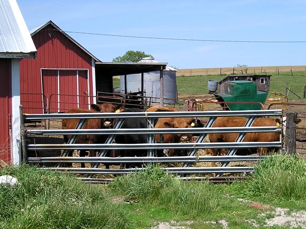
Trying out the new camera
|
|
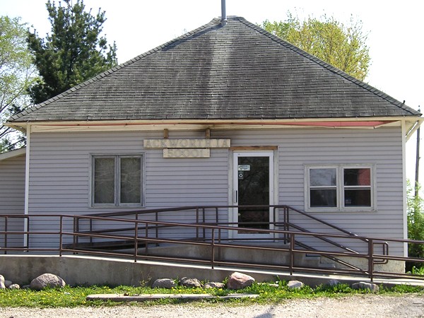 |
Ackworth isn't first alphabetically in the list of Iowa's incorporated communities, but it is first by ZIP code, 50001. The first town alphabetically, Ackley, has a ZIP of 50601. The most interesting ZIP code in Iowa is 50012, reserved exclusively for one part of Iowa State University - Friley Hall, what remains of Helser Hall, and nearby buildings that opened in the 2000s. |
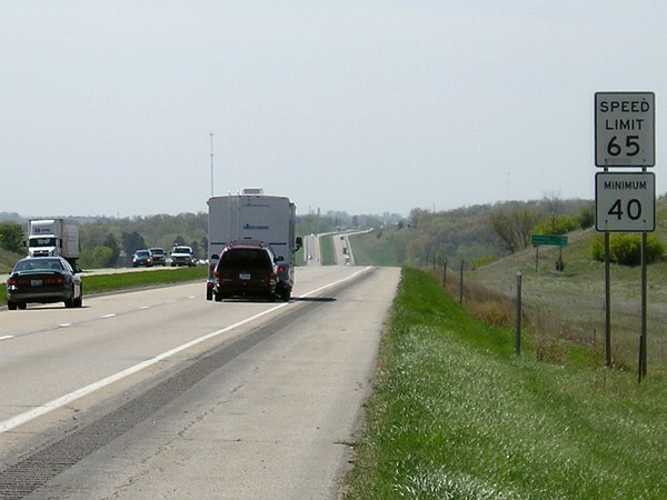 |
Five days before this picture was taken, Gov. Vilsack signed a bill to raise the speed limit on rural interstates from 65 to 70, effective July 1. This is on I-35 in Warren County. |
 |
This mileage sign on US 69 at IA 152 includes the word "Interstate" in the little I-35 shield. |
|
May 10:
Southeast Iowa
|
|
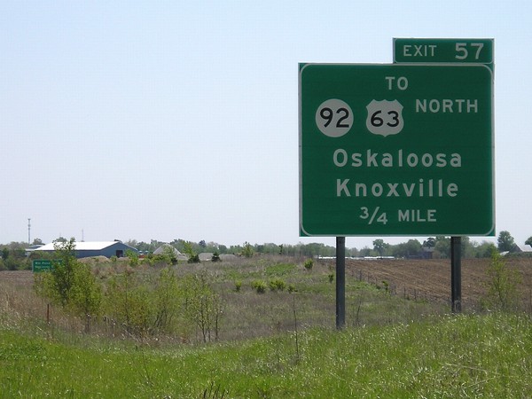 |
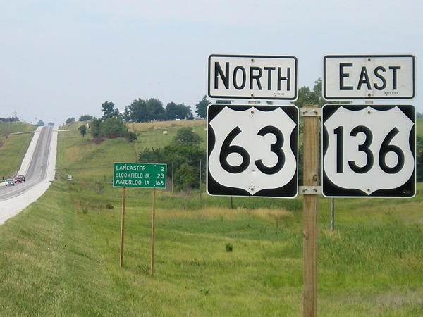
IA 163 deviates from its pre-four-lane path slightly to skirt Oskaloosa farther west. The interchange for IA 92 includes a shortcut to US 63, though there is also an exit for northbound 63 at the end of IA 163. (Given that there's no interchanges between IA 92 and US 63, that's kind of a surprise.) |
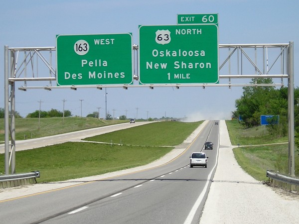 |
Through a coincidence in highway mileage, US 63 and IA 163 converge upon their respective Mile 60 in nearly the same spot. IA 163 enters its 61st mile between its exit for northbound 63 and the mainline's merge into southbound 63. This photo is within 63's 60th mile, so in a sense US 63 is exiting from itself here. For more, see the end page for IA 163 East. |
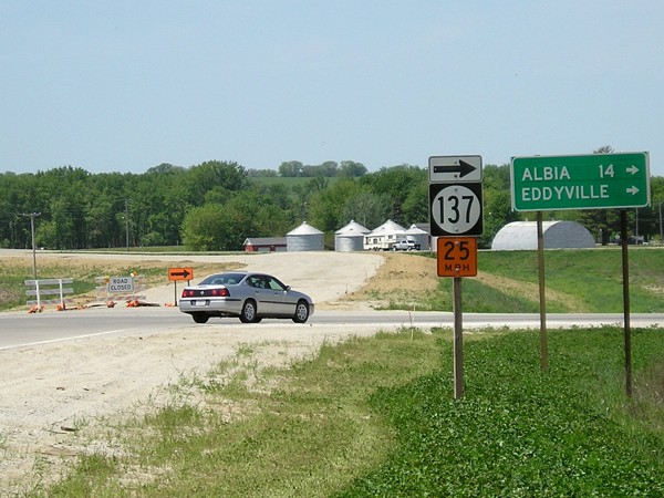 |
After the Eddyville bypass opened, IA 137 was temporarily routed on a piece of old US 63 until a new connection was made between the Monroe/Wapello county line and the new interchange. The pickup in the background is on 137, on the piece of road that was later bypassed and closed. |
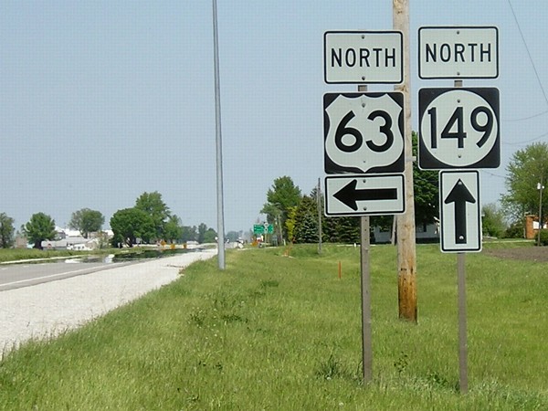 |
These large shields for US 63 and IA 149 at the partial interchange north of Ottumwa are unique. Their days are likely numbered with construction of the Ottumwa bypass in 2007. In the background is the old US 63/IA 389 intersection. |
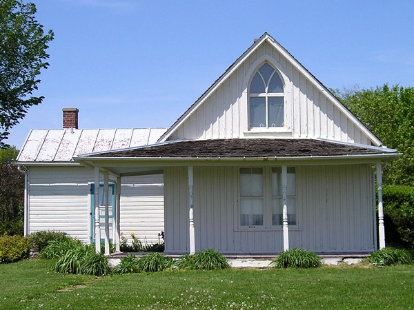 |
A short drive off IA 16 in Eldon is the 125-year-old house used as the background for Grant Wood's most famous painting, "American Gothic." (As with most famous locations, it looks smaller in person.) In the syndicated "Who Wants to be a Millionaire," a woman won a million dollars by knowing that the man who posed as the farmer was Wood's dentist. |
 |
What are you looking at? (North end of IA 98) |
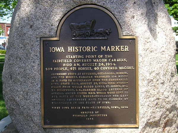 |
This plaque is in the Fairfield town square, along the one-block duplex of IA 1 and US 34. |
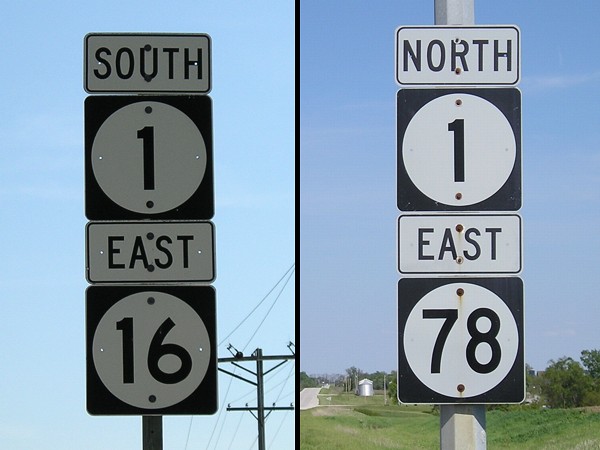 |
IA 1 has duplexes with two state highways along its route. It meets IA 16 in Jefferson County - this trip was my first time in that county - and IA 78 mostly in Washington County except the mile in Keokuk County where this picture was taken. |
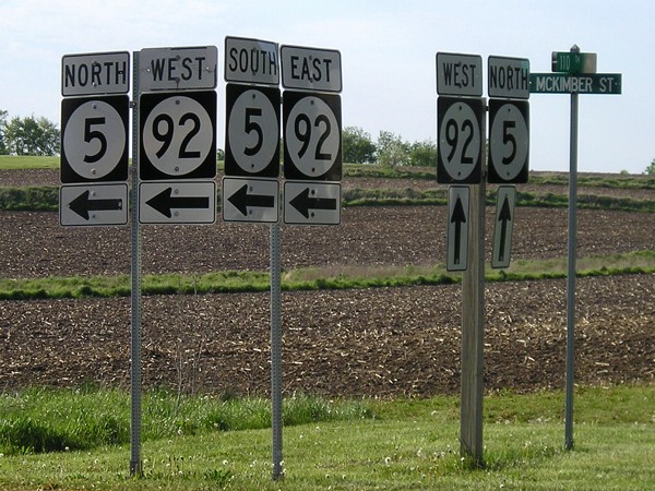 |
These signs at the west end of Business IA 92 in Knoxville were replaced and put on metal poles sometime between June 2002 and May 2005. The leftmost pair is for the northbound road (110th) intersecting Business 92. The two other pairs are for westbound Business 92; going straight ahead merges into 5/92 west of Knoxville. |
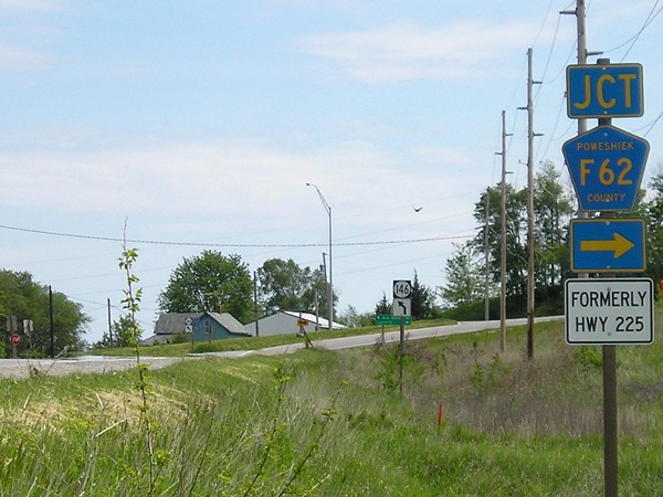 |
This picture, from another May trip, shows what Poweshiek County did after IA 225 was decommissioned. Jasper County had done the same type of thing with IA 223 in 1997. |
|
June 12:
Sioux City trip with Jason Hancock
|
|
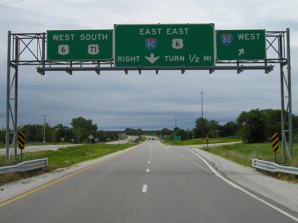 |
Currently, US 71 at I-80 is a folded diamond interchange, but now that the railroad is gone, a cloverleaf is planned for construction in 2007. This picture is just south of the Audubon/Cass county line because I-80 and I-680 stay half a mile south of the county lines from I-29 to Dexter. |
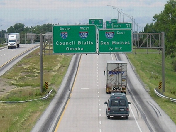 |
View of I-29/I-680 from the former IA 362 bridge at the Loveland interchange. I had last been here in June 2003, and once we got north of IA 175, it was entirely new ground for me. The BGSs visible here were replaced sometime between July 2004 and this trip. |
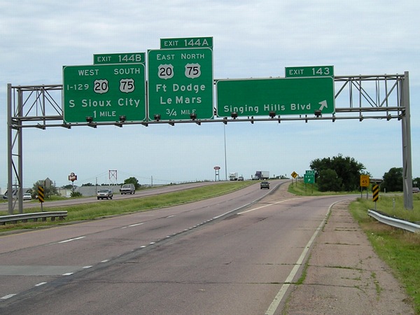 |
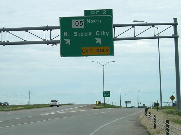
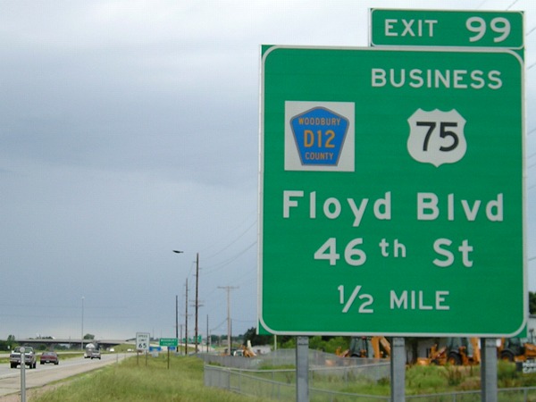
This assembly on the south side of Sioux City got a new middle sign with the opening of the US 75 bypass, but the right sign had its "75 North" taken off without the business route being marked. The text "I-129" is one of the few such indicators remaining at this interchange; newer signs have I-129 shields. Why it wasn't like that in the first place is unknown. |
 |
There are three problems with this sign in South Dakota: 1) Chris Geelhart says SD 105 was decommissioned here in 1998, and the South Dakota DOT's county (but not state!) map agrees; 2) It's in uglier Butt-Ugly Kansas-Style Signage that usual, with that thicker N; 3) This is also Business Spur I-29 eastward to old US 77. If it's not SD 105, then that spur should be signed. |
 |
This gantry is part of the volleyball interchange that marks the north end of US 77, which becomes one of the three US highways (77, 83, and 281) to end in Brownsville TX. Thus, 77 is also one of two Mexico-to-Iowa US highways, the other being US 67. For a lot more pictures of 77's north end, see this page. |
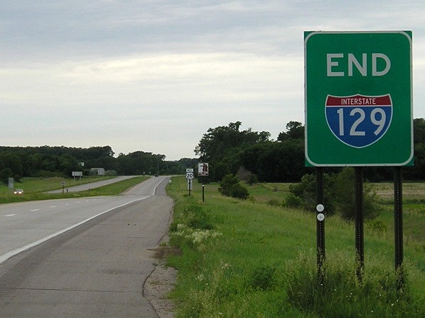 |
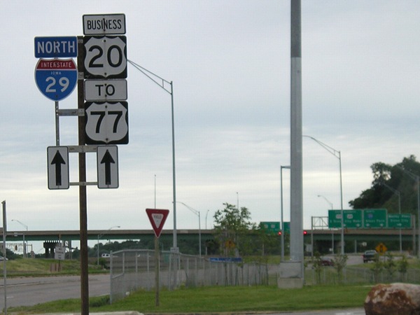
The west end of Interstate 129, one of the rare 3-digit interstates to enter a state that its parent doesn't, is marked just west of an interchange with US 77 in Nebraska. From here, it's about 550 miles along US 20 to Casper WY, the next city with a population above 6,000. (Conversely, there are ten cities along 20 above that mark in the 450 miles heading east - Sioux City, Fort Dodge, Webster City, Cedar Falls, Waterloo, Independence, Dubuque, Freeport, Rockford, and Belvidere - and then you start to hit Chicago's outer suburbs.) |
 |
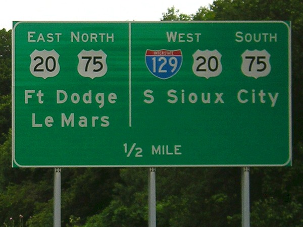
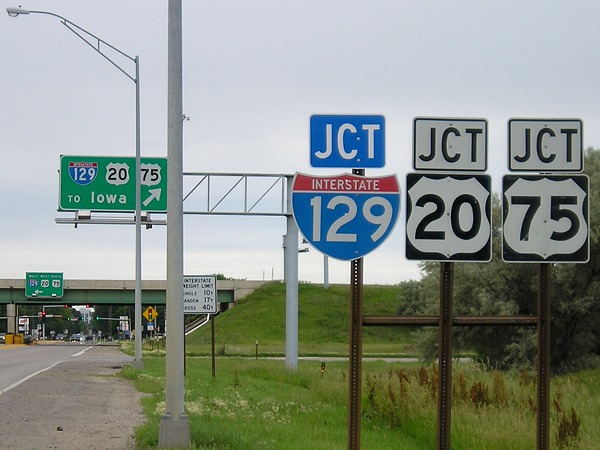
The one and only standalone I-129 shield in Iowa is in the lower right-hand corner of this picture. The DOT could easily make a sign for the gantry to match I-235 and I-680, though. Notice the sign here still points to Sioux City instead of Sioux Falls. More pictures of both ends of I-129 are on this page. |
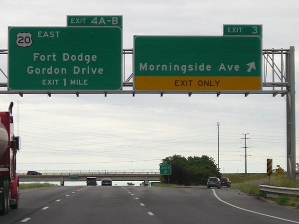 |
The space at the top of the right sign likely held a "To IA 982" or something similar, but only for a few months as the sign was put up after June 2002 and IA 982 was decommissioned July 1, 2003. The space on the left sign was probably "12 North" - notice the "Exit 1 Mile" at the bottom, indicating this sign is very old - and should be filled with a "20 Business". |
 |
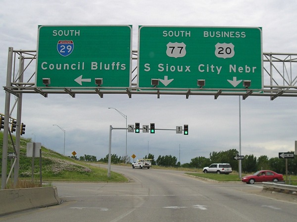
This could be the only regular US 77 shield in Iowa. It's on Gordon Drive as it merges with the offramp from I-29 and goes to the volleyball interchange with 77. (These pictures have been put up in the order they were taken. As you can see, Jason and I approached multiple sites from multiple directions to get the most pictures possible.) |
 |
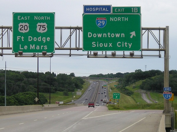
This post-2001 sign on southbound I-29 brings I-129 shields to the Iowa side of the interstate and marks the US 75 duplex with 20. |
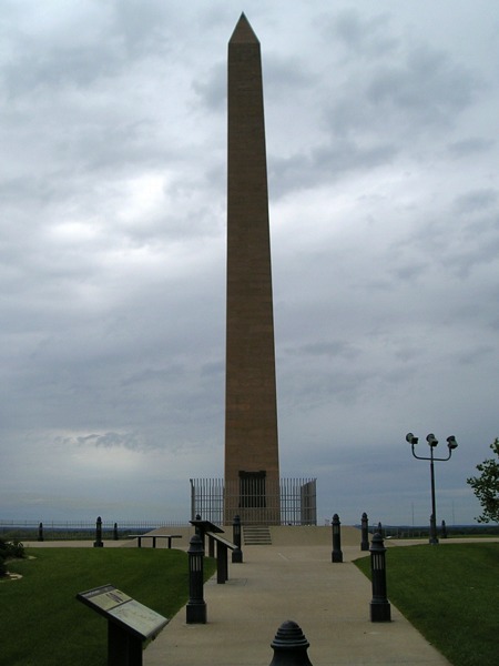 |
Sgt. Charles Floyd was the only member of the Lewis and Clark expedition to die along the journey. Two hundred years later, an obelisk along Business 75 calls attention to his memory. The alignment of 75 here was originally built in 1934, but the monument has been around since 1901. |
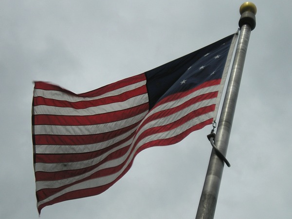 |
This 15-star and 15-stripe flag is like the one Lewis and Clark would have carried as they explored the Louisiana Purchase in 1804-06. (This is despite the fact there were 17 states; Vermont, Kentucky, Tennessee, and Ohio had joined the Union by the time the expedition began.) |
 |
The US 75 bypass on the northeast side of Sioux City joins the 1949 four-lane in a pair of half-interchanges. This photo was taken in Plymouth County, but the Woodbury County sign can be seen by the "Speed Limit 65" in the background between here and the offramp. |
 |
Back in Nebraska again, the route (formerly?) known as NE 35 (and before that, US 73 and 77) meets I-129 in the only interchange between termini. This is supposed to be the end of a Business 20 that started on the east side of Sioux City and crossed into Nebraska on US 77, but signage in South Sioux City is dismal to nonexistent, including here where it's not signed in any direction. |
 |
This is the only four-way stop remaining on US 20 in
Iowa. In October 1958, a month after the first piece of I-35/80 opened
in the Des Moines area, a four-lane segment of US 20 opened
starting here and continuing three miles east. The four-lane has not
progressed eastward since. |
|
July 11:
Clinching IA 5 and south-central Iowa termini
|
|
 |
This county sign in Unionville, Iowa, turns conventional sign justification around: The highways are on the far right, and the mileage comes before the shield instead of vice versa. |
 |
The southernmost sign to reference Waterloo is a few miles into Missouri, and just south of the first sign to give a distance to Jefferson City. |
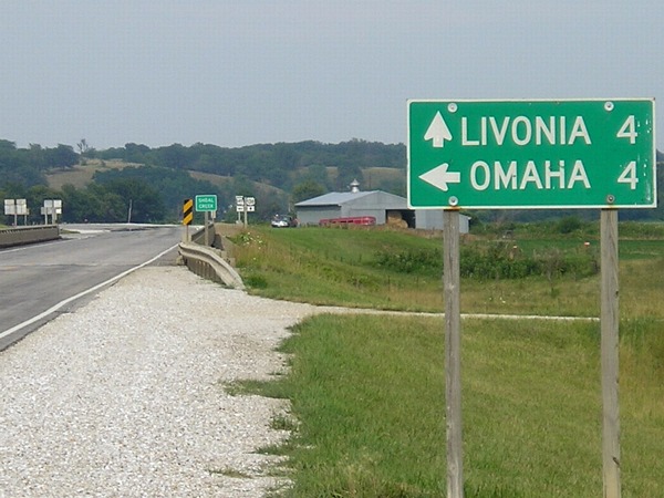 |
No, not that Omaha: MO 149 heads north from US 136 to end at the Iowa line south of Exline, but doesn't connect to an Iowa highway. Omaha MO is so small it's not even on the state map. |
 |
Only about 36 miles from Unionville IA is Unionville MO, home to the Pvtnam Covnty Covrt Hovse. A marker outside says that Putnam and Dodge counties "extended 9 miles into Iowa until the U.S. Supreme Court established the Mo.-Iowa boundary, 1851." This is a bit of...historical license...on Missouri's part, since Iowans would argue that those nine miles were never a part of Missouri to begin with. See my page on Iowa's southern border for more on that controversy. |
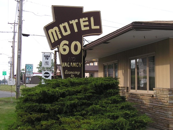 |
One of the few indicators in the state that is a reminder of a previous highway number is the Motel 60 in Centerville, originally in business when IA 5 through town was IA 60. It kept its number after the Great Renumbering of 1969. (Come to think of it, I wonder what happened to the Hi-Way 20 Cafe in Parkersburg after US 20 was rerouted in 2003.) |
 |
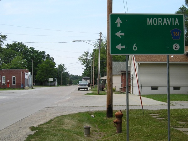
This trip was longer than I thought - not only did I pass Moravia, but I apparently went to New England, which is where US 5 actually is. (Old east end of IA 142) |
|
Assorted
other July 2005 trips
|
|
 |
It should have been a straightforward job: Replace a straight arrow at a T intersection. Instead, this shorter arrow under the IA 17 shield points right into a ditch. |
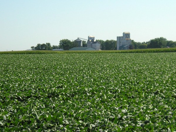 |
A view looking northeast toward the unincorporated village of Fernald from the geographic center of Iowa (more or less). Ahead, you see soybeans. To your left, more soybeans, to your right, more soybeans. Good thing it wasn't a cornfield the year I took this picture. |
 |
This freakishly large mileage sign is on southbound I-35 after the IA 210 interchange. For some reason, the letters are as big as those on a standard BGS. |
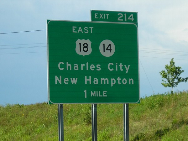 |
This sign along the Charles City bypass was replaced in 2006 when US 18 was rerouted. Fortunately, the eventual change had been known for a while and I was able to get pictures of some of the signs put up when the bypass opened in 2000. |
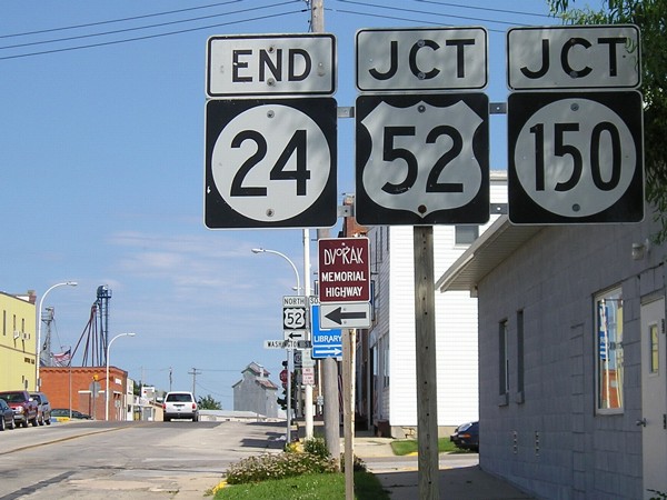 |
Common end of IA 24 and IA 150 in Calmar. From here, it's 70 miles to downtown Waterloo, 73 miles to Mason City, 80 to Rochester, 90 to Cedar Rapids, and 93 to Dubuque. |
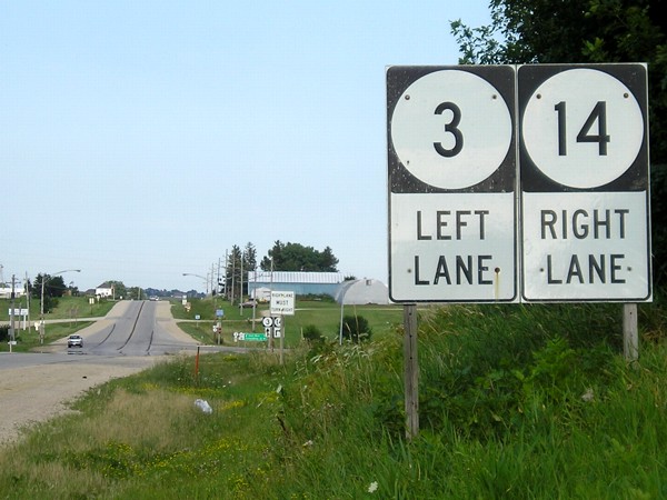 |
IA 3 and IA 14 barely get to know each other along the south side of Allison before they split again. This single-panel sign divides them up. I wonder if the folks at Road Sign Math would accept this picture as an example of pi (3.14)? Mmm...pi... |
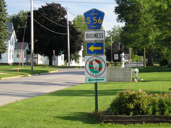 |
A business route for a county road? Ackley put one up for S56. This is west of the business district. Eventually, the real S56 will head south to the new US 20. |
|
October
21: Extreme southeast Iowa
|
|
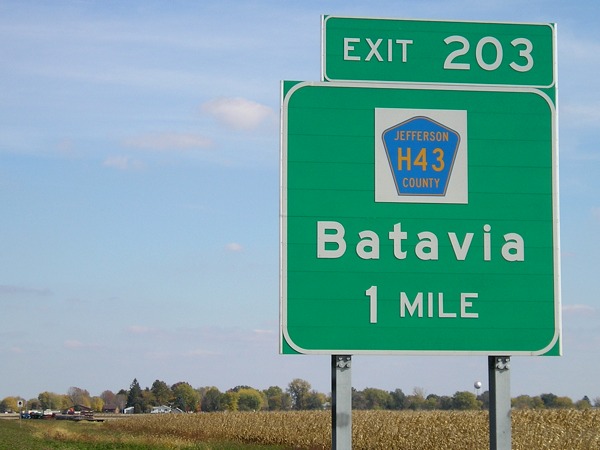 |
The US 34 Batavia bypass was completed before four-lane segments on either side. This sign was up just west of the Wapello/Jefferson county line. H43 is, by its letter, an east-west road, but it's the only way to connect to old 34 through Batavia because the road west of town is blocked off. The interchange is east of where H43 had been; it goes back west through town and then south, then east toward Libertyville. |
 |
In this picture, you can see IA 1's entire duplex with US 34 through Fairfield. The west end is here, and the east end is by the farthest-back yellow banner. While the duplex goes past a park, the county courthouse is farther to the north. Eventually, this will be Business 34 after the last link in the Des Moines-Burlington expressway is completed, a project 40-plus years in the making. |
 |
New 34 around the north side of Mount Pleasant opened in August, and all the signs on southbound 218 were replaced - not for 34, but to add Business 218! See the IA 438 page for the "before" picture, which ironically marked the unopen route (34) instead of the open route (Business 218) for five years. |
 |
A little piece of old US 34 hangs out on the Des Moines County side of the New London bypass; the road that continues ahead in the background curves south (left) to meet 34 at the county line. At far left in the background is an even earlier version of US 34, which was a little south of the pre-bypass route from behind the camera to downtown New London. |
 |
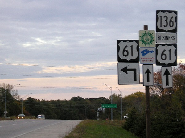
The south end of US 218 in Keokuk is a few miles away from both Missouri and Illinois. In the recent past, all the signs at this intersection were replaced and put on metal poles. In the 14 months between the time I took this picture and visited Keokuk again, all signage on westbound US 136 had disappeared. |
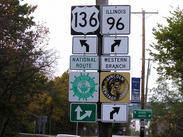 |
IL 96 follows along the Illinois side of the Mississippi River from Kampville to a point southeast of Burlington. Much of it is also the Great River Road. Unlike Iowa, Illinois uses full-sized GRR shields. There is also a sign for the Lincoln Heritage Trail here, and a Mormon Trail sign in the background. It's about two miles from this intersection in Hamilton to Iowa. (IL 96 also goes left with US 136 here.) |
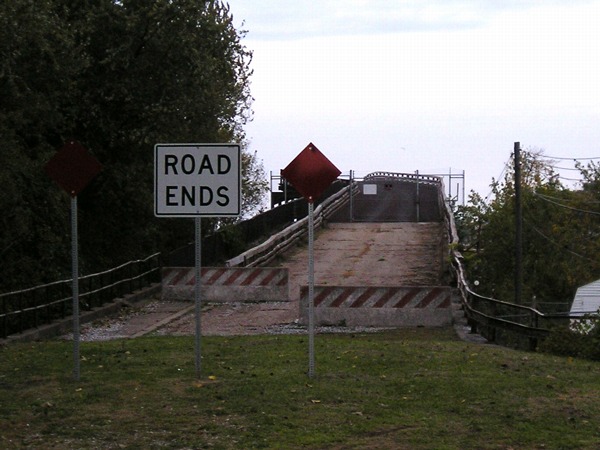 |
The road approach for US 136 to the old Mississippi River bridge is completely blocked off. The other end in Keokuk is also blocked, though you can get to the old toll booth. |
 |
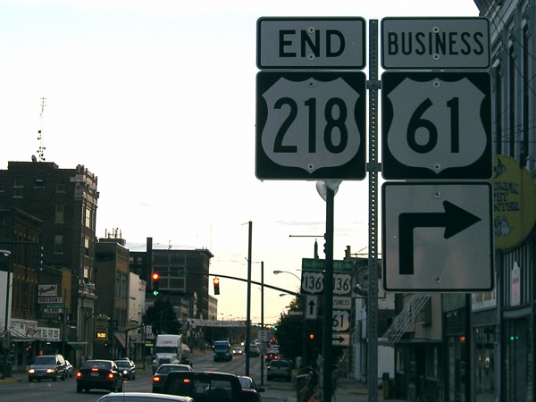
The southernmost highway intersection in Iowa is that of US 61 and 136 at Keokuk's western city limits. The two highways are joined in Iowa just long enough to cross the Des Moines River. Then, 61 splits off to the north while Business 61 follows the old 61 route along 136 and 218 through downtown. Another sign at this intersection points to 218 (follow 61, it says). The part of 61 here up to 218, along with the segments through Fort Madison and Davenport and between Burlington and old IA 305, are the only remaining two-lane segments of that highway in Iowa. |
|
November-December:
Miscellaneous
|
|
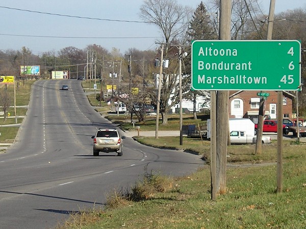 |
On Hubbell Avenue (US 6) just east of 42nd Street - Des Moines' city limits, though development extends far beyond that - is this mileage sign. However, 6 only goes to one of those cities, Altoona. Bondurant is on US 65, which was on Hubbell prior to the end of 1994. Marshalltown was probably originally put on this sign when IA 64 was with 6 and 65 through Des Moines, prior to 1969. Now, one must travel on four highways - 6, 65, 330, and 30 - to get to Marshalltown from here. |
 |
Erroneous US 65 shield with a US 6 shield just past the intersection of Hubbell and Broadway. US 65 is actually on the bridges in the background. Again, this setup would have been right before December 1994. |
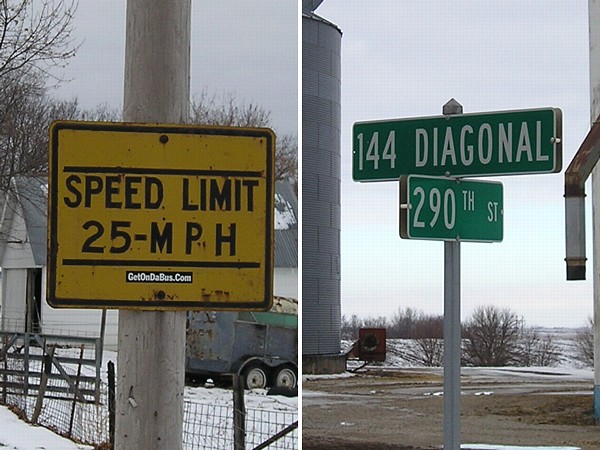 |
Two sort of interesting signs in Rippey. The yellow speed sign at left appeared very old, with embossed lettering. The rural sign on the edge of town by the elevator is on a part of IA 144 that was diagonalized to follow the railroad in the 1940s. |
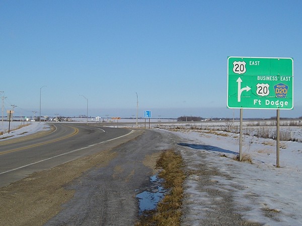 |
Just after this intersection, as US 20 goes across old 20 in the background, 20 becomes a four-lane highway eastward to Dubuque. I was in Fort Dodge that December day for a meeting about future four-lane 20 west of here. This intersection will be changed then; the road that is currently 20 heading east from Moorland will go more northerly to an interchange with new 20. |
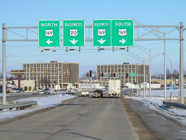 |
Old US 20, now County Road D20, approaches US 169 in Fort Dodge. Notice the "End D20" at right. Straight ahead, along old 20, are now Business 20 and Business 169, both marked here. |
Page created 1/21/07; links updated 1/21/18