Feb 24

V is for Vincent


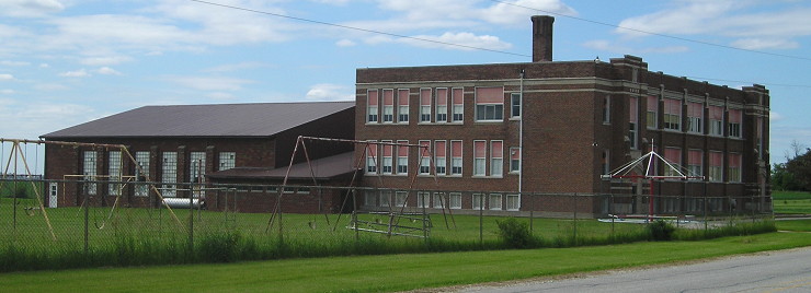
July 6, 2011: Entrance to the Vincent school building in northeast Webster County. At the time the picture was taken, a sign outside said “Vincent Antique Galleries.”

The Eagle Grove school district closed the Vincent attendance center at the end of the 1980-81 school year. Parents appealed to the state to keep it open, but the higher per-pupil cost for the school and a decision by the Iowa Legislature to cut previously proposed education funding in half for 1981-82 made that futile.

Posted in Schools, Sequences | Comments Off on V is for Vincent
Feb 23

W is for Wyman


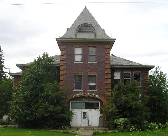
June 1, 2015: The Wyman building is on the cover of Barb and Dave Else’s book “For All the Small Schools: A Photographic Pursuit of Iowa’s Forgotten Schools.”

The village of Wyman, east of Crawfordsville, has a scattering of houses and a Farm Service dealer. Brian McMillin of Iowa Backroads (and the host of this site, BTW) has more about the Wyman school on his website.

Posted in Schools, Sequences | Comments Off on W is for Wyman
Feb 22

Carving up Farragut

The eastern quarter of Fremont County, including the towns of Farragut and Imogene, will become part of the Shenandoah school district next year. The Iowa Department of Education released its plans for the Farragut district, which will be forcibly dissolved at the end of this school year. Articles: Council Bluffs Nonpareil, KMA.

County Road M16 is the dividing line. All of the Farragut district east of it goes to Shenandoah. West of that highway, district land will go to Fremont-Mills (a strip a mile wide), Sidney, and Hamburg. The line separating the latter two east of Riverton is a mile south of J46, meaning all of Riverton goes to Sidney.

The Farragut district was wholly within Fremont County, and Shenandoah edged into the county already. Shenandoah will also be responsible for the Farragut school building.

The dissolution lines imposed by the state are straight and clean, a far cry from what happened to Clearfield when local landowners and the district being dissolved were allowed to create a crazy-quilt map.

Posted in Maps, Schools | Comments Off on Carving up Farragut
Feb 19

X is for Exira

(Hey, that’s cheating! — Ed.)

May 22, 2014: Five weeks after this picture was taken, the school building used in Exira for most of the 20th century was destroyed in a controlled burn.

There is an easy way to tell if a core school building was built before about, say, the Great Depression and if it was built later without looking at a single picture of the building. Find it on a map. Many old schools are in the middle of town, built on land that may have been set aside for a school all the way back when the town was originally platted, to make it easy to walk there and to be a point of pride.

As the land area covered by a single school increased, and the school itself needed to expand, the district would have no choice but to build new on the edge of town. Thus, today’s Exira-Elk Horn-Kimballton High School is on the south side of Exira.


Exira High School’s last hurrah before joining EHK: A 2010 state champion team featuring future ISU and two-time All-Big 12 player Hallie Christofferson.

(The exception to this location postulate, of course, is when the town/village wasn’t big enough to have a “middle”, and then it’s on the edge of town on the main road. For example, Yarmouth.)

Posted in Schools, Sequences | Comments Off on X is for Exira
Feb 18

Y is for Yarmouth


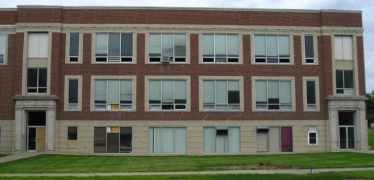
June 1, 2015: The Yarmouth school building in northwest Des Moines County.

The Yarmouth school building is visible from a distance on X31. According to the Mediapolis 1975 centennial book, the school was still in use at that time, 14 years after Yarmouth joined the Mediapolis district.

The front of the school is centered on the street that runs eastward past the few buildings and the elevator in the unincorporated village.

Posted in Schools, Sequences | Comments Off on Y is for Yarmouth
Feb 17

Z is for Zero

There’s nothing there.

Posted in Iowa Miscellaneous, Sequences | Comments Off on Z is for Zero
Feb 17

Clutier’s 1942 championship team remembered

The Gazette looks back at small-town six-on-six champions from eastern Iowa from the first half of the 20th century.

(Coincidentally, the listing of the towns one by one is the same narrative plan I had for something else involving girls’ basketball, the product of which will come later.)

Posted in Schools, Sports, Tama County | Comments Off on Clutier’s 1942 championship team remembered
Feb 16

Diagonal last sub-100-enrollment school standing

Iowa’s 2015-16 certified enrollment numbers were released last month. There was no press release dedicated to it (the annual Condition of Education report comes out at the same time). The overall public enrollment ticked up, but it’s from a trough in 2009, and a shade under the state total in 2003.

The attrition continues in the state’s smallest districts, and we have a “last school standing” of sorts. Prescott, technically the state’s smallest (certified enrollment 79.8), is a zombie district — all its students are going to Creston, and it will fully merge July 1. All Prescott properties are going to be auctioned off tomorrow, BTW.

It’s Diagonal, with 97, that is the smallest school actively educating students, and also the smallest with a high school. The next-smallest K-12 district is Whiting, with a certified enrollment at a whopping 185.6. Lu Verne doubled in size by gaining the lion’s share of Corwith-Wesley’s students.

It takes the bottom 100 Iowa school districts combined to get an enrollment equal to Des Moines’. Oh, and Ankeny’s enrollment has passed Dubuque’s.

(Updating my super-spreadsheet of statewide enrollment 2000-present is much easier after I put in a column listing the school code numbers. Thanks, past me!)

Posted in Schools | Comments Off on Diagonal last sub-100-enrollment school standing
Feb 15

Mediapolis bypass, IA 78 interchange part of US 61 plans

Iowa’s last rural segment of US 61 that isn’t four lanes north of Keokuk is between Burlington and Grandview, and a meeting in Mediapolis on Tuesday is about closing that gap.

The existing five-year plan has US 61 four-laned from the north side of Burlington to a mile north of IA 78 by 2020. Much of the alignment follows existing 61 (PDF), but it bypasses Mediapolis and straightens up north of H28. A new interchange would be built to the east of the present IA 78 intersection.

Posted in Highway Miscellaneous | Comments Off on Mediapolis bypass, IA 78 interchange part of US 61 plans
Feb 12

iPhoto Places thrown onto Apple’s abandonware heap

Apple said, We upped our photo-management system…now up yours!

[This is a rant that needed to be written seven months ago, when the event actually happened, but nothing would have changed if it had. I know that, you know that, and Tim Cook knows that. — Ed.]

It is one thing to introduce a new application that does something “better” and expect (or demand) users to adopt it. But to introduce a new application and cripple an existing one is underhanded, arrogant, and one of the most disturbing trends in software today.

I speak of the tool I have used extensively for years and has been an integral part of the work for this website, iPhoto and specifically its Places tool. To make this clear from the outset: I use iPhoto strictly as an organizational tool. I do my work in GraphicConverter, the venerated Swiss Army Knife of image utilities. But now, the ability to pin photo locations on a map has been taken from me.

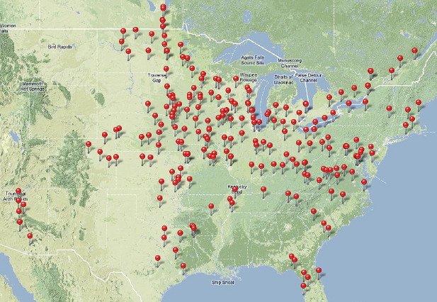
The introduction of Places in iPhoto ’09 was itself a compelling reason to get a new computer. At the time, I had 13,500 photos dating back to June 2001. I had keywords created for the counties I had the most photos in, but I had also taken trips to Virginia and in Florida in the previous 18 months. I could now pinpoint where I was when I took each photo and not only have a big map to show for it, but effortlessly call up every photo I had ever taken near a given location. After two months of work, the national map looked like this:
places-pins-13817

Continue reading →

Posted in Uncategorized | Comments Off on iPhoto Places thrown onto Apple’s abandonware heap