
-
Recent Posts
Informational PDFs
- 2010 Iowa City Population Descending Order
- 2010 Iowa County Population Descending Order
- 2020 Iowa City Population Descending Order
- 2020 Iowa County Population Descending Order
- Iowa HS FB playoff brackets 2014
- Iowa HS FB playoff brackets 2015
- Iowa HS FB playoff brackets 2018
- School Directions Booklet FINAL
Key Posts
- College conferences and House apportionment
- How Iowa State has lost football games in the 21st century
- Iowa 2010 population breakdown
- Iowa daily newspaper publication, 2022
- Iowa school enrollment changes, 2001-15 (maps)
- Iowa's largest school enrollment gainers, 2001-15
- Kossuth County Area Schools and Rural Iowa's Population Collapse
- Post offices targeted for closure (1)
- Post offices targeted for closure (2)
Roadgeeking
Categories
Jul
04
My Lincoln Highway centennial column
Posted in Highway Miscellaneous, Iowa Miscellaneous
Comments Off on My Lincoln Highway centennial column
Jul
04
Lincoln Highway in Story County
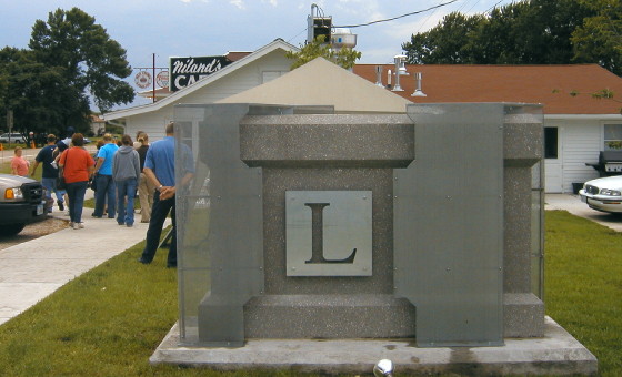
July 7, 2004
The Reed-Niland corner in Colo is an example of a Lincoln Highway landmark that has been given new life in the 21st Century. The cafe and small motel had been closed for years, but both have been restored. The cafe has exhibits and pictures of the Lincoln Highway inside.
The not-quite-an-interchange grade separation of the Lincoln Highway and US 65 dates back to the late 1930s. According to a marker at the motel, Reed resisted the condemnation of his businesses between the Lincoln and what had been a curve for US 65 turning west to Ames when the Highway Commission planned a full cloverleaf.
Posted in Highway Miscellaneous, Sequences
Comments Off on Lincoln Highway in Story County
Jul
03
WordPress image upload troubles
No Lincoln Highway post today. I’ve been fighting with the blog’s image uploader ever since upgrading to 3.5.2. I don’t know what’s wrong or how to fix it. I may have to upload to the site and then link.
Posted in Uncategorized
Comments Off on WordPress image upload troubles
Jul
02
Lincoln Highway in Marshall County
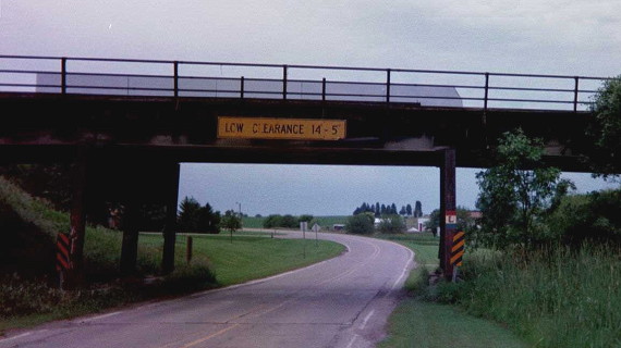
State Center has four different historic routings of the Lincoln Highway, and that’s not counting present-day US 30 to the south or the 1912 Transcontinental path. The town recently put out a pamphlet to explain the different markings.
The photo above is from 2001, showing the railroad overpass on 9th Avenue on the west side of town. That was part of the third-generation route; note the L on the right side. The routing right before that crossed the railroad downtown, using Main Street and 3rd Street before that to go northwest. This section with the overpass remained a part of US 30 until the 1960s.
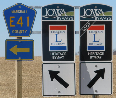
The original original didn’t go through State Center at all but stayed to the north, along 230th Street to Lamoille. Although the Transcontinental used present-day E41, the north route was chosen first and then moved south later. Today, the north route is marked as a loop, shown below at the east end near Lamoille in 2011. This photo also illustrates how the “Loop” sign is not much different from the regular and be hard to grasp on the road.
Posted in Highway Miscellaneous, Sequences
Comments Off on Lincoln Highway in Marshall County
Jul
02
South Sioux City Bluejays
We interrupt the Lincoln Highway photo series for ESPN’s HOW DO I GEOGRAPHY. Deadspin, yes, but just look at the images. Memphis is in Dyersburg, Georgetown is in Delaware, and UConn is in Massachusetts!
Posted in Maps
Comments Off on South Sioux City Bluejays
Jul
01
Lincoln Highway in Tama County
Happy LH centennial! Today is also the 150th anniversary of the beginning of the Battle of Gettysburg.
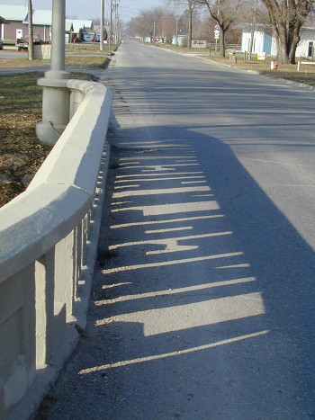
November 27, 2002: Morning shadows on the Tama bridge.
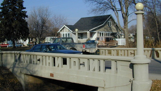
November 27, 2002
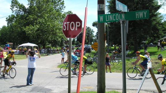
July 23, 2008: RAGBRAI riders pedal through Montour on the Lincoln Highway.
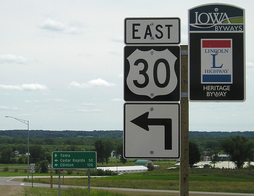
June 24, 2011: The most recent change to the Lincoln Highway happened with the opening of the Tama bypass. About a mile-long segment where 30 and the Lincoln remained together on the east side of Tama, from by the bridge past the King Tower Cafe, was removed when the four-lane opened.
Posted in Highway Miscellaneous, Sequences
Comments Off on Lincoln Highway in Tama County
Jun
30
Lincoln Highway in Benton County
 November 29, 2002 (open picture in new tab for larger version)
The George Preston station in Belle Plaine is one of Iowa’s best-known Lincoln Highway landmarks. He tacked up signs for just about anything road-related, or that you’d buy on the road. When I took pictures at the station in 2002, I had the luck of meeting his son, Ron, who had carried on his father’s legacy. Ron died in 2011, and much of the memorabilia the two had collected was auctioned in 2012.
The garage looks a little different now, with signs for IA 21, IA 131, US 30, and Iowa Scenic Byway on the doors.
Posted in Highway Miscellaneous, Sequences
Comments Off on Lincoln Highway in Benton County
Jun
29
Lincoln Highway in Linn County
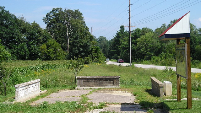
August 8, 2009
East of Cedar Rapids, Mount Vernon Road had a little hiccup in its straightness that was ironed out by the late 1930s. The segment left behind between 44th Street and Wilder Drive is named Lincoln Heights Drive, reflective of its role as part of the Lincoln Highway. However, the original Lincoln didn’t run here; it went through Marion instead.
The Lincoln Highway in Linn County played a background role in Iowa’s last major county-level political change: Cedar Rapids replaced Marion as the county seat in 1919, and Mount Vernon Road was paved eastward to the “Seedling Mile” two years later.
In the 1920s, convincing Iowans to get the state “out of the mud” was a project nearly as herculean as building the roads themselves. But as a few pieces were finished here and there, the lesson became very clear. As Pete Davies put it in the book American Road, pavement was power.
Posted in Highway Miscellaneous, Sequences
Comments Off on Lincoln Highway in Linn County
Jun
28
Complete, comprehensive U.S. Lincoln Highway map
The Lincoln Highway Association has a zoomable, detailed, nationwide overlay on Google Maps of the 1913 Lincoln Highway and some subsequent iterations.
I do see one potential issue in Iowa related to the railroad crossing west of West Side, but there are some clarifications/corrections to my earlier thoughts, including some stubs in Loveland that were there before former IA 183 hugged the railroad closer at a curve, and the Honey Creek Cut.
Now if only I knew how to create a Google Map that used that many points, lines, and details.
Posted in Highway Miscellaneous, Sequences
Comments Off on Complete, comprehensive U.S. Lincoln Highway map
Jun
27
Lincoln Highway in Clinton County
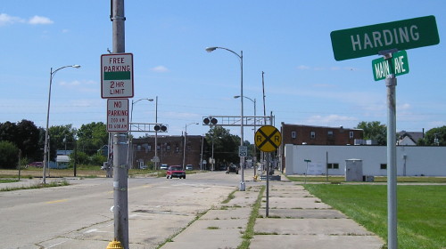
The intersection of Main and Harding in the north part of Clinton, formerly the town of Fulton, is where the Lyons-Fulton bridge reached Iowa after crossing the Mississippi River (and following a long dogleg). This is a few blocks north of where IA 136 crosses the river now.
This picture was taken before official Lincoln Highway signage was put up, but there’s a loop that comes through here before returning to 136 to enable the route to continue into Illinois.
Posted in Highway Miscellaneous, Sequences
Comments Off on Lincoln Highway in Clinton County