
When you look at IA 406 before its death in the Second Great Decommissioning, it’s hard to make an argument for its existence. It was never a spur to West Burlington — in fact, it’s a bypass of the oldest part of town — and Mount Pleasant Street (old US 34) is only a mile away. Yet it dates back to the very formation of Iowa’s numbered system. Why? The name of the road and the November 1915 Iowa Highway Commission Service Bulletin provide likely answers.
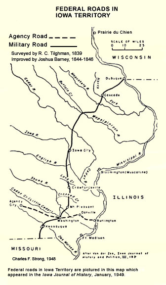
Agency Road ran from Iowa’s first territorial capital in Burlington west to Agency via Hillsboro, then known as Washington. A map in Transportation in Iowa: A Historical Summary, reproduced at this link, indicates it was the first east-west federal road in Iowa. The Service Bulletin fills in more:
Agency was the site, years ago, of an Indian agency and this road is the trail which led across the Pioneer prairie to that point. Agency, while an important point in pioneer days, is now but a very small village a few miles southeast of Ottumwa, and entirely overshadowed by her newer sister, the county seat of Wapello county.
Agency Road is not straight, whereas Mount Pleasant Road to the north is both on a section line and paralleling the railroad, providing another clue to the relative age of this route. But while being there first isn’t a qualification for being an Iowa highway, being paved first would be.
The term “seedling mile” is typically associated with the Lincoln Highway. Such miles were built to promote both the highway and the “Good Roads” movement through use of concrete. Iowa’s Lincoln Highway Seedling Mile is in Linn County. This mile west of Burlington was not associated with those, but it would serve the same purpose.
The November 1915 Service Bulletin does not say precisely where the mile was, only that it was outside Burlington, 16 feet wide, and cost $15,000. It was built by Des Moines County, because the state was not in charge of any roads until July 1, 1920. Agency Road then was designated IA 80, because it would have made plenty of sense to have this pavement as part of the state system.
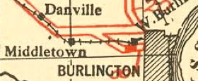
This is from the 1921 state map. From this, it’s reasonable to say that the paved mile was somewhere along the 2-mile section west of today’s Roosevelt Avenue/US 61, which runs along the section line, and east of the point the road angles northwest. The rest of IA 80 was paved in 1921, along with IA 8 between Burlington and Middletown.
If the little part west of Gear Avenue before the angle was involved, then it was part of the state system until 2003. If it was between Gear and Roosevelt, it was part of the state system until 1976. Agency Road east of Roosevelt was dropped in 1956, the year US 61 was rerouted onto Roosevelt and the year before IA 80 was redesignated IA 406 to free up the number for the new east-west interstate.
While IA 406 ended as a vestigial component of the state highway system, its early history made it a logical addition.
Much more about the highways in Burlington can be found in my Burlington Highway Chronology, which I’ve had sitting around for a while but didn’t make active until a reader e-mailed me wondering if one was ever going to be made. Just ahead of the curve.
Sources: IHC Service Bulletin, November 1915; IHC Service Bulletin, May-June 1920.