
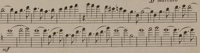
Oh, I’ll tell you what “mf” stands for here, that’s for sure.
This issue is endemic to all Sousa marches, even “Stars and Stripes Forever.” Whee, sight-transposing!
From “The Thunderer,” which the Marine Band says was Sousa’s wife’s favorite (PDF).
Oh, I’ll tell you what “mf” stands for here, that’s for sure.
This issue is endemic to all Sousa marches, even “Stars and Stripes Forever.” Whee, sight-transposing!
From “The Thunderer,” which the Marine Band says was Sousa’s wife’s favorite (PDF).
Iowa’s school districts start enrollment in the 2020s the same way as previous decades — with some of the rich getting richer and many of the poor getting poorer.
Total Iowa public school certified enrollment, rounded, is palindromic: 490,094.
About one-tenth of the state’s districts — 32 of 327, North Scott and up, all 3000 or greater — have 51.6% of the state’s public students. Forty districts lost 20 or more students.
North Tama’s certified enrollment (446) was unchanged, and that’s good enough to be in the top half, growth-wise. If you add together every school North Tama’s size and smaller, you get 79 districts with about 24,000 students — approximately the same as Waukee and Ankeny put together.
Those two suburbs continue to add a small district’s worth of students every year. This year Waukee’s growth of 504 matches BCLUW as the 99th-largest district in the state; Ankeny’s 279 is about that of Tri-County. Elsewhere, North Tama’s entire enrollment equivalent moved to Sioux City, to create the latter’s largest total of this century.
I would argue that this continuous flow to certain districts is affecting other measurements — for example, the number of students participating in sports. The top 20 districts in 2000-01 had nearly 38% of Iowa’s public school students and 34 varsity football teams. The top 20 districts in 2019-20 have nearly 43% of Iowa’s public school students — and 36 varsity football teams.
There are kids who might have been a second-stringer in a small school but plain aren’t out for the sport. Then, of course, there’s specialization (say, a girl no longer being double-counted in basketball and softball because she spends the summer on a non-school team), playing a more niche sport that’s only available in the biggest schools, etc.
To put the growth inequality one more way around: Between 2015 and 2019, statewide certified enrollment grew by 5716. Five districts — Waukee, Ankeny, Iowa City, Dallas Center-Grimes, and Pleasant Valley — grew by a combined number larger than that.
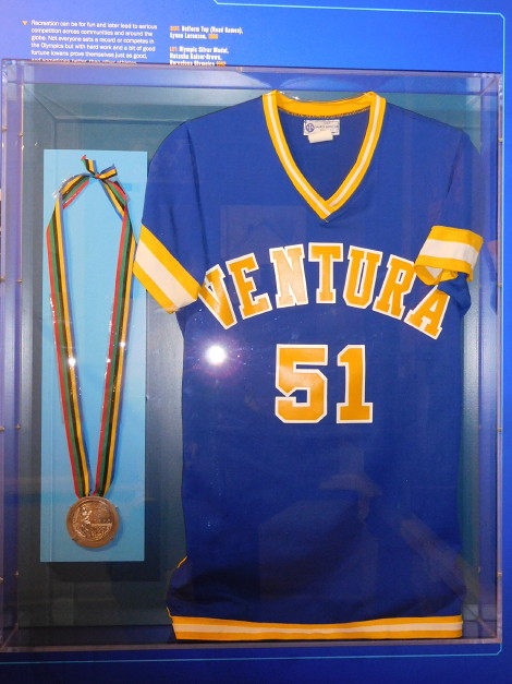
August 17, 2017: The jersey of six-on-six basketball star Lynne Lorenzen of Ventura High School is in the State Historical Society’s “Iowa History 101 Mobile Museum.” At left is Natasha Kaiser-Brown’s medal from the 1992 Summer Olympics. I saw the RV at the Iowa State Fair.
Severe financial difficulties are causing a reconfiguration of grades in the Garner-Hayfield-Ventura school district and the first building casualty of the 2020s. The vote happened last week, according to this partial story from the Clear Lake Mirror Reporter.
Enrollment in the district is barely above what Garner-Hayfield by itself had a student generation ago. According to the Mason City Globe-Gazette, the consolidated district’s spending authority, the difference between money spent and money allowed to be spent, has decreased substantially. The Garner Leader has a shorter story.
At some point between 2013, the first year of sharing between Garner-Hayfield and Ventura, and now, the second school building in Ventura was closed. I found a Mirror Reporter article from 2014 regarding a proposed configuration that had grades 5-6 in the Intermediate School and grades 7-8 in the junior high (Ventura HS), and the district itself still has a page for the intermediate school. However, the drop-down menu has 5-8 in the junior high/middle school and the Globe Gazette story says the school is currently operating three buildings.
Either way, moving grades 5-8 will put all grades in Garner, and Ventura will become the first town in the 2020s to lose its school building. The Globe Gazette says the building will be leased to Four Oaks social services.
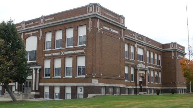
October 16, 2009: Belle Plaine High School (1911), last used as Central Elementary during the school year this photo was taken, was torn down in 2016-17.
I was going to use this as an intro to a post, but its length and overall spirit lend themselves to a post by itself.
In a quiet and determined manner the people of Benton county have turned their faces toward the betterment of their schools. A fine high school building was built in Belle Plaine some two or three years ago. It now has one of the best high school buildings and schools in the state. … Newhall is already occupying one of the best small town school buildings in the state. It has a school in keeping with the building. Keystone is taking pride in showing its handsome new school building to managers within its gates. And well it can afford to. It is a strictly up to date school building with all the modem conveniences. It, too, has a school in keeping with the building. Van Horne, not daunted because it failed to establish a consolidated district, has gone ahead with and will vote bonds for a new building which will rank with the best there is in the country.
— “Walford to have a splendid school,” Vinton Eagle, July 14, 1916
Remember the prolonged struggle between Wapello and the Iowa DOT, and Mediapolis and the Iowa DOT, where the communities are fighting tooth and nail to get multiple exits on a four-lane US 61 and the DOT is having none of it? That has been kicked up a notch.
The state representative for both those towns filed a bill (HF2260) to compel the DOT to
provide access or interchanges to the municipality consistent with access or interchanges to other municipalities along the same route, allow for sufficient emergency medical services access to the municipality, and preserve or maintain rural road crossings where possible.
The “explanation” is the bill’s language repeated almost verbatim. The language directly reflects Mediapolis’ argument four years ago that one interchange without access at either end of the bypass would impede emergency services. “[C]onsistent … to other municipalities” is an attempt to override the DOT’s mid-2010s change in philosophy toward such bypasses.
In this case, at least, it can’t be said that a legislator isn’t acting in response to the wishes of their constituents. However, the bill would have to get out of committee this week for future consideration.
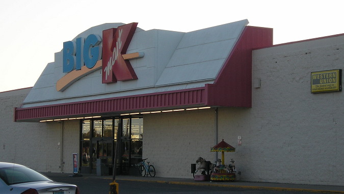
August 19, 2019: This is not a Kmart in Iowa; this is the one in International Falls, Minnesota, that was in the nationwide round of Kmart closures announced in September and closed Dec. 16. It will be the last Kmart I bought something in. This blog spares no expense in bringing you pictures of big-box stores.
KCHA radio says the Algona and Charles City Kmarts, the last in the state of Iowa, will close on Sunday. KCHA also says Floyd County’s unemployment rate is the second-highest in the state.
Remember how the news about the transfer of Business US 169/IA 926 to the city of Fort Dodge had a curious caveat? That caveat has become meaningful.
In 2014, the transfer of jurisdiction said “excluding bridges,” the bridges in question being the Karl King Viaduct and Kenyon Road bridge, both over the Des Moines River*. Fort Dodge took that jurisdiction and mangled a central intersection.
Now, there’s a notice for a DOT meeting Feb. 18 about “proposed traffic control options” for replacing the Kenyon Road bridge, the southern one of the two. A bridge in this location dates back to 1935, and used to carry US 20. (However, 20 may not have been put on it until 1937, and I address that discrepancy in my Fort Dodge Highway Chronology.)
The press release says the bridge replacement will take place in 2023.
*As of this writing, Google Maps is labeling the Des Moines River north of Saylorville Lake as “Deer Creek” and not labeling it north of Jackson MN at all. Huh?
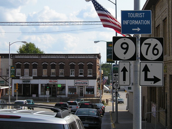 September 7, 2006: This photo looking south clearly shows the offset intersection of IA 9 and IA 76 in Waukon. Until 1968, IA 9 turned right (west).
The intersection at the core of Waukon has always been a bit off. There’s a 60-foot jog where Spring Avenue becomes Allamakee Street at Main Street, the kind of thing that would have been ironed out a LONG time ago if it had been nearly anywhere except where it is. Traffic flow changed when IA 9 was rerouted, so that route now runs north-south through the entire town, and must take the jog at that intersection.
Earlier this month, the DOT reconfigured the stoplight assemblies and turn lanes at that intersection, the Waukon Standard reports. The article goes into detail about those changes, which could have benefited from a diagram (not that a weekly paper has a graphics desk, of course). The kicker is at the end:
As several have stated in regard to adjusting to the new traffic light and intersection changes, “At least we don’t have a round-about!”
I went through Waukon twice, almost exactly three years apart, but haven’t been back since 2009.
I read as much as I ever have, but most of it is article after article viewed online. Much of my reading is for information, for truth, and for insight based on information leading to truth.
(LOL nothing matters.)

My print-book consumption for 2019 was very small. It’s not the pile I had in 2017, but each has its place, covering different aspects of the world we live in today. In chronological order of reading:
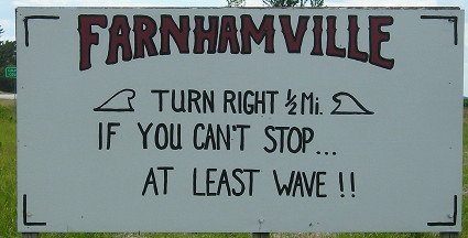
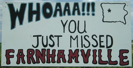
June 24, 2017: Is this an excuse to post one of the best “welcome to” sign pairs in Iowa? Possibly.
At the end of 1939, the expansion of Iowa’s highway system abruptly slowed down at number 372, a spur to Preparation Canyon State Park. During World War II, only 13 numbers were added. Then, in 1946-48, a mini-boom brought 12 more numbers, and that’s where things stayed for a decade.
The Great Commissionings of the 1930s ensured that any town with a population of 250 that was not near the primary road system had a state-maintained connection to that system. Those spur routes often went straight into the business district. But, if a town’s city limits touched an existing route, that town was considered to be in the system. New Providence, 6 miles away from IA 175, got a state highway than ran right to the intersection of Main and Main — but Radcliffe was stuck with 175 running along the south side of town and not into the business district.
Obviously, this would not do. So some towns in that situation pulled their city limits away from the highway by a matter of a few hundred to a few dozen feet, and then told the Highway Commission, Hey, we’re not on the system anymore, we need a highway into downtown. It worked. Mallard got IA 354; Radcliffe got IA 355. Calumet did it in 1946, right as US 59 was being paved on the edge of town; IA 388 was the result.
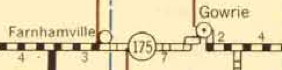
In the early 1950s, a significant percentage of Iowa’s highway system was still gravel. The Highway Commission started to tackle this right before, and while, construction of the interstate system was getting underway. For the most part, alignments of highways didn’t need to be changed as they were blacktopped or paved. An exception was IA 175 through Gowrie. Although it looks obvious now — a straight line from Lake City to Dayton — 175 moved north a mile, went through Gowrie’s business district, and stairstepped out.
 1953 state map
The state ironed that out in 1953 with the intention to pave the road between Gowrie and Farnhamville a year later. Although it is not shown on the 1954 map, the eastern part of the jog remained under state control, christened IA 53 because the number was free.
Now, consider this educated speculation. You’re in Farnhamville, and you just saw the Gowrie bypass open, but it keeps a state highway into downtown. How did that happen? Because the new IA 175 missed Gowrie by precisely 165 feet.
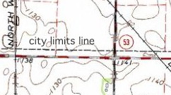 USGS, ca. 1964 (south of Gowrie). The city limits have been pulled closer to Gowrie since that time.
So what happens in Farnhamville? The southern border is pulled northward — by precisely 165 feet. Farnhamville got its spur about 16 months after Gowrie did. The identical distance, to me, indicates either coordination or a copycat move.
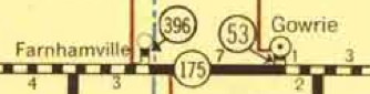 1956 state map; notice how Farnhamville magically moved away from IA 175.
New numbers that followed were realignment-related. Farnhamville, with IA 396, is the last time a town got its own spur highway purely by gaming the system.