Dec 25

Union of Soviet Socialist Republics, 1922-1991

The Soviet Union officially came to an end a quarter-century ago today.

Posted in Uncategorized | Comments Off on Union of Soviet Socialist Republics, 1922-1991
Dec 23

License Plate Letters — EZE

As 2016 comes to a close, the E series of Iowa license plates is too.

I have yet to “stand on the corner in Winslow, Arizona.” Some day.

Posted in License Plates | Comments Off on License Plate Letters — EZE
Dec 22

KOKZ begins closing the circle

^ So mid-’90s it hurts.

KOKZ-FM 105.7 in Waterloo switched to oldies in late 1996 or early 1997*. That was the station the school bus radio was turned to, and for quite a while there was a one-hit wonder practically on repeat, “Breakfast at Tiffany’s”. After the format change, the bus driver found a different station, I started driving myself to school, and that was that.

But recently, as I was scanning the airwaves to find something other than bro-country, the dial landed on KOKZ again, and what I heard was “Everybody Wants to Rule the World” and then “The Boys of Summer” – definitely not oldies.

So, KOKZ dropped contemporary (1981-96) to play music from 40 to 25 years ago (1956-71), and is now playing music from 45 to 30 years ago (1971-86). At this rate, “Breakfast at Tiffany’s” will make its return to the station in about a decade.

(Filed under “The Oldies Station is Playing Van Halen.” Related blog post: 1990s country is splitting into its own genre)

*I wanted to be precise about this and was getting nowhere. I found archives for Duncan’s American Radio, 1976 to 2002, PDFs with searchable text. KOKZ is Top 40/contemporary in fall 1996 and oldies in spring 1997. Perhaps I should also point to NorthPine.com, which keeps tabs on Upper Midwest broadcasting like I do Iowa school districts.

UPDATE 12/13/22: The changeover was in February 1997.

Posted in Iowa Miscellaneous | Comments Off on KOKZ begins closing the circle
Dec 21

The Final Countdown: 4. Archer


October 3, 2016: Archer, like MANY other hamlets in Iowa, owes its existence to the railroad, but the rails were pulled up when a Cherokee-Sioux Falls line was abandoned in the mid-1980s.

Archer, pop. 131, is five miles from US 18 and six from US 59, so it was far off my radar while going after highways. Since it was the farthest out of my remaining places, you could argue that this was a trip to Archer, surely the first time anyone without relatives there has ever said that.


The siding in the background marks the edge of the demolished original school building and the addition now used as the town library.

Posted in Iowa Miscellaneous, Sequences, Trip Reports | Comments Off on The Final Countdown: 4. Archer
Dec 20

The Final Countdown: 4 1/2. Meriden

The trio of Meriden, Cleghorn, and Marcus were once served by individual spur routes from IA 5 (now IA 3) until the highway was moved closer to the railroad. Today, IA 143 is the only number that remains, because downtown Marcus was still a mile off the road and then 143 was extended northward later.

I thought I was able to mark the threesome off the list back in June 2004. They certainly look “on” the highway, right? But just to be sure, I checked the city maps online. Cleghorn’s southern border is IA 3, but then I saw the dotted line for Meriden, implying that the city limits did not reach the highway. Then I looked on Google Street View and saw the arrow pointing to the town rather than announcing city limits.


October 3, 2016: Somewhere in that green space is the official city boundary. Perhaps a rail siding was removed or, more likely, the highway pavement shifted northward. This photo enlarges in a new window/tab.

If I had completed my travels and then saw this, I would have been some combination of upset and resigned, because it’s not a short jaunt over there. Fortunately, I could incorporate a visit into this last trip with little difficulty.

Downtown Meriden. Behind the camera is the telephone company, which aside from the elevator was the only place cars were parked in the middle of a weekday afternoon.

For good measure, I also took the time to go into Cleghorn rather than just past it, and photograph the school that was closed recently. MMC got to keep a high school in Marcus after a tenuous dance with Remen-Union to the west, but Cleghorn Elementary was shuttered as a side effect. There are now only seven high schools along IA 3 west of I-35.

Posted in Iowa Miscellaneous, Sequences, Trip Reports | Comments Off on The Final Countdown: 4 1/2. Meriden
Dec 19

Bernard school in trouble


June 18, 2015: The Bernard school was built in 1960. The lettering outside, presumably original, says “West Dubuque” instead of “Western Dubuque” — a name that would have brought it in line with all the other “West”s in Iowa.

The Western Dubuque school district could shut down Bernard Elementary at the end of the school year, KWWL reports. The district says it costs twice as much to operate and has fewer than three dozen students.

Western Dubuque overall is a growing district — it passed 3000 in 2015 and WDHS was promoted to Class 4A in 2015. But the growth is mostly along US 20 — remember, Western Dubuque is a two-high-school district and about a third of its students go to Cascade — and that puts Bernard in a tough spot.

The news story mentions that an addition was built to Cascade Elementary this decade, which is endemic of another trend — an addition gets built in a larger/more centralized part of a school district and an outlying building gets shut down.

Posted in Schools | Comments Off on Bernard school in trouble
Dec 16

Iowa Highway Ends’ 15th anniversary


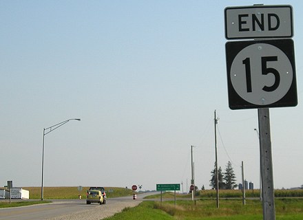
September 2, 2008: South end of IA 15


July 23, 2009: North end of IA 140


June 14, 2011: South end of IA 62

Fifteen years ago today, after a couple weeks of “beta launch,” I let other roadgeeks know that I had created the Iowa Highway Ends website. At the time, the pictures were exclusively in the box of an area between Ames and Waterloo, but I had much bigger ambitions.

In June 2015, I finished traveling every mile of every highway in Iowa (now the recently relocated IA 31 and, as of yesterday, IA 100 extension await). Between March 20, 2003, and October 4, 2016, I visited every incorporated community in Iowa. I have also entered 1470 counties in the United States, including all of them in Iowa and Illinois. With the exception of the very newly christened I-41 and 50 miles of I-94 west of Mandan ND, I’ve traveled every interstate in the Central Time Zone part of the Midwest.

Highways in Iowa and the “roadgeek community” — not to mention the nature of the Internet itself — have changed a lot over a decade and a half. The Second Great Decommissioning happened, suddenly freezing in time a great deal of my early photos. About 75 miles of four-lane US 20 opened, moving its route significantly from segments that had been around since its birth 90 years ago. The misc.transport.road user group that traced its roots back to Usenet was abandoned. GribbleNation is shutting down, to be replaced with a scaled-down version Jan. 1. Dale Sanderson completely retooled his USEnds.com website a month ago with a new layout and inlaid Google Street View images. Signage was standardized at interchanges across Iowa at the cost of unique shield assemblies and distance signs. The Iowa DOT has made information available online that I would’ve spent days in the bowels of the archives to find a decade ago (and, in the case of microfilm research from 1920 to 1940, did precisely that). And then, of course, practically no one makes a personal website anymore, not after social media ate the world. (Angelfire is still there, at least, the part of my website that was local to my first web address.) I’m practically retro (not quite as retro as those still running Mac OS 9, but not that far off either).

I don’t plan on changing anything (at least, not as long as my computer holds out, knock on wood). I’ve been writing HTML for four-sevenths of my life now. I don’t have time for bells and whistles. Heck, I barely have time to add to what I already have up. (I spent a whole evening working on pages with fall 2015 photos, promise!) Perhaps 2017 will be a year of taking what I’ve done and getting that online.
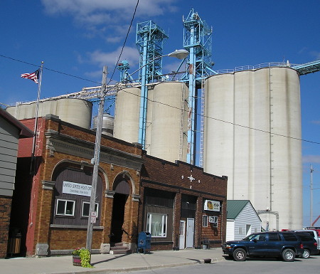
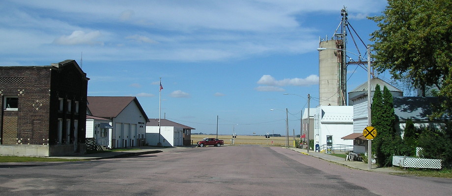
Posted in Uncategorized | Comments Off on Iowa Highway Ends’ 15th anniversary
Dec 15

IA 100 extension opens today


December 3, 2016: Cedar Rapids Mayor Ron Corbett (second from left) and other dignitaries have a ceremonial ribbon-cutting for the first phase of the IA 100 extension.

The extension of IA 100 from Edgewood Road to Covington Road opens to vehicle traffic today, almost two weeks after it had a one-day opening for bicyclists and a ribbon-cutting. This opening, which comes ahead of schedule, provides a much-needed additional crossing of the Cedar River for the area. The rest of the IA 100 bypass, down to US 30/218, will not be completed until 2020.

This change in the Iowa highway system will be easy for me to cover. 😉

Posted in Construction, Highway Miscellaneous | Comments Off on IA 100 extension opens today
Dec 14

The Final Countdown: 5. Varina

OLYMPUS DIGITAL CAMERA
October 3, 2016: No big stone lions guarding this library.

As I crossed IA 4 on US 20, I saw long green tubes on freshly churned dirt in the middle of a cornfield, and I realized I was entering Bakken country.

You have heard about the Bakken pipeline, or Dakota Access Pipeline, in the news, but knowing about it and seeing it come together are two different things. Construction on the pipeline was in full swing at this time, and I crossed it three times between Jolley and Storm Lake. Lines of corn abruptly stopped to make way for pipe (or were harvested early). Crews were hard at work.

But in Varina, pronounced Var-EYE-na, it was still. I saw one vehicle. If any of the town’s 71 people were home at midday on a Monday, I couldn’t tell.

OLYMPUS DIGITAL CAMERA
Information on the sesquicentennial board in town.

Posted in Iowa Miscellaneous, Sequences, Trip Reports | Comments Off on The Final Countdown: 5. Varina
Dec 13

The Final Countdown: 6. Duncombe

IF
October 11, 2002: Mile marker 11 on IA 928 near the Highview elevator in Hamilton County shows a countdown to Fort Dodge, even though the Webster County segment was turned over almost right away. On old 20, you can be midway between Highview and Duncombe and see both elevators.

In fall 2002, my photography was mainly from a camera I had for a photojournalism class (this Lincoln Highway set was the final project) and I didn’t have time to get out except for weekends. On Oct. 11, 2002, when North Tama played Northeast Hamilton, I got some evening photos along old US 20 between Fort Dodge and Webster City. However, this date was too early for the starting point I set in 2015 for visiting each town. This year, on my way west to reach the final towns I hadn’t been to, I made sure to stop in Duncombe.


October 3, 2016: The Duncombe post office and one-block business district are shadowed by the elevator.

Duncombe has a big elevator, too, as do many towns along the central part of US 20 and the former Illinois Central Railroad. The original route of US 20 closely followed the IC (later ICG) east of Fort Dodge; today it’s Canadian National track.

Posted in Iowa Miscellaneous, Sequences, Trip Reports | Comments Off on The Final Countdown: 6. Duncombe