Apr 20

The 1981 map and the tail end of the Great Decommissioning

1981mapdisclaimer
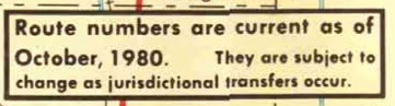
The disclaimer on the 1981 Iowa highway map.

From the start, I have limited the reach of Iowa Highway Ends to those state highways on the 1981 map and later. (For the US routes, since there are far fewer, any once-existing state line is fair game.) I set that because the Great Decommissioning of 1980 was a watershed in both the scope and purpose of the Iowa highway system. Also, finding the precise in-town endpoint of a highway that hasn’t been signed for decades can be difficult because it could change over the years. Spurs would have a few blocks added or subtracted in an effort to be more consistent in where in the business district they ended, or in relation to a construction project.

There are multiple dates involved in the creation or turnover of a highway, and there can be months in between:

  • The day(s) the local jurisdiction (city/county) accepts.
  • The day the Highway Commission approves (or, when the system was expanding, the day of the meeting the number was designated).
  • The day the signs go down or are put up, or the road opens.

Unless Jason or I have been able to track down that last date, we’ll typically use the second for historic routes, first based on my days spent going through microfilm Highway Commission minutes to get the starting dates for many routes and now on a read-through of the legal descriptions to get the ending dates. A substantial majority of those routes affected in 1980 had both jurisdictional transfers and signs down in July. Otherwise, if I can find it, the date a road opened or closed gets top billing. (Until a year ago, getting that for the 20th century relied on hours of scrolling through newspaper microfilm or my visits to the DOT library in 2006.)

With the online information, and notes from the 1980-81 route logs that I made in 2010, the breakdown of the last spur highways involved in the Great Decommissioning looks like this:

  • On the 1981 map, but not in the 1981 route log: 42*, 95**, 155, 166, 213, 219, 226, 231, 246, 328*, 365. Then there’s IA 154, which we know was replaced by IA 187 in November 1980.
  • On the 1981 map, but already turned over inside city limits: 125, 237, 351, 352, 356. Also the part of IA 114 in Wellman, which still ran south to IA 92 until February. For these routes, I have added the city limits as a “temporary” end, no photo necessary.
  • Turned over in their entirety in 1981: 216, 303, 326, 390
  • Not on the 1981 map, but not turned over until April: 90

That makes 23 highways that, in some fashion, existed on October 10, 1980, but not January 1, 1982***. To simplify that in the index, I lumped all but IA 95** into a “Late 1980 or 1981” category on the index. Any route that had an endpoint changed in 1980 or 1981, but was/is still around, is treated normally.

Coincidentally, that leaves 23 spur routes that were dropped over the next 20 years — until the Second Great Decommissioning. If I had based my website on the 1983 map instead, the spur index would be 17% smaller.

While making all those changes, I also altered the color for the “Late 1980 or 1981” numbers in the table. Finally, IA 216 had been omitted from the index at some point; it’s in now. Those responsible have been sacked and replaced with 40 specially trained Ecuadorean llamas.
*The county portions of 42 and 328 were turned over in December, and while Riverton took its piece Dec. 29, Galva didn’t. Because you can’t sign a route inside a town when it doesn’t connect to the system, it got a secret “900” designation. The same thing happened in Murray, Unionville, and Woodburn, but those numbers had been taken off the 1981 map already.
**IA 95 was supposed to be deleted in 1980, but Adams County “refused to accept jurisdiction of their portion” and the road was designated IA 951 in 1983 and lived another decade.
***IA 244 and 362 had both the old and new versions on the 1981 map, but for simplicity’s sake, I only deal with the latter. IA 91, 333, and 428 had neither.
Posted in Iowa Miscellaneous, Maps | Comments Off on The 1981 map and the tail end of the Great Decommissioning
Apr 19

Why we don’t have a 2017 map yet

The first part of the year used to herald the annual arrival of two Map Days. One, in late winter, would be the release of the full RAGBRAI map in a Des Moines Sunday Register. That appears to have been discontinued in favor of trickling out daily maps on the website; a composite map of the entire route isn’t released until later (there’s one for 2017 now).

The second, a more recent Map Day, is when the Iowa DOT puts the new state map online. The widespread release of the paper copy follows soon after. In 2015, the first year of a newly established two-year cycle, the map didn’t come out until the beginning of May and the print version didn’t get an official announcement until June.

I’m kind of surprised that there wasn’t an online-only “updated 7-1-16” version to show the US 71/IA 196/IA 471 shuffle, but the only precedent for that would be a late inclusion of new US 34 in 2014.

This time, even if May/June is going to be the new time-frame for releases, I think there’s a second reason for a delay in issuing a new map — the DOT is waiting for Gov. Terry Branstad to resign. The governor has a “Welcome to Iowa” message on the back of each map; the lieutenant governor’s photo was added in 2000.

I pointed out in 2015 that an odd-year printing would sync up with gubernatorial elections — inauguration in January, map in March(ish). But a modern mid-term resignation is not something Iowa has experienced; the closest is when Robert David Fulton* was governor for 16 days in 1969 until Robert Ray was inaugurated (and it was Ray’s name on the map).

If there wasn’t a delay, and Reynolds lost in 2018, the state map would never feature the face of Iowa’s first female governor. So, since there’s less of a rush to put a map out than even a decade ago, it makes sense to take the time. Branstad won’t be confirmed as ambassador to China until the first week of May at the absolute earliest, but a 2017-18 map released on Memorial Day 2017 is better than a 2017 road atlas issued on Tax Day 2016.

*Had Branstad served out the current term, Iowa would have gone 50 years with only four governors. Instead, Iowa will go just over 47.

Posted in Maps | Comments Off on Why we don’t have a 2017 map yet
Apr 18

The new R&T lofts

OLYMPUS DIGITAL CAMERA
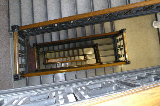
June 11, 2013: View down the staircase that runs the height of the 1918 Register & Tribune Building.

The historic Register & Tribune Building in Des Moines, where I worked for a decade, is almost ready to open as a giant apartment building, KCCI reports. (Video at the link.) It’s a huge transformation, discombobulating even.

The newsroom space (where you see the reporters working on iMacs in the decade-old file footage) is part of the 1949 addition. The giant hole that was once the pressroom underneath is still vacant, though.

Kyle Munson wrote a column about touring the renovated building, which has a slightly different address.

Posted in Iowa Miscellaneous | Comments Off on The new R&T lofts
Apr 17

I wrote a check for 67 cents

Ever since the IRS stopped mailing income tax forms, I’ve been free-filing my taxes online with H&R Block. It’s been fine — or at least it was, until this year.

For 2016, my withholding ended in “9.33” — but the taxes-owed number ended in zero. That meant technically I owed 67 cents, but since the online prep rounds the numbers, I was marked for the full dollar. Then I got a very unwelcome alert message.

“Since you contributed to a Health Savings Account (HSA), you’ll need to use H&R Block Deluxe to prepare this year’s taxes. Complete your return in H&R Block Deluxe for an additional $34.99.”

This is not directly related to the Affordable Care Act, except inasmuch as HSAs have become more popular. But because I had an HSA, H&R Block saw fit to make me pay. It worked last year, so this is a change.

But no one ever told the tech support people. I was on the phone for half an hour trying to find out if I could at the very least get a PDF of what I’d already entered. After much work, I did, sort of — as a 1040EZ, except you have to fill a full 1040 with an HSA (form 8889).

The woman on the support line and I commiserated about the bait-and-switch. I told her I would put in a good rating for her if there was a survey after my call.

“The phone survey system is not available at this time.” Click.

I laughed for a good long time. Then I got editable PDFs and filled in my numbers, to the cent, and paid my 67 cents, plus the 49 cents I had paid for the stamp, plus another 49 to mail the Iowa form since I wasn’t allowed to file that one electronically without the federal.

The check was cashed at the beginning of March.

Posted in Uncategorized | Comments Off on I wrote a check for 67 cents
Apr 14

The thought process of a roadgeek

“Do I contradict myself? Very well, then I contradict myself, I am large, I contain multitudes.” — Walt Whitman

My sister remembered I wanted to see her in Colorado! That’s good! But I have to do it by Memorial Day. That’s less good.

Clinching US 34 is right out, then. It’s shut down through Rocky Mountain National Park until Memorial Day.

But I could still do it in Nebraska. Besides, I want to get to Traer, Kansas.

You are the only person in the world who would mark Traer, Kansas, as a must-see.

Hmm. I could still reach Traer on a loop if I stayed on US 6 and ducked into that county in the corner.

You mean like how you walked three feet into the one by the northeast corner of Colorado?

Still counts. I’d at least be in the car this time.

You’ve had this idea planned for a year, and now you’re just going to ax the entire return leg via US 34/36?

I’d just have to do 34 in far western Nebraska some other time. Maybe throw US 138 into the mix then. Yeah, I’ll miss out on the whole thing, but that’s the way it goes.

OK. Let’s look south. You haven’t been to New Mexico in 19½ years. Never been on an interstate there either. Santa Fe is…five hours and change. Seven if you want to make it interesting.

oh jeez

oh jeez

Grand Junction? Out on 24/6/70, back on 50?

Maybe. That’s a challenge for a flatlander, especially one who won’t have his road-tripping sea legs. Colorado is notoriously horrible at signing when 6 gets on and off I-70 through the mountains, though.

And back to Pueblo. Then what?

US 350 is one of the country’s shortest US routes, and it’s probably an hour added on vs. I-25 to Trinidad. And it follows the north route of the Santa Fe Trail.

[stares at map some more, realizes he should get Kansas Atlas & Gazetteer]

[curses Google for the eleventy billionth time for not putting county lines on as default]

Hey. I could travel the entire route of US 56, which is also the auto route for Santa Fe Trail. Wouldn’t that be wild, hitting multiple historic Western pathways within a year?

You have a strange definition of “wild.”

Look! The Oklahoma Panhandle! Five US routes converging in the middle of nowhere! Multiple state corners!

But then that is a lot of Kansas.

A LOT of Kansas.

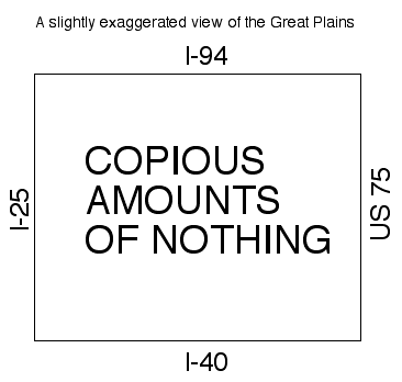
viewofplains

That’s the worst map you’ve ever drawn.

Well, I didn’t take time to mark Mount Rushmore. And I’d rather drive 60 through nothing than 20 through something, anyway.

No one who cares enough to map their travels has ever gone the entire length of US 56.

Then I’ll be the first. It would make a huge dent in my unvisited space in the almost-Southwest U.S.

You’re really thinking about doing this, aren’t you?

I am very probably going to try.

Posted in Trip Reports | Comments Off on The thought process of a roadgeek
Apr 13

GR dissolution hearing Monday

Two members of the public attended a March meeting regarding the second attempt to force dissolution of the Gladbrook-Reinbeck school district, the Grundy Register reports. That’s a far, far cry from a year ago, at least the one I attended. But there wasn’t much to report, either, since the proposed dissolution map hasn’t changed from the first go-round.

There’s going to be a hearing on Monday, which could bring more attention if it’s the last before a potential vote this fall. On the other hand, if everyone’s opinion is set (and I can’t believe that’s not the overwhelming case), then what is there to learn at the meeting?

In both related and unrelated news, the GR school board approved $151,000 in budget cuts on March 23.

Posted in Schools, Tama County | Comments Off on GR dissolution hearing Monday
Apr 12

E is for Eldora


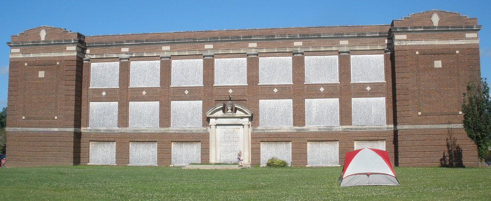
July 21, 2015: A lone RAGBRAI tent is pitched on the west side of the original Eldora school building. Every window on this side was blown out in a hailstorm Aug. 9, 2009. Open photo in new window/tab for larger view.

In September 2014, the Eldora-New Providence school board approved the demolition of the 1916 building that had been the high school until the early 1990s and then ENP Middle School until 2008. But a year after demolition was approved — as you can see in the photo of RAGBRAI campers — it was still there. A state grant was given in May 2015 to help pay for the demolition.

OLYMPUS DIGITAL CAMERA

Eldora-New Providence began whole-grade sharing with Hubbard-Radcliffe in 2007, making this building (and later additions) superfluous. The two districts, together as South Hardin, have never consolidated, and won’t until at least the middle of the next decade.

UPDATE 7/21/22: Corrected year sharing begain.

Posted in Schools, Sequences | Comments Off on E is for Eldora
Apr 11

KCCI shines a light on Dysart

Well, sort of. Look at where the burst of light for the “Around Iowa” graphic originates from.

kcci-around-iowa-2013

Posted in Tama County | Comments Off on KCCI shines a light on Dysart
Apr 09

100th anniversary of Traer school fire

OLYMPUS DIGITAL CAMERA
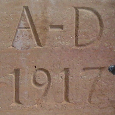
August 14, 2010: Cornerstone of Traer School built after the 1917 fire, now the core of the North Tama school, along the hallway connecting the original building and the elementary.

One hundred years ago tonight, within a week of the United States’ entry into World War I, the Traer school burned down.

A class of girls which was rehearsing in the Traer high school last night for an operetta narrowly escaped death when fire broke out. All were rescued without harm, although many were hysterical. The fire almost totally destroyed the building, which was erected eight years ago. It is believed to have originated thru defective wiring in the attic, as the fire broke out in the roof and manual training room on the attic floor. (Waterloo Evening Courier)

Because of the fire, Traer became one of the Iowa towns with classic symmetrical, brick multi-story buildings from a construction period that ended around the Great Depression. Lots of core schools around Iowa — many in use, many not — will be having centennials over the upcoming 10 years.

NT1917bldg_Nside_94
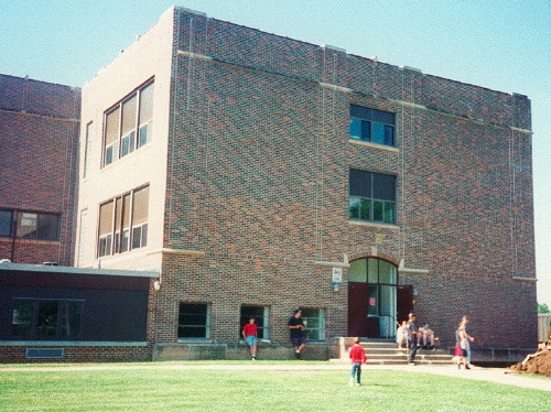
Excavation begins for an elevator on the north side of the 1917 school building in Traer in 1994. Additions since then have hidden everything visible in this family photo from the middle of the third floor down.

The 1917 building runs longer north-south, allowing for classrooms on the east and west sides to have natural light. Because the main entrance was on the west side — where the cornerstone is — the school’s address remains 605 Walnut St. despite all future main entrances facing Sixth Street. A reminiscence in the Traer Star-Clipper includes an excellent photo from the northwest corner.

There have been many, many additions in the decades since. The last one, in 2010, removed all the remaining open space on the Sixth Street side and created an imposing new front entrance and new gym entrance, all with vaulted ceilings (SO STUPID — Ed.) that obscure everything from before on that side. From Walnut Street, the 1917 building still rises above the 1964 elementary, and the south side view is unobstructed.

Next fall the structure built after the 1917 fire will have served Traer, Traer-Clutier, and North Tama students for a century. May it serve for a century more.

Posted in Schools, Tama County | Comments Off on 100th anniversary of Traer school fire
Apr 07

US 30 Grand Junction overpass delayed

According to a short item in the Ogden Reporter, construction of a new US 30 overpass on the east side of Grand Junction has been delayed for at least a couple of weeks.

The overpass is modern US 30 over the Lincoln Highway into Grand Junction, the east point of a realignment in 1958 that took 30 off some of Iowa’s earliest rural concrete paving across Greene County. The new overpass is supposed to have decorative elements commemorating the Lincoln Highway. Will it be finished before the Lincoln Highway national convention?

Posted in Construction | Comments Off on US 30 Grand Junction overpass delayed