May 04

Council Bluffs 2017 construction preview online


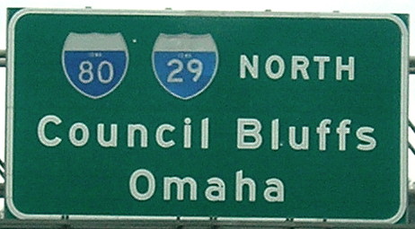
April 19, 2017: This sign, and the one beside it, are the oldest existing and last button-copy BGSs in Iowa. By the end of the year, the whole thing will be gone when a new alignment for westbound I-80 as it joins I-29 opens.

The Iowa DOT’s dedicated website for the Council Bluffs Interstate System project has an “online meeting” in the form of a slideshow. Many of the slides have short videos. What we’ll see in the coming construction season includes eastbound I-80 express lanes, although they won’t exist as such yet. The I-29/I-480 interchange still has two plans under consideration (PDF), all of which will involve either permanent closure of nearby partial interchanges or incorporation of them into frontage roads. That won’t even get under construction until the next decade.

Posted in Construction | Comments Off on Council Bluffs 2017 construction preview online
May 03

Great Plains Trip Day 7


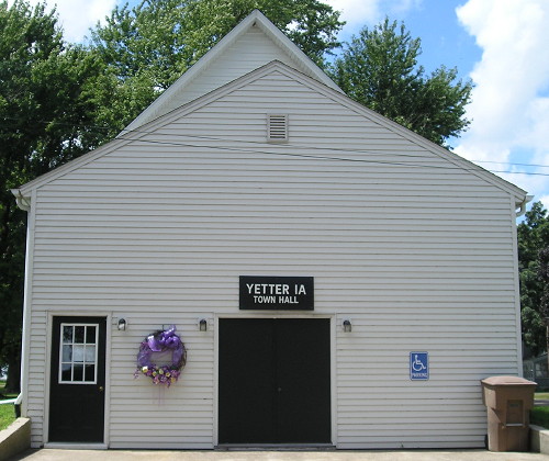
August 8, 2016: Now entering Yetter, fourth from the bottom in the Iowa alphabet. Now exiting Yetter.

Cedar Rapids, Iowa — A drive on Iowa’s newest highway and to five unvisited towns scattered across three counties finished off a vacation that couldn’t have gone much better. (Even if I should have waited for that semi before turning left.)

counter08

Route: IA 175, E16, L51 to Ricketts and back, E16, N20, US 71, US 20, IA 471, IA 175, gravel, D53, IA 175, N47, old IA 286 (E26 to Lidderdale and back), US 30, X Ave (Napier), E57, US 69, US 30

OLYMPUS DIGITAL CAMERA
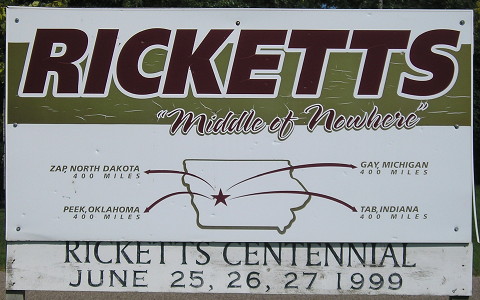
Ricketts really calls itself “Middle of Nowhere” and it is.

I had seen a story on the Council Bluffs Nonpareil‘s website about a 1945 Crawford County bow bridge being damaged. I was going to go right past it so I had to get pictures before its potential demolition. Then I went to Schleswig to see if the old school had been torn down yet; it had. From there it was a straight shot to Breda, where I managed to miss the exact location of IA 217’s last endpoint.

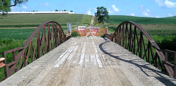
Bowstring bridge, B Avenue north of E16, Crawford County. The county had a handful of these built during World War II when steel was in short supply, resurrecting an old design.

New 71 is all signed with good concrete, and pictures aplenty are on the updated IA 196 page. Stopped at Casey’s in Early for pit stop, gas, and biggest slices of pizza I’ve seen. Then I went down IA 471, clinching the state’s newest highway as signed in the field.

From what now is the US 71/IA 175 split, I drove east to Yetter. The railroad crossing was closed for loading a long train at the elevator, but I just had to go back to N28 and down a mile and then used a gravel connector to Lake City.

After Lake City I hit two other L towns — Lanesboro and Lidderdale — and then took US 30 all the way back except for a dip down to Napier and Kelley.

I finished the seven-day trip in early evening, with plenty of pictures, a lot more experience with the Plains, and a deeper kinship with the travelers of America’s past.

counter09
Posted in Trip Reports | Comments Off on Great Plains Trip Day 7
May 02

Great Plains Trip Day 6

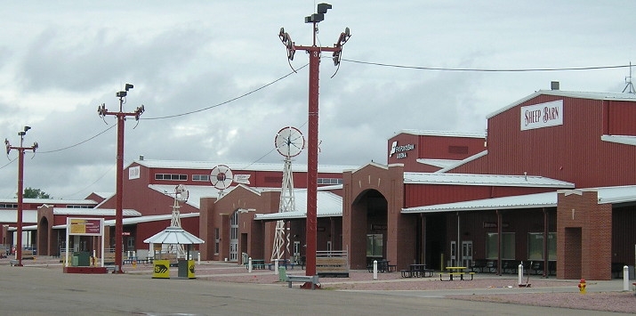
August 7, 2016: This photo encompasses a significant portion of the buildings of the new Nebraska State Fairgrounds, relocated from Lincoln to Grand Island in 2010 because of poor attendance. I better stop here before I say something about the best state fair in OUR state.

Onawa, Iowa, August 7 — For a day that didn’t really have a travel portion until 3 PM, it wasn’t a shabby trip at all. In fact, today had a little something from nearly every decade of the past 150 years.

I had no idea how much time I would spend at the Stuhr Museum of the Prairie Pioneer, but I couldn’t do anything until it opened at noon. That gave me time to check out the Seedling Mile and, get this, read the Sunday Omaha World-Herald in the city park.


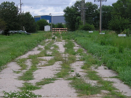
Weed-strewn original concrete from the Lincoln Highway Seedling Mile on the east side of Grand Island, 100 years and nine months after it opened and 85 years after US 30 bypassed it.

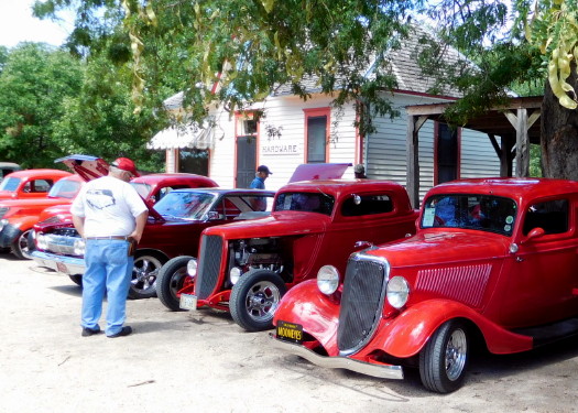
By the time the museum opened, it was a beautiful day. The museum itself took about an hour, with a downstairs temporary exhibit about the 150th anniversary of the Union Pacific and an upstairs collection of everyday life in the 1920s-30s. Then I found myself in an anachronistic situation — classic cars lining the streets of an 1890s pioneer village!

IFCherry, apple, cinnamon, and other flavors at the Stuhr Museum of the Prairie Pioneer.

Then I walked, or slightly rushed, through the Antique Auto and Farm Machinery exhibit building. If you have a child who loves tractors, or if you’re an adult who feels like a child when seeing lots of old tractors, this is a place you need to go. There’s even a Waterloo Boy among the machinery.

counter07

Route: US 30, US 281, US 34, US 81, US 275, NE 51, IA 175

I was farther along than I had budgeted for the trip, and still had a day to go, so I used the late afternoon/early evening to close a gap on US 81. That included passing through Columbus and seeing a place originally set aside to honor the native-son creator of the Higgins Boat that has expanded to become a park/memorial for all veterans. (The Higgins Boat, too, figures prominently in the waiting room of the National World War II Museum in New Orleans.)


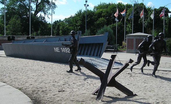
Higgins Boat at the veterans memorial in Columbus, Nebraska (hence the 1492 designation), where US 81 meets the Loup River.

By getting to Onawa, I set myself up for a super-productive day, at least as far as my Iowa travels are concerned.

While doing research for this leg of the trip, through an application for the Lincoln Highway in Nebraska on the National Register of Historic Places (large PDF), I learned something for my Council Bluffs Highway Chronology page. The first four-lane divided highway in Nebraska was a 6-mile stretch of US 73/75 to Fort Crook, later Offutt Air Force Base. It opened on Monday, December 8, 1941.

Posted in Trip Reports | Comments Off on Great Plains Trip Day 6
May 01

Great Plains Trip Day 5


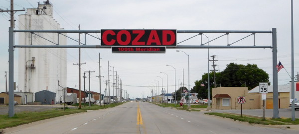
August 6, 2016: An overhead sign tells US 30 travelers they’ve crossed the 100th Meridian in Cozad, Nebraska.

Grand Island, Nebraska — Of things that could go “wrong” on my trip without being time-consuming or truly tragic, three of them happened on this leg. It rained, I missed a clinching segment, and the GPS trip-tracker had a brain fart. But I also experienced some things that are what the United States is all about.

counter06

Route: Old NE 71, US 30, L51B, I-80 (exits 133 to 145), L51C, US 30

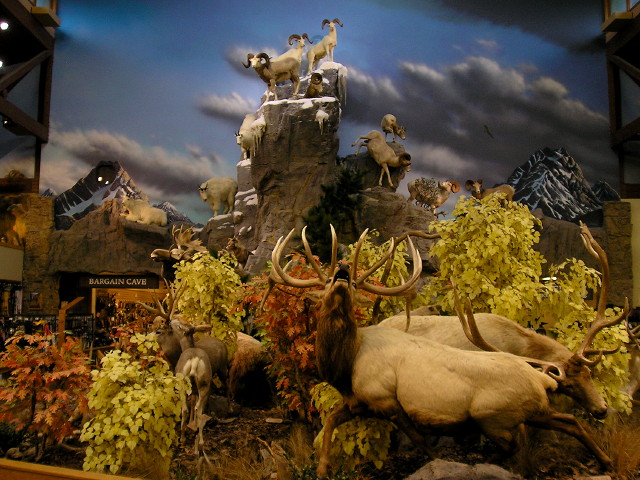
There was sporadic rain after Kimball, and for much of the morning. In Sidney, I stopped at Cabela’s — not just any Cabela’s, but the flagship store — and took some pictures of the mounts inside. Sadly, Cabela’s future as a Nebraska business icon is likely on borrowed time. Between Cabela’s and ConAgra, if the Nebraska Unicameral could ban activist hedge funds, I’m sure plenty would back the move.

Cabela’s flagship store and headquarters are just off I-80 in Sidney, Nebraska.

After more rain it cleared up between Chappell and Brule, so I got some pictures of US 138’s east end (including a mistaken NE 138 on one sign). I was intending to find the school in Brule and once I got there, there was some event going in the park. I had stumbled onto Brule Day, a small-town festival. A sloppy joe with ice cream for $5? Absolutely! And then the PIE. Rhubarb. Peach. Cherry. America at its greatest. I left Brule at 1 MDT and got gas in Ogallala at the end of US 26.


An old alignment of the Lincoln Highway runs through Brule, Nebraska; US 30 runs on the south side of town.

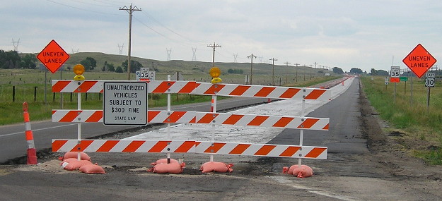
US 30 looked drivable between Roscoe and Paxton, but … it was closed. I followed the detour, depriving myself of the chance to clinch US 30 in Nebraska, so it remains my only gap between WY 34 and Pittsburgh. In North Platte, I must have missed a sign for the Golden Spike Tower, and had to do a GPS search. Doing that either nuked everything I had done earlier in the day, OR kicked it back into gear, but either way, everything from Kimball to North Platte was unavailable when I retrieved the data.


D’oh! This prevented my clinching of US 30 in Nebraska.

Still cloudy at Golden Spike Center. I spent much of an hour watching video about North Platte Canteen during WWII. The city and surrounding area went all out to give traveling service members some home cooking and hospitality during the war. Two months later, when I went to the World War II Museum in New Orleans, the orientation was in a “train car” with “North Platte” written on the side. So if you go, now you know why.

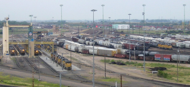
Bailey Yard as seen from Golden Spike Tower, North Platte, Nebraska.

From the observation tower I looked out at Bailey Yard. Activity might not have been as high as usual since it was a Saturday, but still, that’s a lot of trains and a lot of tracks. I exited to the west, got back to 30, then went back east again, and never got away from 30 the rest of the day.


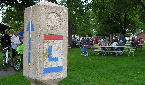
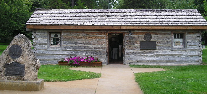
I also stopped at the relocated Pony Express station at the city park in Gothenburg. 

Posted in Uncategorized | Comments Off on Great Plains Trip Day 5
Apr 28

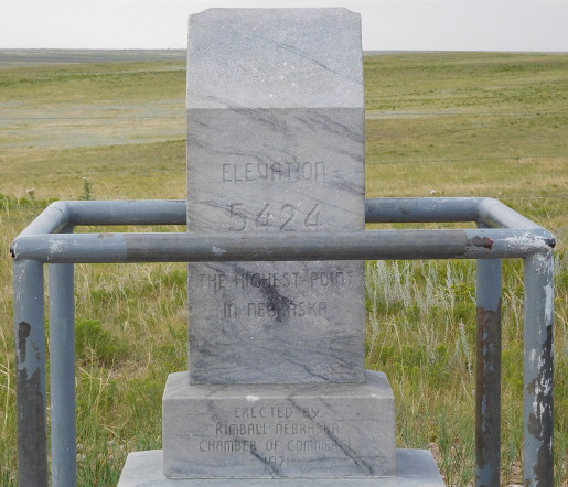
The southeast corner of Wyoming, the highest point in Nebraska

Pine Bluffs, Wyoming, August 5 — After leaving Cheyenne, I headed east on I-80 almost to the state line and then turned south to reach the Colorado-Nebraska-Wyoming corner and the highest point in Nebraska. The two locations are within eyesight of each other, but not direct driving distance, and the landowners don’t want you to walk between. I drove Colorado gravel for about 15 minutes, adding that state to this trip. This is the second state high point I’ve visited.


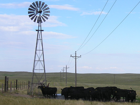
Local wildlife near the tri-state marker, visible at the end of the fence line, above the spigot of water pumped from the windmill.


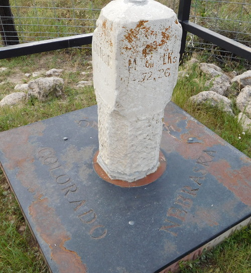
Facing northwest. I am standing about a foot onto the Colorado side. The base is built from stones from each state but the ground has crept up on the side coordinate labels and a black plate covers the top.

IF
No snow-capped peak here. I thought of putting something Iowa State-related on the top — this is, now, at the western edge of Big Ten country — but instead I’ll refer you to NINE-SEVEN because of EIGHT.

IF
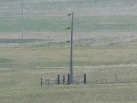
Is there anywhere else that a state’s border is visible from its highest point?

Finally, I got back onto 30 and took that to Kimball. Before the trip, I asked the Nebraska Department of Roads if US 30 enters via the two-lane or I-80, since the signs contradict themselves; I was assured that the Lincoln Highway is the correct route.

Posted in Trip Reports | Comments Off on The southeast corner of Wyoming, the highest point in Nebraska
Apr 27

Great Plains Trip Day 4


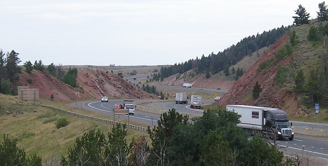
August 5, 2016: View of I-80/US 30 from the Wyoming Welcome Center, the highest point on the interstate.

Kimball, Nebraska — From a college football stadium to a tri-state corner, this day had a little bit of everything.

counter05

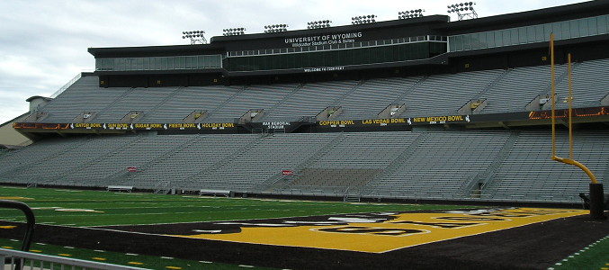
The first stop of the day was before I even left Laramie, at War Memorial Stadium. The “Bucking Horse and Rider” silhouette is everywhere around Laramie; in addition to being the logo for the University of Wyoming, I learned later that day the shape is the longest-running drawing used on license plates.

IF

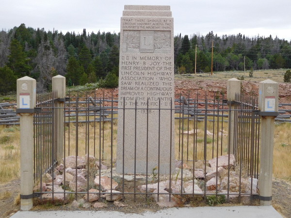
The I-80 rest area southeast of Laramie is a haven for highway history. It’s the highest point on the interstate and US 30 in the country. There are informative panels about the Lincoln Highway and the state in general. There’s a monument to Lincoln, and a monument to Henry Joy, the father of the Lincoln Highway. (The Joy monument was moved from Rawlins, a site he had picked out but was abandoned after I-80 was built; the Lincoln monument was moved its original location a few miles away, the highest point on the original Lincoln Highway, in 1969.)


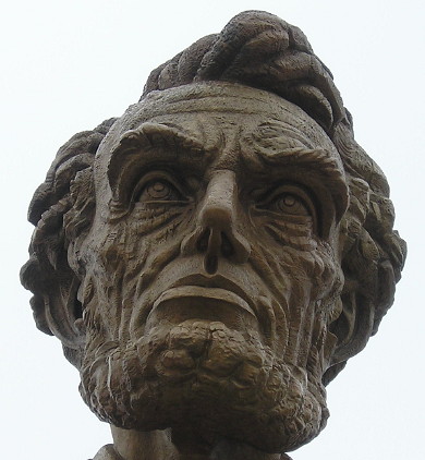
A war-weary version of Abraham Lincoln is used for his monument.

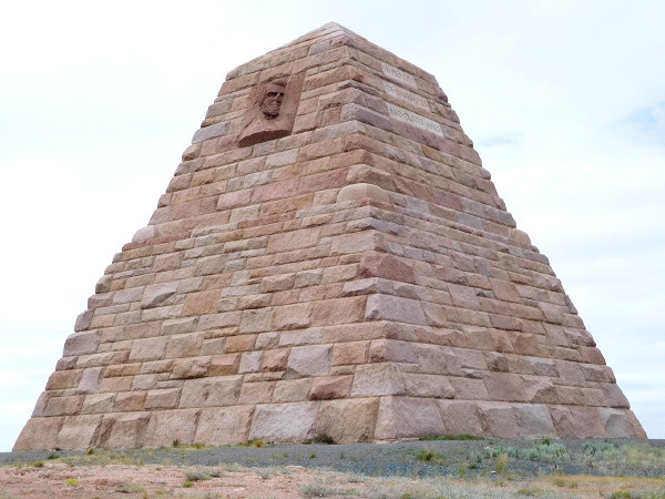
I had yet another monument to see, the one for the Ames brothers, two miles away from the interstate. Oakes and Oliver Ames — the former the namesake of Ames, Iowa — were “instrumental in completing the Union Pacific section of the [transcontinental] railroad,” a marker at the monument says. But Oakes Ames’ involvement in the railroad turned into his involvement in the Credit Mobilier scandal. The monument was placed near the highest elevation of the railroad — but as UP improved its system, huge segments of the first transcontinental were left behind, including the one past the Ames monument.

IF

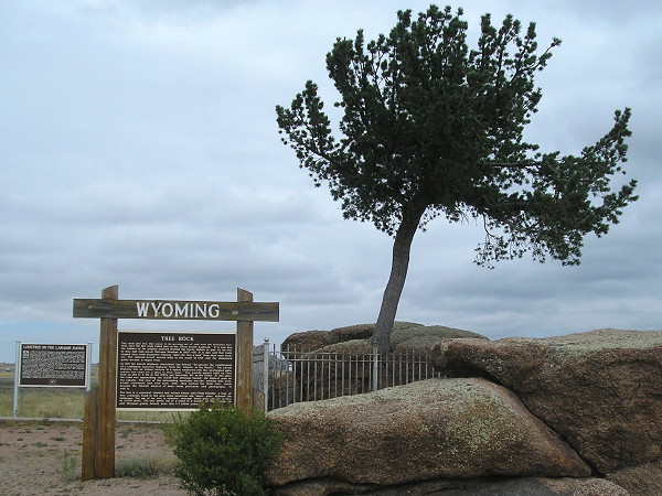
A short distance east of the Ames monument is the “Tree in Rock,” which was along the railroad route, and then US 30, and today is between the lanes of I-80.

OLYMPUS DIGITAL CAMERA

I exited off 80 to follow the Lincoln Highway again into Cheyenne, which goes right into downtown and the Cheyenne Depot Museum, and found myself at… a food truck rally. So I got a wood-fired pizza before going into the restored depot and seeing the museum and the model trains upstairs. The whole museum was excellent and highly recommended. The main area of the former depot was open and had a map of the railroad inlaid on the floor (with Omaha marked for the starting point and date, July 10, 1865).

With the capitol closed for construction (and already visited, in 1995) my only other stop was the state museum. It was also excellent and highly recommended. It does a great job of telling the state’s story chronologically, in the traditional museum way of artifacts and informational panels.

To be continued…

Posted in Trip Reports | Comments Off on Great Plains Trip Day 4
Apr 26

Great Plains Trip Day 3


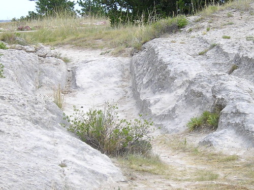
August 4, 2016: Pioneers literally wore down the stone here. Oregon Trail ruts, Guernsey, Wyoming.

Laramie, Wyoming — This would be my first entry into Wyoming in nearly 16 years. But first, some auto work. After that, I stopped at Rebecca Winters’ grave (PDF) on the east side of Scottsbluff, then I was off on 92.

counter04

Route: Downtown Scottsbluff, US 26, NE 92, WY 92, US 26, I-25, WY 34, US 30, to end of BL 80 and back, WY 130, I-80

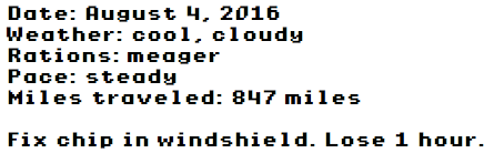
In Lyman, barely on the Nebraska side of the border, I saw an old school and went to photograph it. Then someone pulled up behind me and then it looked like he was writing in a notebook. I was about to leave but then thought, I need to find out what’s going on here. He’s a student at Nebraska-Kearney, and he’s on a mission to visit every incorporated place in Nebraska! He only has 530 cities to see (and only 149 of them are above 800) in a much bigger area. It was a great moment, and if I hadn’t had to wait for the windshield chip I wouldn’t have met him.

I traveled the westernmost part of Highway 92, into Wyoming, and photographed its end in Torrington, clinching (more or less) the entire route of the four-state Highway 92. I then took US 26, at 70 mph, to Fort Laramie, where I figured I needed to eat. There was only open place, a little mom-and-pop diner.


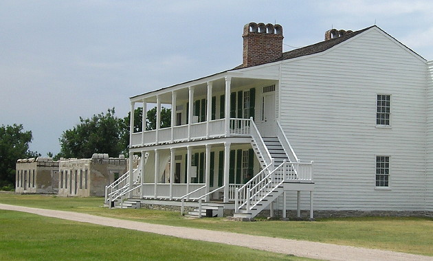
Restored and un-restored buildings at Fort Laramie. For as remote a place as this is (comparatively), quite a few tourists were there that afternoon.

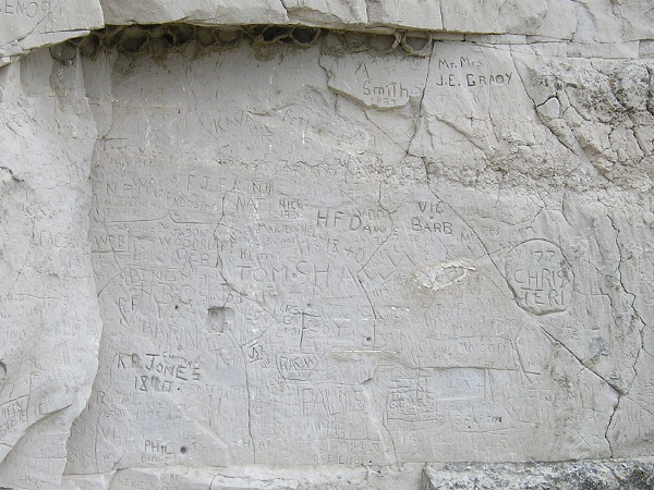
I spent almost two hours at Fort Laramie (and learned, much later, that I had mis-set the date on the camera.) I spent another hour seeing trail ruts and Register Cliff near Guernsey.


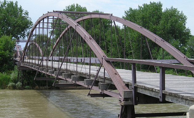
“Old Army Bridge over the Platte River, erected in 1875. This bridge was a vital link between Cheyenne, Fort Laramie and the military outposts, Indian agencies and gold fields of the Black Hills Dakota region. Placed by the Historical Landmark Commission of Wyoming, July 1951”


Register Cliff, 15 minutes from the trail ruts. If it’s 160 years old, it’s history; if it’s 50 years old, it’s graffiti.

I-25 is posted at 80 mph and while traffic was sparse it was an experience. “Next fuel 70 miles” after Wheatland. Yes, definitely the West.

At Morton Pass on WY 34, I experienced something that few Americans do today: A cell phone that said No Service. Shortly after that, it started sprinkling. It stopped around the time I reach WY 34’s end at US 30/287 — the westernmost point of this trip, and what I wanted to be the westernmost point of a continuously traveled stretch of US 30 throughout the country.

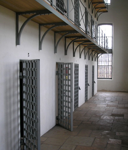
I followed 30 into Laramie and then went to the Wyoming Territorial Prison. It was ALSO open until 7 (Hooray!) and it was an informational, entertaining visit.


Wyoming Territorial Prison, Laramie.

There were some others touring the prison, including a couple with small dogs. Museum staff caught up to them in the horse building and told them to “vacate the premises” because one of the dogs did what dogs do. Seriously, who is inconsiderate enough to bring dogs inside historic buildings?

After tonight, it would be on to the next historic trail portion of vacation, east on the Lincoln Highway. 

Posted in Trip Reports | Comments Off on Great Plains Trip Day 3
Apr 25

Great Plains Trip Day 2

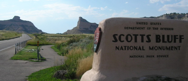
August 3, 2016: Entrance to Scotts Bluff National Monument via old NE 92. NE 92 used to end much farther east, at NE 61 in Arthur County, but then was extended across the state and joined WY 92.

Scottsbluff, Nebraska — Where does the West begin?

Is it the Appalachian Mountains, or the Mississippi River? Is it the north-south run of the Missouri River, where places like Council Bluffs, St. Joseph, and Independence were the starting points for great Western transportation routes, then on a line to the south, where as Will Rogers said, “Fort Worth is where the West begins and Dallas is where the East peters out”? Is it 100 degrees West longitude, the approximate demarcation of the Great American Desert?

Or is it where you’re not reasonably sure of finding a pit stop 20 minutes in the direction you’re traveling?
I was about to go where comparatively few have gone before — as far as both population and 21st-century roadgeeking are concerned. At the time, McPherson County (total pop. 539) and Arthur County (pop. 460) ranked among the 20-least-visited by county counters at mob-rule.com, but they would be my 1399th and 1400th.
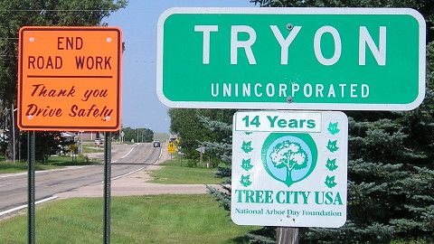

The McPherson County seat of Tryon is an unincorporated village.

Route: NE 92, NE 88 to Courthouse/Jail rocks and back, old NE 92, old NE 71, NE 71 down to CR 40 (Banner County) and back to US 26

A Big Breakfast with Hotcakes at the Broken Bow McDonald’s would have to serve as my fuel, as I would not see another place to eat until the end of the day. However, as a prepared Scout, I did have granola bars and Gatorade that came in handy later. Early clouds cleared rapidly, giving me nothing but sun as I drove through the Sand Hills, often with no other cars to see on NE 92.
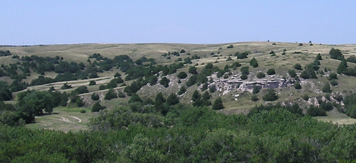

The view from Ash Hollow State Park, Oregon Trail ruts at left.

I stopped at Ash Hollow and Windlass Hill, where you can see Oregon Trail ruts and a pioneer grave. I’d been here once before, in 2009, but in a rush without a visitor center stop. Starting here, 92 engages in its dance with US 26, joining and separating the rest of the way. I also dipped south to see the Courthouse and Jail Rocks south of Bridgeport.
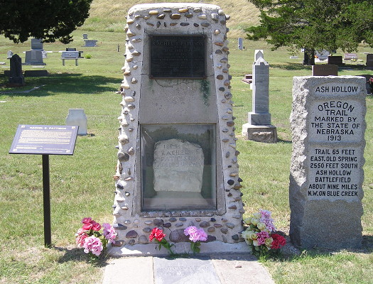

Preserved grave of Oregon Trail pioneer Rachel Pattison at Ash Hollow.

If you look at the map and wonder why US 26 isn’t simply routed east to US 385 north of Bridgeport, there’s a travel-related answer: Because then you would miss Chimney Rock. Right now, though, 26 was under construction, and with the landmark in sight…PTACK! a pebble or small rock, probably kicked up by the car in front of me, threw a ding into the windshield.
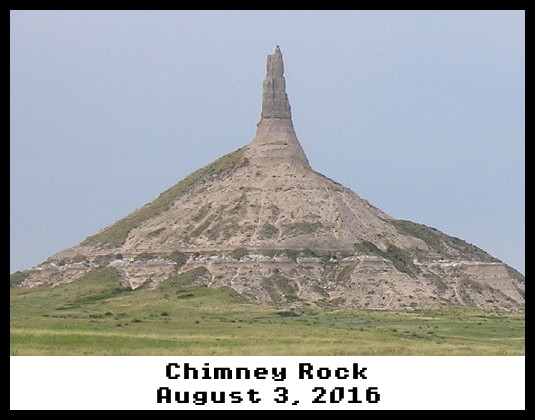

As seen on the Apple //e! OK, not quite.

For the Oregon Trail travelers, Chimney Rock marked the completion of one-third of the journey — the easy part. Today, it’s literally less impressive than it was 175 years ago, after attacks from erosion and lightning. But it’s still a pretty sight, and has a nice visitor center.

From there, Scotts Bluff (the natural formation) is visible, a real sign I’m in the High Plains. And in summer it’s open until 7. Thank you, National Park Service! The late sun made for spectacular views.
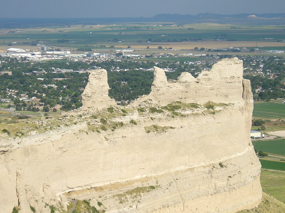

View from the top of Scotts Bluff in the summer evening light. Chimney Rock is barely visible in dead-center background, above the middle bluff peak.

Highway 92 used to run through Scotts Bluff National Monument, but now 92 is on a bypass west and north of Scottsbluff. I got one of a surprisingly few hotel rooms available and made some calls to deal with the windshield.

Posted in Trip Reports | Comments Off on Great Plains Trip Day 2
Apr 24

Great Plains Trip Day 1


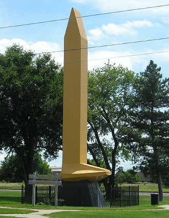
August 2, 2016: The Golden Spike Monument in Council Bluffs marks the east end of the Transcontinental Railroad, as designated by Abraham Lincoln himself. However, the first rail bridge to Omaha didn’t open until March 1872.

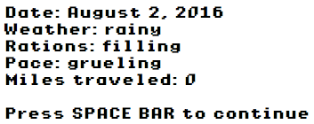
Broken Bow, Nebraska — This trip is about two-lane roads and historic trails: NE 92, the Oregon Trail, and the Lincoln Highway. As a member of the Oregon Trail Generation, with those factors in mind, there’s really only one way to chart the passage of time, right?

counter02

Oh yeah.

Route: US 30, IA 330, I-80 with old IA 925, I-29, 25th St, 9th Ave, get to IA 192, US 275, US 75, I-80, I-680, US 6, NE 92

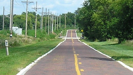
With the threat of rain along I-80 I took 30/330 to Des Moines, and it worked surprisingly well. West of Des Moines, I picked up the White Pole Road, aka IA 925, aka Old Highway 6, and also made stops in Earlham (unvisited) and Walnut (school). Then, in Council Bluffs, I stopped to see the Golden Spike Monument, and took pictures of the new South Omaha Veterans Memorial Bridge. By now, it was a beautiful sunny day, and I got to my first Lincoln Highway item: the brick section in Elkhorn.


Preserved brick section of the Lincoln Highway between 180th and 192nd Streets. With the upgrade of US 6 (West Dodge Road) to a full freeway, the east end is reached via the 168th Street exit. Built in 1920, it was only part of the Lincoln/US 30 for a decade, until it was rerouted via Blair.

From there, it was time to get familiar with NE 92. Really familiar. Sadly, this exacting travel got an asterisk; I had to take about 10 miles of gravel where 92 was closed off for bridge construction. Otherwise, the conditions were perfect and I got to Broken Bow, setting up camp for the night at the Big 12 Motel.

Fresh with the spirit of exploration, I attempted a local delicacy. They call it a Runza.

Posted in Trip Reports | Comments Off on Great Plains Trip Day 1
Apr 21

Dispatches from the frontier

The Washington Post went to Kiron, Steve King’s hometown, and put its observations on the front page earlier this week. The article doesn’t set out for a particular point, more of a “day in the life” of pretty typical Iowans.

This is the second report from Crawford County in a month. The New York Times went to Denison and Orange City in March. Apparently, enough NYT readers don’t understand what it means to start a story with “ORANGE CITY —” that the paper will be ushering in the end of the dateline as we know it.

Whether these are examples of trying to see why Steve King keeps getting elected, an installation of decline porn, or both is up to the reader.

Posted in Iowa Miscellaneous | Comments Off on Dispatches from the frontier