
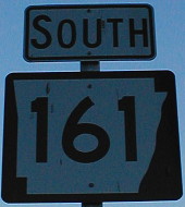
December 28, 2001: AR 161 at I-40 just east of I-30. It is one of the pre-freeway segments of US 67 in central Arkansas.
December 28, 2001: AR 161 at I-40 just east of I-30. It is one of the pre-freeway segments of US 67 in central Arkansas.
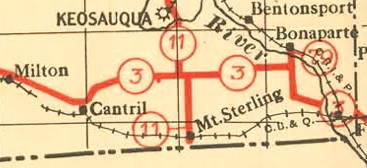
Clip from the first state highway map (1919)
When the Iowa highway system was created in 1920, Mount Sterling was important enough that it (or the Missouri border just south) was the south end of IA 11. That only lasted four years, though, until the connection to Missouri was moved to the road south of Milton. That connection eventually became the south IA 15. The Iowa Highway Commission briefly considered making a spur connection to Mount Sterling — one of the first additions to the original system — but it never was put into effect.
On Wednesday, Mount Sterling, the 14th-smallest incorporated place in Iowa, will cease to exist as a town. News reports say it will be the first to disincorporate since Littleport in 2005, but that is only if Searsboro’s has not gone into effect. (Those two would leave 945 incorporated Iowa towns.)
Mount Sterling, Iowa: 1907-2012.
EDIT/UPDATE, April 12: The current tally of incorporated Iowa cities remains 946. “The county wouldn’t take us,” Searsboro’s mayor says. The title, but not the link, has been updated accordingly.
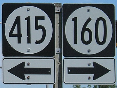
July 23, 2008: West end of IA 160 in Ankeny. The entire route has been inside Ankeny’s city limits nearly since creation. It was originally a connector between IA 60 and US 69, but has moved off that original piece.
In commemoration of the 105th anniversary of the Battle of Shiloh (April 6-7, 1862), in which many Iowa soldiers died, historian Timothy Walch corrects a statement that many people, including myself, had believed to be true. It’s reprinted here for the record. Walch’s full piece can be read here.
For generations thereafter, Iowans would proudly brag of having shouldered more than their share of the burden. Some went so far as to claim that, per capita, Iowa had sent more soldiers to the war than any other state in the Union. Unfortunately, that boast was not true. In his award-winning book, Bright Radical Star, historian Robert R. Dykstra gives credit to Iowa for sending nearly half of its prewar white military-age population off to war. He also adds, however, that four northern states had higher percentages of service per capita than Iowa.
The Centerville Daily Iowegian wrote about Iowans’ participation in a re-enactment of the battle.
Ulysses S. Grant had ordered the Iowans to hold their position at all costs. They did, for six hours — enough to enable the Union to organize its lines and win the battle the next day.
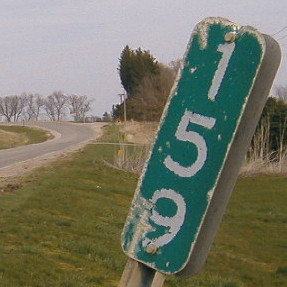
April 9, 2004: Old MM 159 for old US 6 east of Colfax. A few miles ahead, past these curves, is Exit 159 for I-80.
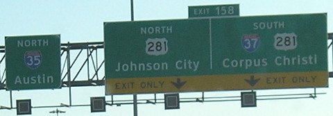
January 26, 2012: I-35 at the north end of I-37 in downtown San Antonio. This picture is one tiny piece of this complex interchange. At this point, we’re not even a third of the way up I-35 in Texas. I-37, meanwhile, is one of Texas’ three two-digit in-state interstates (27, 37, 45).
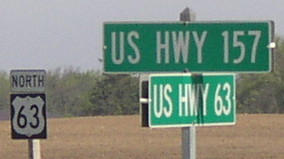
May 19, 2004: A rural signing error near Lime Springs, at the west end of former IA 157. There’s no US 157, and even US 57 toils in obscurity. It was over 10 months after the Second Great Decommissioning, and no replacement county road signs had been put up. It was also the first day I saw $2 gas in Iowa, at the gas station at the corner here.
An essay on athletes, toughness, and determination by former ISU basketball player Lindsey Wilson. Just as interesting is the credit line: Wilson is a certified hypnotist.
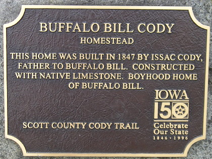
The Buffalo Bill Cody home is not necessarily one of Iowa’s best-known historic sites, but it is a notable connection to the history of the West. William Frederick “Buffalo Bill” Cody only lived here for three years, though, and his family had left Iowa entirely by the time he was 7.
The name of Isaac Cody, Buffalo Bill’s father, is misspelled on this 15-year-old marker. The Scott County Conservation Department has it as “Isaac,” as does this grave marker directory.
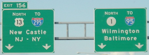
June 27, 2009: DE 1 and US 13 cross for the last time in northern Delaware. There are four different states represented on these two signs: Delaware, Maryland, New Jersey, and New York.
Delaware was my 47th state visited — but as fate would have it the Capitol Legislative Hall was closed. That day was also the last that a gift shop near their old capitol would be open before being claimed by budget cuts.
Georgia and Pennsylvania are the only states in which I don’t have at least a fraction of a mile traveled on I-95.