Jul 29

2010s state travel recap, a town view

Originally written shortly after Christmas 2019, then fell down the line. You will see why that’s important. — Ed.


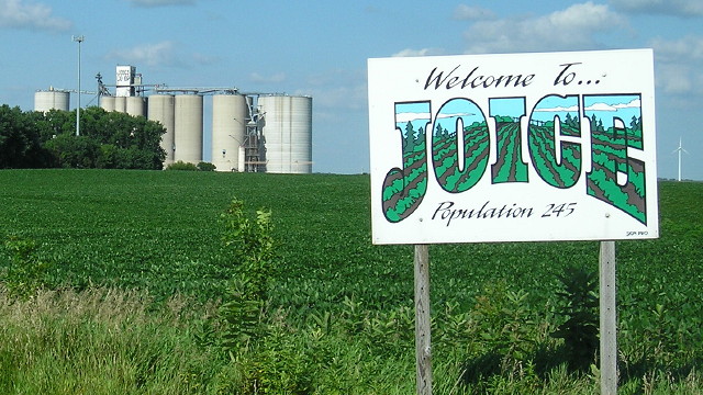
July 26, 2016: Joice is 11 miles from the state line and half an hour from the nearest Wal-Mart (Albert Lea and Mason City).

At the beginning of the decade, though I hadn’t really crystallized the plan, I was in the middle of a 14-year quest to visit every incorporated community in Iowa.

Now, going by my most recent visits to all locations, I visited all but 80 Iowa towns in the 2010s. Of those, only five have a population above 2000, and only seven are in the area bordered by US 20, I-35, I-80, and the Mississippi River. For Ruthven, Lehigh, and Templeton — all unseen since 2003 — I’ll be back for better pictures someday.

I didn’t quite “compress” my timeline to a decade, but 850-plus isn’t shabby at all. I mean, revisiting Riverton AND Ridgeway AND nearly every town on IA 10 is not just something I can do on a whim.

In the past three years, I’ve been to all but 13 counties. My least-recently-visited four (Lyon, Sioux, Wayne, and Appanoose) are all border counties from my circumnavigation.


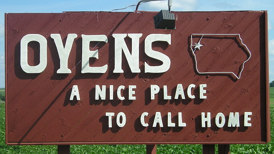
July 15, 2014: Oyens, Plymouth County (recycled from this post).

Do I have a list of Iowa towns I would like to live in if I didn’t have to worry about employment or access to a four-lane road? You betcha. Am I going to share it? Nope.

Unfortunately, at the moment, the near future isn’t looking great travel-wise. I have had some notable expenses, and the car isn’t getting any younger. I really need to plow some money into savings before the next recession (or worse).

UPDATE 7/29: So, about that recession (or worse).

Posted in Iowa Miscellaneous, Trip Reports | Comments Off on 2010s state travel recap, a town view
Jul 27

The ‘last’ of the astronaut wives

Rene Carpenter, the wife of Mercury 7 astronaut Scott Carpenter during the Space Age, died Friday (obit: Washington Post). (She was born in Iowa, hence the very tenuous hook for this blog post.) I say “during the Space Age” because, despite or because of the massive spotlight put on the astronauts and their families in the 1960s, there were many divorces in the group. With Carpenter’s death, that group is gone.

Being an astronaut’s wife required keeping up appearances, maybe even painfully so, to match the expectations of the era. To illustrate somewhat, here is a paragraph from a wire service feature on “Mrs. Scott Carpenter” (as both the headline and first paragraph addressed her) published in the Cedar Rapids Gazette on May 5, 1968:

Rene Carpenter just turned 40, wears a size 6, weighs 110 pounds, stands 5 foot 3 and is totally averse to wearing something just because it’s ‘in.’ Her skirts go from mid-thigh to three inches above the knee and she gets a sick look whenever anyone mentions midis. “I will never, never lengthen my skirts,” she said.

“Kooky dresser campaigns for RFK”, the subhead said, and much more attention was paid to the first half of that than the latter. But then, it was running in the Gazette’s women’s section, above ads for Younkers and Newport’s Greenhouse.

The astronaut corps has included women for decades, including two born in Iowa who have since retired. One can only imagine how an article written in the same vein today would treat their spouses.

Posted in Uncategorized | Comments Off on The ‘last’ of the astronaut wives
Jul 26

Iowa’s 1920 highway system: The smallest routes

I used an unscientific formula to “rank” the primary routes from 1920, from the least to the most important. That will be a framework for blog posts about the system. The smallest spurs to the smallest towns, not surprisingly, fill the bottom ranks.

For the routes that lasted after 1980, I expanded their already existing pages and added photos to quite a few. If you try to go to a route in the 1920 series and it doesn’t have its own page, there should be an automatic redirect.

  • IA 70, half a mile to Macksburg, leads off the list.
  • Spurs that were practically unchanged until 1980 or shortly thereafter: 42, 54, 7987, 102
  • IA 72 almost fit the above point, but it had changes to the west end and was extended to I-35 for six years.
  • Spurs that were practically unchanged until 2003: 3641688297.
    • IA 50 was extended into a double spur for decades, but its 1920 and 2003 endpoints were identical.
  • Spurs that were unchanged or slightly changed except for a number replacement: 52 (to 272), 67 (to 55), 69 (to 138), 92 (to 363)
  • Other routes: 81 (which later became IA 114), 84 (tied into the history of IA 999)
Posted in 1920 Highway Sytem | Comments Off on Iowa’s 1920 highway system: The smallest routes
Jul 23

A cure worse than the disease?

Spanish Influenza yields to old-fashioned remedy

Recent research tells us that the Spanish influenza germ and the Grippe germ are much alike.

The sneezing, the racking cough and the inflammation in chest and throat of Spanish influenza is swiftly relieved by the old-fashioned cold remedy of goose-grease and turpentine.

Science has improved this splendid old remedy by adding to it Menthol, Wintergreen and other healing oils, whose fumes, inhaled, bring relief in twenty minutes.

This new-old remedy is Men-Tho-Eze.

As Spanish influenza is still spreading, there should certainly be a 30-cent jar of Men-Tho-Eze ready at hand in your home — preparedness pays. For sale by most druggists.

Mapleton Press, October 3, 1918
(note: This was styled as a story, but placed beside the ads, so today it would be “advertorial” and/or carry a “paid advertisement” disclaimer.)

Posted in Iowa Miscellaneous | Comments Off on A cure worse than the disease?
Jul 22

Iowa’s 1920 highway system: What ISN’T here?

In 1920, Iowa was the 16th-largest state in the country by population. That population was as distributed as it was ever going to be, as many rural counties had peaked in population 20 years earlier and were already starting to decline.

As such, the primary route network, then and now, had a lot of the same ideas for community connections. But there are some noticeable holes in what we have now vs. what was marked in 1920. Aside from the interstates and four-lane roads, of course, these links tend to fall in broad groups.

  • Two major diagonals, IA 60 and IA 330, came later. The former followed the Chicago, St. Paul, Minneapolis and Omaha Railway; the latter was a brand-new line that set off fierce debate in the Legislature.
  • Long, straight or mostly-straight roads that go significant distances with few/very small towns along them.
    • The most glaring case is Cherokee to Pocahontas, which didn’t become a state highway for 20 years!
    • Nearly the entire routes of IA 21, IA 143, IA 188, and IA 281, and all of IA 182 and IA 346
    • Nearly the entire route of IA 15 (Rolfe to Armstrong), excluding the northernmost and southernmost portions
    • The north half of IA 146
    • IA 17 north of IA 3
    • IA 1 north of Iowa City, even though it follows the path of the original Military Road
    • IA 92 west of US 71
    • US 59 between Ida Grove and Denison, which seems odd because it connects two bordering county seats
    • IA 3 between Strawberry Point and Luxemburg
    • The Fayette County portion of IA 93
    • US 59 south of US 34
    • US 65 south of US 34
    • IA 25 south of US 34
    • IA 148 north of US 34 (notice a lot of these are in south-central or southwest Iowa)
    • All of the above segments combined put around two dozen towns lacking a state road on one or within a couple miles.
  • Maybe-not-quite-as-straight roads that connect little towns along a railroad line.
    • The most obvious, following both a railroad and a river, is the 1920 lack of a “river road” between Dubuque and Clinton. A Davenport-Muscatine road along the river would be added in 1924.
    • All or nearly all of IA 16, IA 22, IA 24, IA 26, IA 78, IA 183 (post-2003 version), IA 191 (post-2003 version), and IA 210. IA 49 would have fit here.
    • IA 175 from the Missouri River to Onawa, Turin to Mapleton, Lohrville to Gowrie, and Dayton to Hubbard
    • IA 141 from Sloan to Smithland, Manilla to Manning, Coon Rapids to Perry, and Woodward to Camp Dodge (the four-lane to Grimes came later)
    • IA 38 north of IA 64
    • The north half of IA 48 (Red Oak to Griswold)
    • IA 4 south of Jefferson
    • IA 83 from Walnut to Atlantic
    • IA 136 between Wyoming and US 61
  • Neither IA 37 east of Dunlap nor the north-south portion of 136 follow any particular railroad, but they sure aren’t straight either.

With the exception of a few short pieces and three longer ones, all of the roads listed above had become part of the state highway system by 1940. The long segments that came later were IA 188 between Plainfield and Clarksville (1949), IA 346 between the Little Brown Church and US 63 (1953), and IA 21 north of IA 8 (1969). The last was the last all-new two-lane road built for Iowa’s highway system (although it was planned as four). Already-existing county roads were incorporated into IA 21, 210, and 281 (1980) and IA 330 between Albion and US 30 (1989).

The last 30 years have been spent on expressways and freeways. The significant relocations of US 20 through Iowa River Greenbelt and between Early and Moorland are the biggest ones you can point at from a high-level view and say there weren’t any roads near them before.

Posted in 1920 Highway Sytem | Comments Off on Iowa’s 1920 highway system: What ISN’T here?
Jul 21

The genealogy of a highway

As you saw in the glossary post, this stuff can get into the weeds. I admit that some of the things I’m researching, I’ve done over a longer time span than the roads in question officially existed. Here I want to explain how I’m doing what I’m doing.

There is no possible way I can pinpoint every original turn of every route. For example, roads that almost-but-not-quite paralleled a railroad, when paved, now ran flush with a railroad, often with no trace or just a partial trace of the old route left. A shift of one mile is usually noticeable; a shift of a few hundred feet is not. However, there are clues one can find today that tell us where the first routing was.

  • The Huebinger maps and guides of the time, and Highway Commission minutes that use the township-and-range system to denote locations, can be compared with modern county maps. God bless the Land Ordinance of 1785 and the Public Land Survey System.
  • Railroads don’t change. They may be gone, abandoned and converted to bike trails if they’re lucky, but tree lines and field scars are often visible from above. Conversely, for roads that followed section lines before being aligned with railroads, it’s very common for a quarter- or half-mile of road on that section line to be gone without a trace a few years after the move.
  • Cemeteries don’t change. It wasn’t uncommon for a primary to go past a cemetery, and the road TO the cemetery might be the first paved segment in the area. Iowa’s oldest existing concrete road (as of 2020) is the cemetery road in Eddyville. However, that one wasn’t part of a primary.
  • Streets outside of suburbs, for the most part, don’t change … except when their names do. And there appear to be a LOT of citywide cases of the latter. But names like Indianola Avenue in Des Moines and Independence Avenue in Waterloo are lovely neon arrows pointing to old alignments. (You do have to watch for red herrings, though.)
  • Downtowns don’t change. Highways that make sense as straight lines today but skirt, avoid, or run perpendicular to the main business blocks (or block, singular) may not have followed what seems like an obvious alignment today. This point was driven home when I figured out there was such a case in Traer.

goldenjubileebig

It’s the Winding Stairs! Our beautiful, iconic stairs! And something painted on the light pole beside it…something that microfilm can’t reveal…

This photo is conclusive evidence that IA 59’s first route in Traer was NOT running up and down all of Main Street, but rather going east-west a block to go through downtown. The design of the streetlight the 59 marker is painted on was brought back in a city project in the late 1980s.

But knowing a route went through a downtown and how it got out of a downtown are two separate things. This is much more difficult because while the Highway Commission was involved in selecting routes, it was not at the time involved in municipal maintenance. That didn’t happen until the late 1930s. On so many maps of the time, once a marked line hits city limits it disappears, and there’s no Google Street View, 1920s edition. So, more often than I’d like, I will be doing this:

The Highway Commission put out a detailed list of every routing in every community in February 1936. These are what formed the basis of the route logs that were put online a few years ago. But the online logs are incomplete, and omit nearly anything from a route before a renumbering. In addition, I doubt that spur routes had primary markings all the way to downtown, because the paint job was a county supervisor contract. So when I look at spur routes, I will be looking at what, in all likelihood, probably wasn’t the 1920 end but what would have been its end based on practices used later in the century.

State-level maps, and even county-level maps, of the time can only go so far. I will do my best to make it clear when I’m extrapolating and making a “more likely than not” estimate. I will be using present-day street names, urban and rural, for clarity, because “from the Smith corner to the Mason No. 2 school” tells us nothing nowadays (unless you have a plat book of the time, and even then it’s iffy).

Posted in 1920 Highway Sytem | Comments Off on The genealogy of a highway
Jul 20

Iowa’s 1920 highway system: Your guide to the guide

This is an explainer for pages about the routes that made up Iowa’s 1920 highway system. It’s designed to augment, but definitely not replace, Jason Hancock’s and my websites.

  • “In 1920, they knew it as”: Did the highway follow, or incorporate a piece of, an existing auto trail? “Existing” is based on Huebinger’s Automobile and Good Road Atlas of Iowa and the Iowa Registered Highway Routes, 1914-1925 map created by the Iowa DOT in 1986.
  • “We know it as”: What is this route’s descendant(s)? This will be given in the most general of terms, usually close to the “linear” descendant(s), i.e. this route became this route became this route, regardless of alignment change.
  • Let’s get granular: A route using modern roads, from dirt to four-lane, that hews as close as possible to what someone would have driven in the 1920s.
    • The most important sources here will be the 1914 county maps (with a certification date of Feb. 14, how romantic), late 1930s aerial photos, and the oldest-available blueprints from the Iowa DOT archives.
    • Known dead ends or notable frontage roads will be pointed out. The overall listing may end up discontinuous.
    • I will try to pinpoint county courthouses if their location is relevant to the route.
    • I realize this would be better as “show” rather than “tell” but I’m not versed in how to draw, or publish, a 300-mile-long multi-multi-turn route on Google Maps, let alone one that draws lines where there aren’t roads anymore.
    • Sometimes, vagueness for clarity’s sake will be required. For example, IA 3 (now IA 2) has so many nips and tucks that segments a mile long or more have been wiped off the map. When written as if a number follows the current road, an assumption of “within half a mile or so” may be needed in the non-flat areas of the state.
    • “Abandoned” and “vacated” will be used pretty much interchangeably to describe a road that was there but isn’t anymore. (In my view, strictly speaking, the former indicates the road is closed but remains visible, while the latter indicates all traces have been removed.) If it’s on a section or half-section line I might explain it in relation to the present-day road it aligned with.
    • Nearly nothing in 1920 ran along a railroad right-of-way (unless the railroad itself was parallel to a section line), so when such an alignment is included, it could mean I don’t have enough pre-1930s information to be more specific.
    • Within communities, I might suss out a “more likely than not” route that would cover a now-bypassed business district, with supporting evidence from late-1930s aerial photos.
  • Related routes: Numerical replacements, routes it either gobbled up or got gobbled up by, spurs created because of an alignment change (even if long after the 1920 version was renumbered), etc. For the more important routes that became four-lane corridors in the last 30 years, this might become needlessly pedantic. (But being needlessly pedantic is what this site is all about! — Ed.)
  • See also: Usually links to city-specific highway histories.
  • Endpoints: Where, based on the information I have available, and as specifically as possible, did this route begin and end in 1920? Some of these will require more explanation and ambiguity than others.
  • Along the route/Points of interest: A grab bag of stuff related to the route. The definition of “related” is up to the narrator.
Posted in 1920 Highway Sytem | Comments Off on Iowa’s 1920 highway system: Your guide to the guide
Jul 17

Iowa Highway Ends: A glossary

With my upcoming exploration of the 1920 highway system, I thought it might be a good idea to explain certain terms and concepts that will come up often. This can double for explanation of the website in general.

I’ve done a lot of research over the years, and it’s gotten me all the way up to … being labeled an unreliable source by Wikipedia.

  • Iowa State Highway Commission: Created in 1904 as part of the Iowa State College of Agriculture and Mechanic Arts, and separated from the university in 1913. The commission, or “IHC” as I might write, was replaced by the Iowa Department of Transportation in 1974. Its functions related to roads are now done by the Iowa Transportation Commission. As far as I know, it is the only state agency in the country that is not headquartered in its capital city.
  • The 1920 system: A network of primary highways across the state of Iowa put into use in July 1920, a year after the Primary Road Act dictated creation of such a network. This system forms the basis of all that came after. Road markers were painted onto poles, with the number inside an outline of the state of Iowa, on the week ending July 17. Iowa was the fifth state in the Midwest to do this, following Wisconsin, Michigan, Illinois, and Minnesota.
  • The Great Truncation: In November 1924, with some followups in January 1925, many primary road numbers that overlapped other numbers for significant distances or were redundantly marked to end in a town instead of a rural intersection had their termini changed. The most notable byproducts of this were IA 127 and IA 128, both around today.
  • The 1926 system: A statewide overhaul of the new system, brought into effect in the fall of 1926 with the creation of a national network of primary roads we call “US routes”. Primary numbers that had kinda-sorta followed the auto trails, which didn’t really begin to die out until the Great Depression, got broken up. This is when the circular shield became Iowa’s marker; it used to have “Iowa” at the top until about 1950.
  • Huebinger guides: The Iowa Publishing Co., under the direction of Melchior Huebinger, put out turn-by-turn guides and maps for major early 1910s Iowa auto trails, eight of which have been digitized in the University of Iowa’s collection. (Note: Previous digital collections links appear to have 404’d at the beginning of 2020.)
  • Huebinger maps: The Iowa Publishing Co. is also responsible for the large maps used for official records of county roads because, according to the very first meeting of the independent highway commission, “the Iowa Publishing Company is the only one possessing the data which the Commission would need for the preparation of county maps required to be furnished by law.” County maps from Huebinger’s Automobile and Good Road Atlas of Iowa, published in 1912, have some auto trails otherwise unknown.
  • “Corridors”: Let’s say I successfully take my time machine to March 21, 1921 — the day the Iowa flag becomes our state emblem. I park my DeLorean in a shed or hide the TARDIS where it won’t be mistaken for an outhouse. I get dressed in appropriate period clothing and hang out in a courthouse square. Someone asks me, “How to I get to [other county seat] from here?” Corydon to Knoxville? Follow #14. Fort Dodge to Algona? Follow #16. Dubuque to Davenport? Follow #20. It doesn’t matter the alignment specifics, if I can give them a number or set of numbers connecting the two locations, that can be a corridor. Today’s Cedar Rapids-Iowa City corridor has three alignments used at various times by IA 11/40, US 161, US 218, and I-380.
  • “Stairsteps”: East a mile, north a mile, east a mile, north a mile. Or south half a mile, west half a mile, south half a mile, etc. Any pattern in a short range that would have required multiple turns, often ironed out between 1928 and 1938.
  • Spurs or stubs: A primary route that does not have one of its termini at another primary route, ending in a city or at a state park instead. I took “spur” as a variant of the term from the interstate highway system, where an odd three-digit number indicates a branch off a parent route. Official documentation, though, used “stub.” But I’m too set in my ways.
  • The Great Renumbering: Iowa renumbered more than a dozen routes to create uniformity with neighboring states. Although we have traditionally used January 1, 1969, as the change date, the signs were swapped the week between Christmas and New Year’s, so it might be more accurate to say the old routes ended December 31, 1968.
  • The Great Decommissioning: In 1980-81, confronted with new financial realities and population needs, the Iowa DOT offloaded many, MANY miles of spurs to county and city maintenance. This resulted in a lot of numbers being dropped from state highway logs.
  • The Second Great Decommissioning: In 2003, the Iowa Legislature passed a law allowing the DOT to dump all the spurs it hadn’t gotten rid of nearly a quarter-century earlier, along with a backlog of previously important two-lane roads that had been bypassed by four-lane routes.
  • The archives: One of two groups of documents:
    • Iowa Highway Commission minutes on microfilm, mostly researched in 2006 and 2007. Many dates from the first half of the 20th century will be taken from these. Unless there is a primary source with additional information about when a highway was constructed or signed in the field, this is the base date.
    • Construction blueprints from the Iowa DOT’s Document Portal/Highway Plans Collection. These are the files toiled over in the drafting room for decades, marking every tree, every house, every surveyor’s nail pounded into a telephone pole. They offer wonderful insights, but somehow, are often extremely bad at saying exactly when each construction project was completed. “Final approval” can come anywhere from one to five years later.
  • County maps: The 1912 and 1913-14 sets available on the DOT’s Document portal are noted above. Some of them have never-would’ve-guessed insights; some have mysterious missing connections that absolutely should be there for updates made before the late 1930s, but aren’t. None of them are great at saying where inside a city limits a route went. The next sets up are from 1945 (used as tract maps for the 1950 census), 1972 (large Highway Commission book), 1997 (same), and modern PDFs.
  • Newspaper articles: For those of you who didn’t do History Day, “A primary source is a piece of information about a historical event or period in which the creator of the source was an actual participant in or a contemporary of a historical moment.” News stories of the time, found through the digitized archives at Advantage Preservation, are primary sources. They, and other primary sources, might use language we wouldn’t use today. Digitized highway blueprints are a primary source, too.
  • “Functional equivalent”: If, in the 1920s, someone told you to turn at such-and-such a corner of intersecting routes, where would you make the same turn today? It may not be the same geographic point, but if it’s close and serves the same purpose, a comparison can be drawn.
  • Ambiguity indicators: About, around, circa, probably, -ish. Roadgeek intuition at work.

Sins of omission are due to lack of some piece of evidence or another, and will be fixed when new or clarifying information is made available. Sins of commission happen because I’m an idiot.

If there’s anything you’d like added to the list, just let me know.

Posted in 1920 Highway Sytem, Highway Miscellaneous | Comments Off on Iowa Highway Ends: A glossary
Jul 16

Iowa’s 1920 highway system: A series

It’s a project 100 years in the making. Or 20. Or five.

Since the fall of 2001 I have been chronicling the endpoints of current highways in Iowa. It’s something that has both reached backwards in time (for older ends of current routes) and radiated in different directions (my school timeline, or all the highway chronologies).

2020 is the 100th anniversary of the numbering of primary roads in Iowa — numbers were painted on utility poles across the state in the middle of July. The system we have today can be traced back to there. A centennial only rolls around once, so I thought I should figure out something special. Now, with resources that have become available only in the past half-decade, I think I have.

This website is going to explore every state route created in 1920. It will have an emphasis on the endpoints, as much as they can be discerned from here, but there will be much more. I will take a larger look at each route, pointing out things that my research has brought to light. I’ll share what I know, and sometimes, what I don’t know.

I’m not going to go in numerical order. I’m going to go in a vague order of importance and “interesting-ness”, starting with the small routes first. This will also give me more time to look into the big ones. Everything I can get my hands on is fair game for inclusion.

It’s going to be a journey of discovery — about highways, first, but also about Iowa and Iowans. Please join me.

Posted in 1920 Highway Sytem | Comments Off on Iowa’s 1920 highway system: A series
Jul 15

Roundabout plan renewed for Urbana corner

In late 2016, after a multi-fatality crash at the IA 150 curve west of Urbana, the DOT started looking at ways to change the intersection.

The first was a simple, obvious intersection. Traffic to and from Urbana (old IA 363) would have the right of way through the intersection. Then, in 2017, a roundabout was thrown into the mix.

Now, with the curve replacement scheduled for 2022, the latest proposal has junked the intersection for a refined roundabout. There is an online public meeting that allows for comments but here’s the direct YouTube link.

Given the time frame, it’s probably too late to ask them to go back to the regular intersection. Sigh.

Posted in Construction | Comments Off on Roundabout plan renewed for Urbana corner