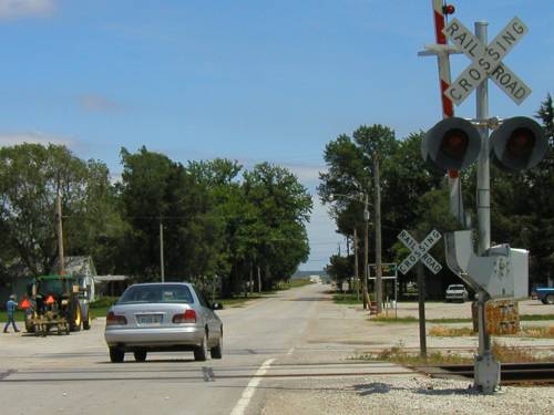
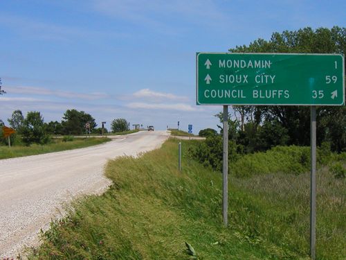
|
Various pictures from May |
 |
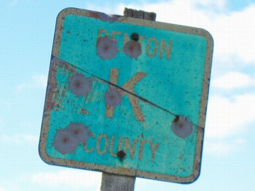
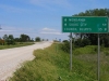
This is the semi-famous "Benton County Road
K" sign as seen on V42 north of Keystone. Iowa went from
lettered trunk roads like Wisconsin to the current alphanumeric
system sometime in the late 1960s or early 1970s. I'm not quite
sure how or when it happened. |
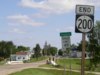 |
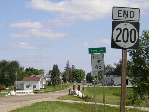
The clock was ticking on IA 200
- and the rest of the spurs in Benton County - when I took a
trip on May 20 to photograph them all. It was a wonderful day
for pictures, making sure these highways were captured before
70-plus years of history disappeared. |
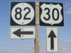 |
The only two-digit spur in Benton County is IA
82
to Blairstown, an original one from 1920. However, the road wasn't
officially "paved" until the 1990s, having previously
been a "dustless" road. |
 |
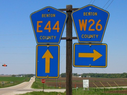
Just a really good shot of county roads running
north-south and east-west just west of Atkins. |
 |
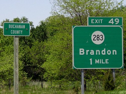
The Second Great Decommissioning also meant that
some shields would be pried off of interstate signs. This one
is on northbound I-380. I am standing in Benton County, while
the BGS is in Buchanan County. |
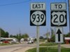 |
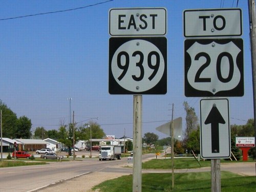
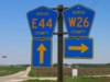
This secret highway had been around a while before
it was made non-secret. IA 939
runs right through the middle of Buchanan County, on a survey
line that many other parts of US 20 followed before being moved
to a four-lane highway south of the original road. On 20's very
first route, the semi coming this direction would have turned
right onto a short curve, then north through Jesup, and then
west again. In 1958, a new route for 20 running east from this
point to downtown Waterloo was opened. |
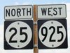 |
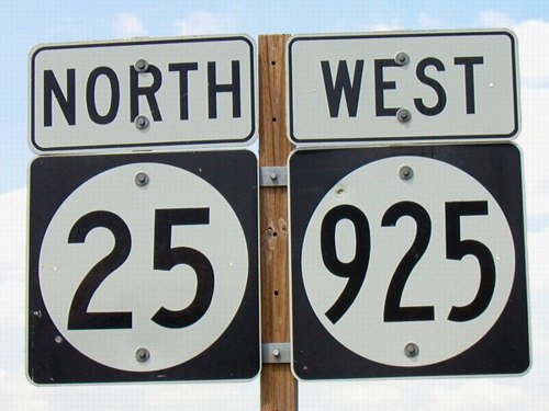
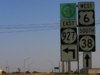
No, it's not a mother-and-child reunion, but
a coincidental duplex of IA 25 and IA 925,
a number given to one of three segments of US 6 in 1980. The
two roads share two miles in southern Guthrie County between
Casey and Menlo. When 6 was tacked onto I-80 in this area, it
meant that 6 no longer entered Guthrie. |
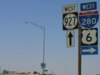 |
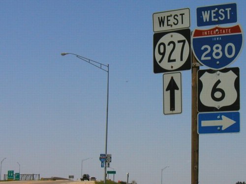
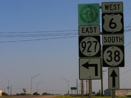
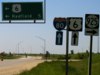
This is the east end of one of those other segments
of US 6, IA 927,
the only state highway to ever end at I-280. (Not that there
are many opportunities to do so.) To follow 6, get onto I-280
and then get over to the left lane so as to not head toward Chicago. |
 |
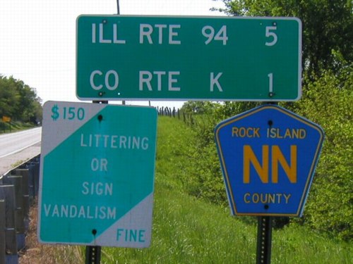
I don't think Illinois really knows what it's
doing with its county roads. In some places, I see them with
numbers, in other places (like here) I see them with letters.
This is one mile north of the Rock Island-Mercer county line
near an intersection with US 67. (I should have gone a mile south
to get Mercer, but I didn't, which was kind of silly since you
can't drive into it from Iowa.) |
 |
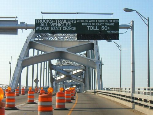
The toll bridge for US 67 had been free for less
than a month when I crossed it on the Saturday before Memorial
Day. The construction barricades were set up because they were
still in the process of removing the toll booths and related
items, such as the sign seen here. With this change, the only
toll bridges on the Mississippi in Iowa are IA 92 at Muscatine
and IA 2 at Fort Madison. |
 |
This is the other end of IA 927, near Wilton.
It's an interesting arrangement because the signs are held together
horizontally by pieces of metal (that aren't regular brackets)
while held up by two wooden posts. Muscatine, West Liberty, and
Wilton are the destinations on the LGS in the background. |
 |
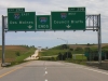
This intersection west of Dexter has gone through so many
versions in the past 50 years it's practically been turned inside
out. The inset shows the sign on the westbound offramp.
- Before the interstates, US 6 faced south, like this picture,
then turned right, while IA 90 went left.
- For a while in the 1960s, IA 90 was on 6's route while 6
used 90's.
- From 1980 to 2003, 6 went ahead while 925 went right.
- And now, County Road F60 is the north-south road while County
Road F65 goes right.
|
|
June 1: Along Interstate 29 |
 |
Here's something you don't see every day: An
"RRX" on an interstate. The Union Pacific tracks run
so near the east edge of the I-29/680 interchange that the ramps
on that side are compressed. The background gantry has a shield
for IA 988,
a secret route that was only signed along northbound I-29 and
eastbound I-680. |
 |
Pottawattamie County generally does a good job
of signing its county roads, although the spacing of the letters
may seem off at times. (The replacement shields for US 275 and
IA 191 are particularly bad.) After July 1, 2003, the right sign
is "Jct L20 <->", a little odd for a north-south
county road to end at another one. |
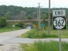 |
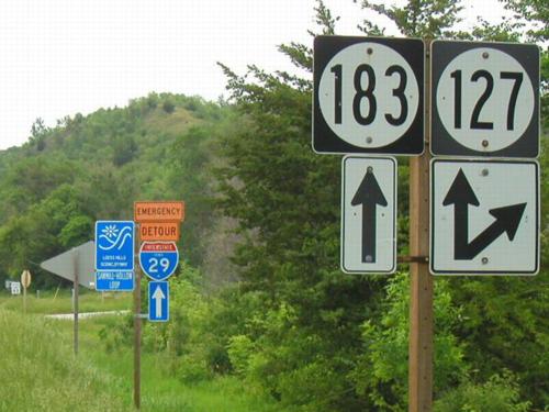
Although it was hard to tell on the map, IA 362
ended at I-29 and did not continue to IA 183, most likely because
of that one-lane bridge. At the time this picture was taken,
the westbound LGS had fallen down. In the background of the large
picture you can see IA 183 behind the bridge. Although there
is a G14 shield here, Pottawattamie County inexplicably decided
to call 362 G12. |
 |
South of IA 127, IA 183 used to be US 75, and
that history is evident in the layout of the road. Continuing
north here is the dominant road. It then curves west toward Mondamin,
where 183 goes north as the leg of a T intersection. Topographic
maps make it exceedingly clear that IA 183 follows the demarcation
between Missouri River valley and Loess Hills, flat to the west
and hilly to the east. |
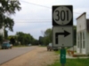 |
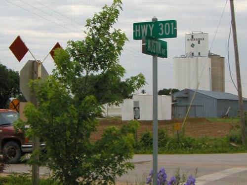
In this out-of-focus picture, IA 301
has just turned north behind the camera and it turning east again
to go through what passes for the business district of Little
Sioux. County Road F20 actually runs along Vine Street (the road
301 came into town on) while the last part of 301 is on Mulberry
Street. Two blocks past 301's end, Mulberry runs into north-south
Main Street, which F20 uses to exit town. After decommissioning,
status of F20's route through town is unknown; it may have stayed
the same or been reconfigured to match 301's old route. |
 |
On IA 301 just east of I-29 is a stop sign at
County Road K45, which used to be US 75 (hence the stop). This
was the original west end of IA 301, here at unincorporated River
Sioux. At the interchange, there is a building that used to be
a Stuckey's. |
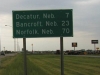 |
Leaving Onawa, there are still about 7 miles left of IA 175
in Iowa, but all the towns are in Nebraska. Norfolk is at the
intersection of US 275 and US 81; I believe Norfolk is the farthest
west town on an Iowa LGS. (Other possible contenders are towns
on US 30 leaving Missouri Valley and US 18 leaving Rock Valley.)
FYI: The last three-destination LGS the other direction, leaving
Grundy Center, is "Morrison 4; Reinbeck 9; 63 7."
|
|
June 9: Pottawattamie County and
I-29 |
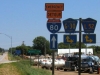 |
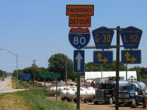
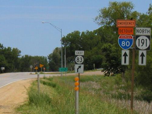
This sign assembly is interesting because one
of the shields has a hyphen between the letter and numbers while
one does not, and it has the "Emergency Detour" sign.
Neither of the roads that allegedly join IA 191 here are co-signed
along the route. After decommissioning, the road ahead would
technically be a county road triplex: G30, L52, and G8L (old
191). |
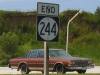 |
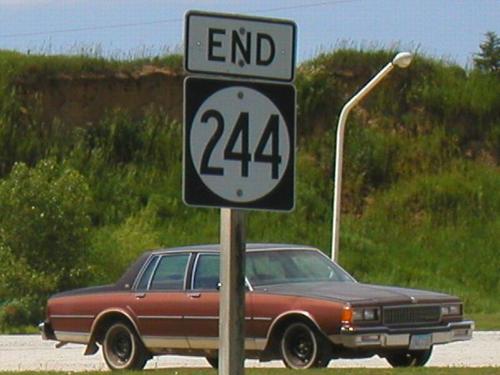
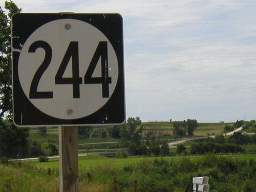
This photo at the south end of IA 244 was taken
for no real reason. It turns out, though, that this is the last
full-body picture I took of my car, which was stolen in Omaha
about a month later. |
 |
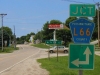
This is the first shield on IA 244
facing south. The interchange at 244's south end is in the background.
You can't see the interchange from the very beginning of 244
because a building is in the way, but once you cross the railroad
tracks and get to this sign it's easy. There is now an L55 shield
here. |
 |
This intersection used to be somewhat important.
The second important route from Council Bluffs to Des Moines,
IA 7 (later IA 64), turned east to go to Avoca. From there it
went north along present US 59 to Harlan, and then east on present
IA 44 to the Des Moines area. After 1969 it was the west end
of IA 83, although the old road pattern (and, to a lesser extent,
signage, noting the 83 pole) was still visible. Today, it is
merely the intersection of two county roads. |
 |
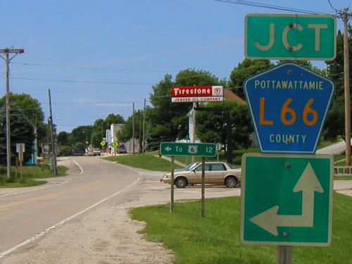
Here's an interesting find along IA 83: Old green
county signs. There are a few green square road shields around,
but the corresponding "Jct" and direction arrows are
even rarer. |
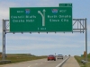 |
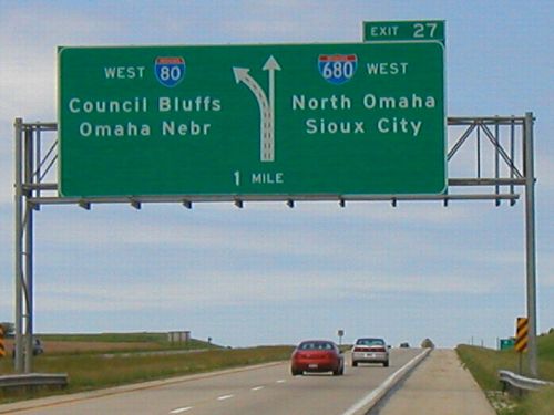
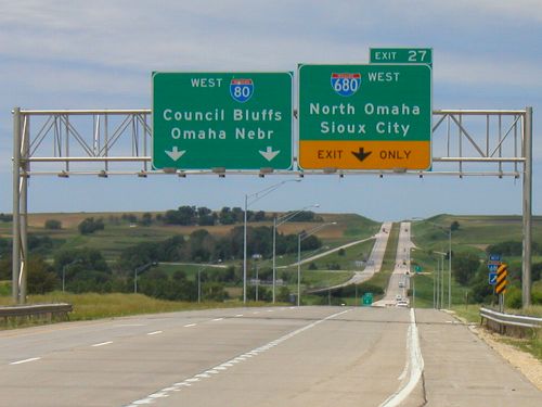
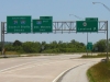
This is one of the rare graphical BGSs in Iowa.
It might seem a little strange given the farmland all around,
but I-680 is a cutoff for Sioux City traffic. I-680 is probably
the least-traveled interstate in Iowa, despite its role as a
bypass of downtown Omaha. Note the inclusion of "Nebr"
instead of just a straight "Omaha". |
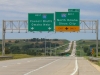 |
I-80 widens to three lanes as I-680 splits off.
In the background is the I-680 interchange with IA 191. |
 |
How little traffic uses I-680? Little enough
that I was able to get this picture. This gantry is within walking
distance of the off-ramp to IA 191. |
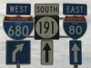 |
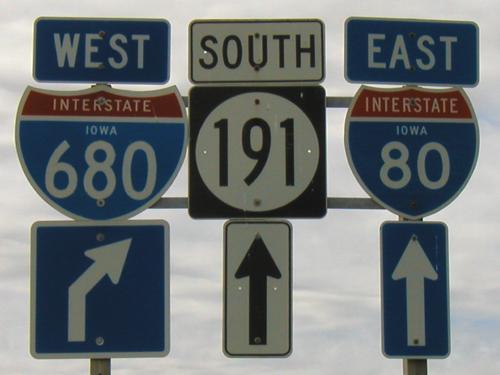
The interchange of IA 191 doesn't bother with
people who want to travel west on I-80 or east on I-680. Because
the end of 680 is right there, it assumes that if you go that
way you want eastbound 80. (You will have to get in the left
lane soon after merging, though; the 80-680 interchange does
allow movement in all directions.) Since July 1, 2003, this interchange
has been the south end of IA 191. |
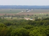 |
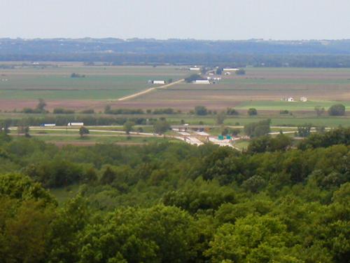
There is a nice scenic lookout on I-680 between
I-29 and I-80. Looking west, you can see the interchange, the
floodplain, and over into Nebraska. (IA 183 is hidden near the
edge of the trees.) |
 |
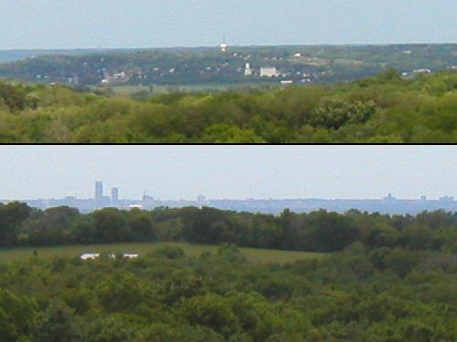
To the north of the scenic lookout (top), Missouri
Valley's water tower pokes out above the town. To the southwest
(bottom), 18 miles away is Omaha's skyline. The First National
Tower is the tallest building on the left, the Woodmen of the
World Building just to its right. |
 |
For IA 300,
as with IA 244, one end is not visible from the very other end,
but it's close. These railroad tracks are about a block away
from the west end, and the east end can be seen because the road
rises slightly to go over I-29. Both IA 300 and County Road F50
were signed on I-29, which may mean the F50 shield is still off-center
today. |
 |
It's not often that you come across an interchange-related
sign on a gravel road. This is the first sign heading east on
a road that becomes IA 127
(and paved) right at the southbound ramps. The first 127 shield
is on the other side of the interchange. |
 |
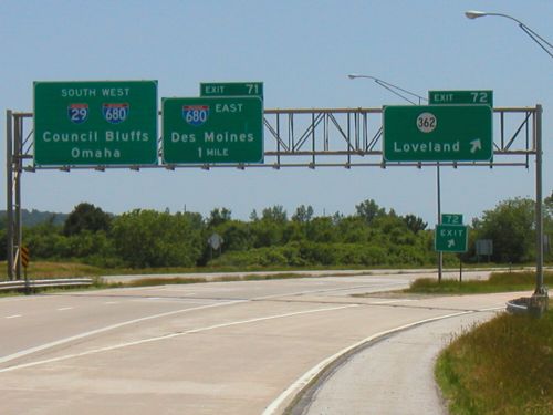
The interchange with IA 362 is so close to I-680
that it's a folded diamond. On the southbound approach, unincorporated
Loveland shares a gantry with Council Bluffs, Omaha, and Des
Moines. Farther south from here is a BGS that looks old enough
and has shields spaced oddly enough that it might have also held
a US 75 shield prior to 1984. (It has since been replaced.) |
 |
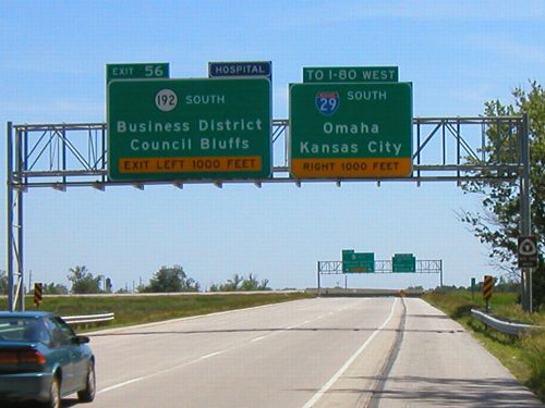
This is, to the best of my knowledge, the only BGS set on
an interstate in Iowa that gives distance in feet. It's a left-hand
exit because, for quite a while, I-29 ended just up ahead and
ran right into a road with at-grade intersections. This and US
65 northbound from I-80 eastbound are the only two left exits
outside of Des Moines' east mixmaster. (Left exits on I-235 are
being eliminated in the big construction project.)
Usually "Business District" appears below the city
name, not above.
|
 |
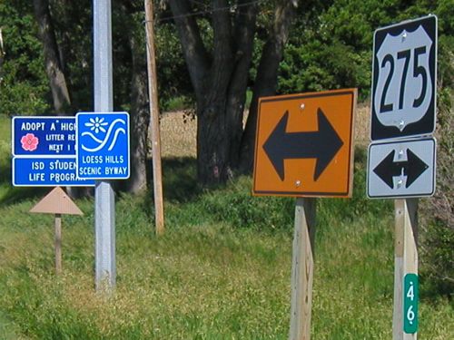
The former east end of IA 370
at what is now former US 275 has 275's mile marker and a Loess
Hills Scenic Byway marker visible. The 275 has been replaced
by L35, and the road between 275 and I-29 is now marked as H10. |
 |
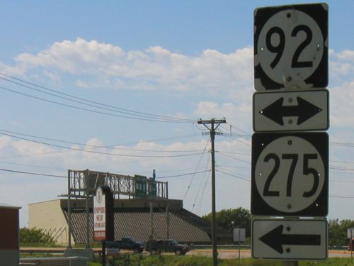
This intersection is near the Iowa School for the Deaf; US
275 is no longer here. Council Bluffs doesn't seem to know what
type of highway it has on its hands; IA 275 shields pop up all
over the place.
The background gantry is for IA 92/US 275 approaching Interstate
29, with signs in button copy.
|
|
June 15: Omaha to Chariton (mainly
US 34) |
 |
Most likely a sign of convenience, although US
34 has been a four-lane here since the 1970s it doesn't have
full BGSs. Since July 1, 2003, that hasn't mattered as much,
because all three shield sets have been taken down. US 275 was
attached to 34, IA 385 was turned over to Mills County, and Business
34 was apparently killed when IA 949 was - even though business
routes elsewhere are local-jurisdiction roads. There was still
a leaving-town LGS on Business 34 because it was a state route;
it even listed Tabor. |
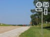 |
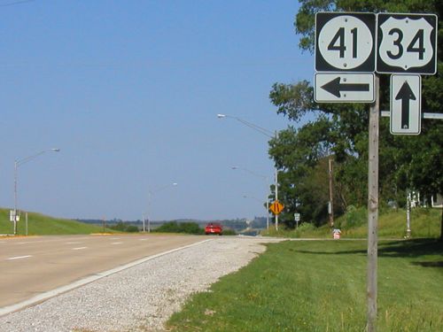
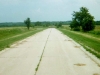
This is one of the last pictures I got with my
digital camera on my trip across southern Iowa. The north end
of IA 41
features, on US 34, an extra westbound lane and a curve for eastbound-southbound
traffic. But for all that, there is no "End 41" sign. |
 |
Psst...the DOT hasn't wanted anyone to know,
but US 34 and US 71 don't meet at an at-grade intersection. In
fact, 34 actually goes out to four lanes for a time at this full
interchange. In addition, US 34 and US 59 don't meet at grade
either, but there's only one two-way road connecting the two
routes. (Interestingly enough, US 59 doesn't intersect old US
34 in Emerson at grade either, and there's no quick road connecting
the two!) |
 |
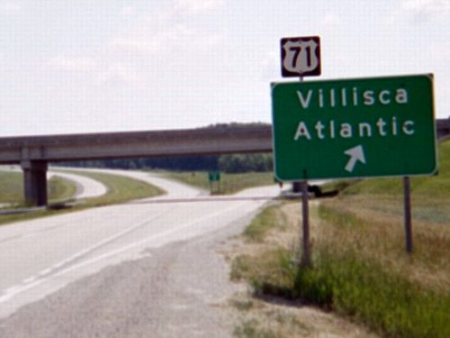
There were a lot of pieces of US 34 left behind
after straightenings in Union County east of Creston. This is...uh,
if I recall correctly...a tiny piece of 190th Street serving
one house just east of the east 34/169 intersection, barely marked
on the county map. (I think a new driveway to new 34 wasn't buit
because of the grade involved.) An excellent aerial shot of the
area is here.
(Links to Iowa GIS) This piece of road is the far left piece
in the photo. |
 |
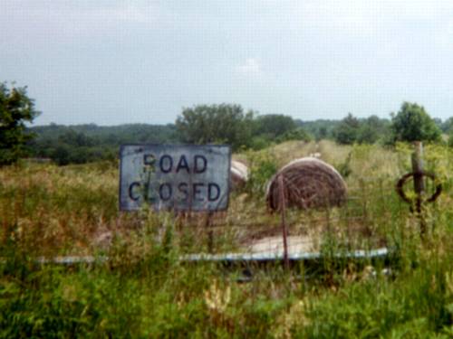
An abandoned barricade with matching hay bales block the way
from further pavement exploration, but aerial photos clearly
show tree-lined pavement angling southeast to the railroad tracks,
stopping, then picking up again on the other side, becoming a
working road after making a curve. I would really like to check
this out someday, but that requires talking to the landowners
first!
Other realignments along US 34 were done in 1964 and 1965;
it's probable that current 34 was also built around that time
(making this "Road Closed" sign 40 years old).
|
 |
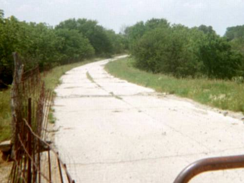
Unmarked on the county maps (but a thin line
in the Iowa Atlas and Gazetteer), for the very good reason that
it is closed, is one more "dip" in old 34's route right
at the Union/Clarke County line. This is looking west into Union
County and someone's field. |
 |
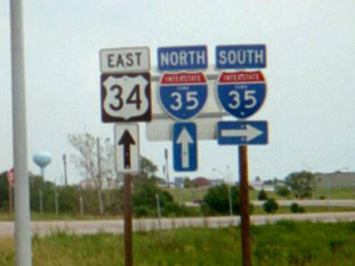
Here's one of Iowa's two sequential US-interstate
pairs, US 34 and I-35 (the other being US 30 and I-29). The northwesternmost
one of these in the country is US 89/I-90 in Livingston, MT (US
91/I-90 at Butte is now gone), the southeasternmost US 19/I-20
in Atlanta. Other nearby ones: US 81/I-80 at York NE; US 36/I-35
at Cameron MO (south-southwest of this one!). |
 |
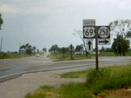
Both the ends of IA 258
and 266 at US 69 were redone in late 2002 or early 2003. Each
now has a sort-of-Y intersection, with "ramps" to either
direction of 69 (but they're two-lane). I'm not sure why such
a thing would be done, given their minor nature and the fact
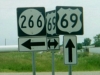
they'd be turned over to the county soon after. IA 258 used to
go from 69 to Van Wert, and was later extended to I-35. |
 |
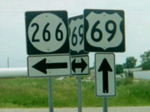
Hello, temporary poles...right? I thought these were a sure
sign of recent construction, but since this trip I have seen
more and more shields on metal poles instead of wood. I don't
know why. Anyway, the 266
shield was gone in a few weeks anyway.
And by the way, 266 was an asphalt road. It was definitely
not "dustless" as the maps showed it.
|
|
June 16: Chariton to Omaha (mainly
IA 2) |
 |
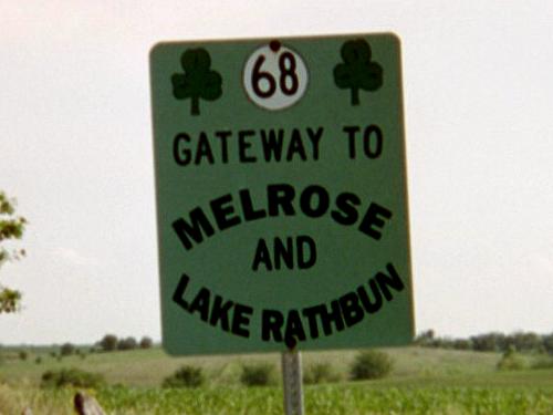
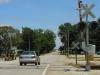
May the luck of the Irish be with you on IA 68
- or County Road S70, whatever the case may be. |
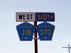 |
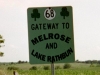
This mismatched directional pairing seems to
indicate IA 142
was marked as an east-west highway crossing the northwest side
of Lake Rathbun. Most likely, it was signed as east-west along
the part that was J18, and north-south along the part that was
S70; J18 wins the duplex pair across the lake. According to the
US Army Corps of Engineers Web site, Lake Rathbun was dedicated
July 31, 1971, with keynote speaker President Richard Nixon.
Nine years later, the state took control of roads along the north
and west sides, most likely for improvements; 23 years after
that the roads became county routes again. |
 |
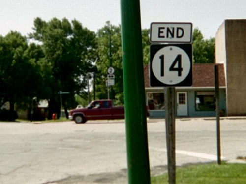
The south end of IA 14
is offset from the street grid in Corydon by half a block, as
streets go on either side of the Wayne County Courthouse. The
courthouse has a distinct mid-20th-century feel to it, as you
can see on the IA 14 page. |
 |
Originally, IA 40
ran the height of the state, along a route that is now US 218
(or bypassed segments thereof). After the US highway system was
commissioned in 1926, IA 40 and IA 55 were banished to southern
Iowa to serve as spurs, 40 right away and 55 in 1934 when it
replaced IA 67. The "BK" (back) on the mile marker
is to correct the mileage after a realignment of IA 2 between
this intersection and US 65. |
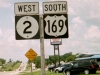 |
One of the larger number discrepancies of highway duplexes
in Iowa; the US highway usually goes on the left, though. "Watch
for horse-drawn vehicles" calls attention to a sizable Amish
contingent in the area.
The two routes share only two miles today, even though 169
will stay in Iowa longer than it needs to as it makes a turn
toward Redding. It might have made sense to route 169 straight
north from Redding along what today is P27 when it was rerouted
around Delphos in 1931 or 1932, but that never happened.
|
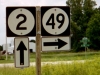 |
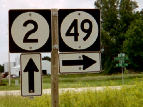
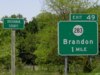
IA 49
was being turned over to Taylor County before legislation was
finalized for the Second Great Decommissioning. In mid-June,
the signs were still up on IA 2, but on IA 49 itself the signs
were gone. (Signage on 2 remained most likely because Adams County
still had 49, and new county shields were not up yet.) Today
49 is an assortment of county roads.
"Old Hwy 49," a continuation of the diagonal toward
an old alignment of IA 2, goes to the left.
|
 |
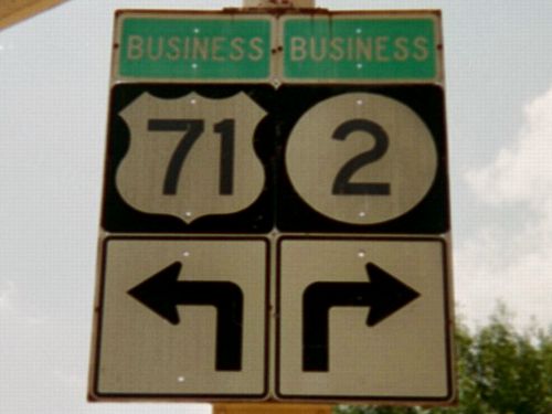
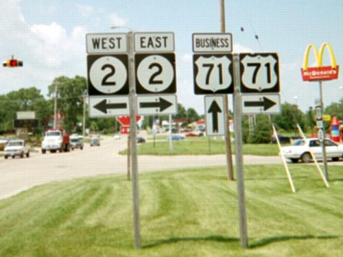
Somehow, the existence of Business
US 71 and Business
IA 2 remained under Iowa roadgeeks' radars until photographic
evidence surfaced in the 21st century. The routes have been there
for 30 years, and the condition of the signage is such that it
may be original. Faded green "Business" tags were more
common at one point but now are almost gone save for those in
Clarinda. This photo is across the street from the northwest
corner of the Page County Courthouse, in the business district.
Business 2 goes a block north and then turns west again. Business
71 goes south to the present 71/2 intersection. The arrows themselves
are slightly different from the current standard. |
 |
When the two highways bypassed Clarinda, sections
of road to the east were also rerouted so the infamous and nearly
inevitable "curve" around a town that characterizes
bypasses is somewhat mitigated. Shields for IA 2 abound here,
not only in the left pole with assistance from the Department
of Redundancy Department but straight ahead in a mistaken placement
under a Business 71 shield. |
 |
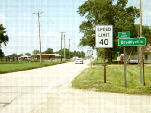
Braddyville is parked right on the Iowa side
of the Missouri border. ("Welcome to Iowa" shows up
on the north side of town.) To the left of the photo's position
is a Philips 66, fully inside Missouri. Maybe the taxes were
better or something. US 71 goes south from here and then east
to Maryville (meeting the continuation of IA 148), then south
to St.Joseph, piggybacking with I-29 to Kansas City. |
 |
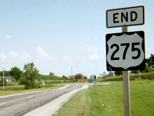
A mere 16 miles into Missouri, US 275 comes to
an end. It originally continued to St. Joseph, Missouri, but
I-29 has supplanted it as the main route between Omaha (Council
Bluffs was its original north end) and Kansas City. With that
in mind, and 275's recent rerouting along I-29 and US 34, I have
wondered if perhaps this road should be decommissioned. Much
of its central portion jumps from one duplex to another, and
then it becomes a more east-west road for the last half of its
section in Nebraska. An IA/MO 275 running south from US 34, with
either an NE 275 or an assortment of other numbers, might be
worth looking into. |
 |
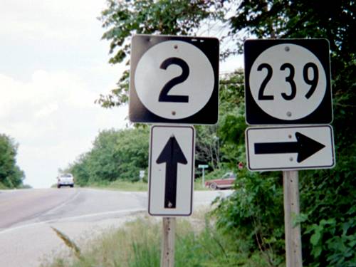
As the southwesternmost former spur in Iowa,
IA 239
is closer to downtown Topeka (130 miles) and Kansas City (142)
than Des Moines (158), despite the latter being in the southwest
quadrant of the state. Its northeasternmost counterpart, IA 364,
is closer to downtown Milwaukee (190) and St. Paul (195) than
Des Moines (214). |
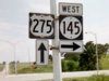 |
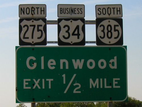
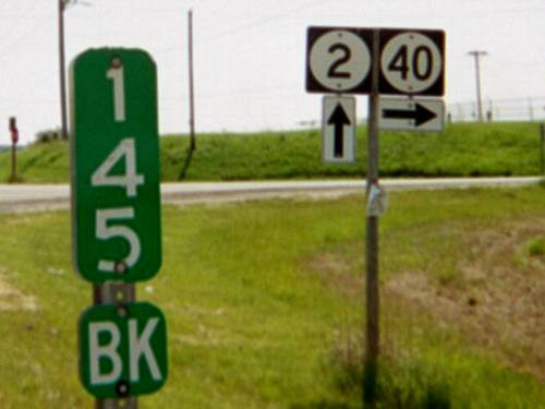
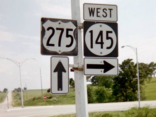
All three state highways touching US 275 south
of Glenwood were affected in the Second Great Decommissioning.
Two of them, IA 145 and 184, were completely decommissioned,
while IA 333 was dropped east of 275 and its duplex removed.
Now, the only state-maintained routes connecting north-south
roads US 59, US 275, and I-29 are US 34 and IA 2 (with 333 connecting
29 and 275). |
 |
This overhead assembly in downtown Omaha, facing
south on 14th Street at Dodge Street, may be nearly 30 years
old. The shield covered up is most likely US 73, which was decommissioned
in nearly all of Nebraska after US 75 was shifted over from Iowa,
which by the early 1980s was duplexed with I-29 from Sioux City
to Council Bluffs. US 75 isn't here anymore either; it's moved
west, onto a new freeway that then merges with I-480. A left
turn will go into Iowa on the bridge that US 6 and I-480 currently
share, a bridge that used to be 75's entry into Iowa. |