
For those of you here for the first time… Hi.
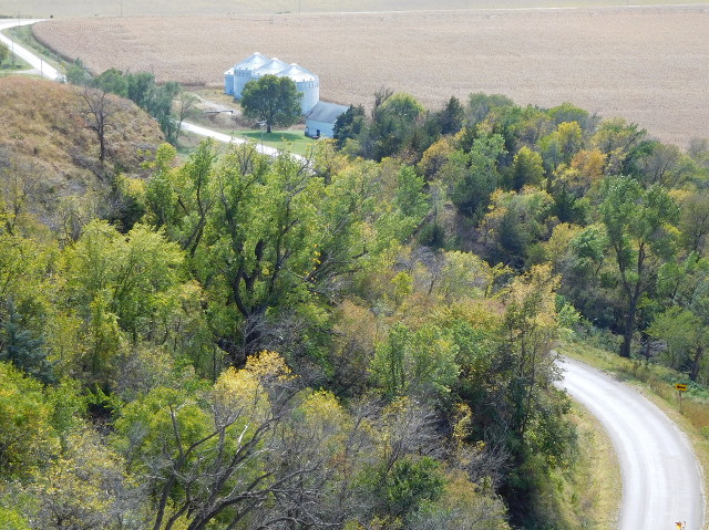
October 1, 2015: Murray Hill Scenic Overlook, northeast of Little Sioux, in the Loess Hills. No highways, just a scenic picture.
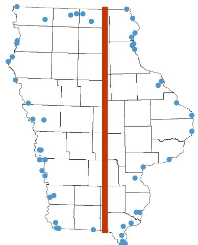
In early fall 2015 I took an eight-day trip around Iowa, and I mean around — I did a circumnavigation of the state. However, it’s only now that I have worked on photos from that trip for the website.
Here’s a condensed map that shows all the locations that got at least one photo. (I’ve remarked that projections of Iowa often tip upward on the west side; this really shows it.)
In list form, the rundown on the Mississippi River: Business US 61 (Keokuk), US 218, US 161, IA 404, Business US 61 (Fort Madison), IA 99, IA 305 (from June), IA 92, US 67, IA 136, IA 64, IA 62, IA 32, IA 386, IA 340, Business US 18, IA 76, IA 364, IA 26 (both ends). In the middle is US 218 at the Iowa/Minnesota line. Then, starting in Dickinson County and working west/south: IA 86, IA 219, IA 238, IA 237, IA 339, IA 9 West/NW corner of Iowa, IA 10, IA 12, IA 403, IA 3, US 77 (Military Road), IA 141, IA 324, IA 37, IA 300, IA 362, IA 165, US 275/IA 92, IA 978, IA 385, IA 239, IA 333, US 275, and US 71.
Phew. Some of those pages haven’t had photos added to them for three or four leap years.
If you get to those pages and see any broken image links, let me know.